
The latest information from the National Center for Hydro-Meteorological Forecasting said that early this morning (November 5), storm Kalmaegi crossed the northern area of Palawan Island (Philippines) and entered the eastern sea of the central area of the East Sea, becoming storm number 13, with intensity of level 13, gusting to level 16.
It is forecasted that around tomorrow afternoon (November 6), the storm will enter the sea area of Da Nang City - Khanh Hoa.
Around the night of November 6 (after 9:00 p.m.) to early morning of November 7, the storm made landfall in the provinces from Quang Ngai to Dak Lak , then moved to Laos, weakened into a tropical depression and gradually dissipated.

Direction and intensity of storm No. 13, updated on the morning of November 5. Source: NCHMF
According to meteorological experts, the characteristics of storm No. 13 are that the storm is very strong, moves quickly, has a wide storm circulation, operates on the tropical convergence zone, the sea surface temperature is still high, the atmosphere is humid, and the cold air is weakening. Therefore, it is likely that the storm will continue to strengthen after entering the East Sea.
Currently, international and Vietnamese forecasts are relatively consistent in terms of trajectory and intensity.
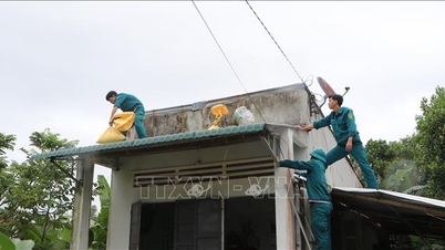
Very strong winds in Ly Son special economic zone
Due to the influence of storm No. 13 Kalmaegi, the central East Sea area (including the sea area north of Truong Sa special zone) has winds gradually increasing to level 7-8, then increasing to level 9-11; the area near the storm's eye has strong winds of level 12-14, gusting to level 17, waves 5-7m high, the area near the storm's eye has waves of 8-10m high. The sea is very rough.
“It is necessary to pay attention to the impacts on the Truong Sa special zone and marine structures,” the meteorological agency emphasized.
At the same time, from early morning on November 6, the sea area from Da Nang city to Khanh Hoa (including Ly Son special zone) gradually increased winds to level 6-7, then increased to level 8-11, the area near the storm center had strong winds of level 12-14, gusting to level 17.
Coastal areas from Hue to Dak Lak have waves 4-6m high, near the storm center 6-8m high, rough seas. The meteorological agency warns of very strong winds in Ly Son special zone.

Satellite image of storm No. 13 at 9:00 a.m. on November 5. Source: NCHMF
From the evening of November 6, coastal areas from Hue to Dak Lak should be on guard against sea level rise of 0.3-0.6m, accompanied by big waves and during high tide, which could cause flooding in low-lying areas, waves overflowing dikes, coastal roads, coastal landslides, and slow flood drainage in the area.
All ships, boats, and aquaculture areas in the above-mentioned dangerous areas are strongly affected by storms, whirlwinds, strong winds, big waves, and rising sea levels.
Strong winds up to level 10-12 in the East of Quang Ngai - Dak Lak provinces
Also due to the influence of storm No. 13, from the evening of November 6, on the mainland along the coast from South Quang Tri to Da Nang, the eastern part of the provinces from Quang Ngai to Dak Lak, the wind gradually increased to level 6-7, then increased to level 8-9, the area near the storm's center passed through level 10-12 (focusing on the eastern part of Quang Ngai - Dak Lak provinces), gusting to level 14-15. The strongest wind time was from the evening of November 6 to the morning of November 7.
In the West of Quang Ngai and Gia Lai provinces, the wind will gradually increase to level 6-7, near the storm's eye, it will be level 8, gusting to level 10.
The meteorological agency warned that due to the influence of the wide storm circulation, it is necessary to guard against the risk of thunderstorms, tornadoes and strong gusts of wind both before and during the storm's landfall.
Heavy rain across the Central and Central Highlands regions
Currently, the cold air is weakening, and there are no signs of it strengthening again on November 6-7. During this time, the activity of the East wind zone is not strong (due to the impact of a very strong storm that has just appeared in the East Philippines), so this rain is mainly due to the circulation of storm No. 13.
Specifically, from November 6-7, the area from Da Nang to Dak Lak will have very heavy rain with common rainfall of 200-400mm/period, locally over 600mm/period; the area from South Quang Tri to Hue, Khanh Hoa and Lam Dong will have heavy to very heavy rain with rainfall of 150-300mm/period, locally over 450mm/period. From November 8, heavy rain in the above areas will tend to decrease.
From November 7-8, the area from North Quang Tri to Thanh Hoa will have moderate to heavy rain with rainfall of 50-150mm/period, locally there will be very heavy rain over 200mm/period.
In addition, due to the impact of heavy rains caused by storm No. 13, rivers from Quang Tri to Khanh Hoa are likely to experience a new flood; in which the flood level and inundation on river systems in Hue and Da Nang are likely to be high, but not as severe as the recent flood.
Some rivers may rise above alert level 3, such as: Bo and Huong rivers (Hue) reaching alert level 2-3 and above alert level 3; Vu Gia - Thu Bon rivers (Da Nang) reaching alert level 2-3, in some places above alert level 3; Tra Khuc and Ve rivers (Quang Ngai) reaching alert level 2-3 and above alert level 3. At the same time, An Lao and Lai Giang rivers (Gia Lai) also rise above alert level 2; Kon rises to alert level 2-3; Se San rises above alert level 2; in Dak Lak: Ba river rises to alert level 2-3; Ky Lo river rises above alert level 3, Srepok rises to alert level 2-3.
The path and impact of storm No. 13 Kalmaegi are similar to storm No. 12 Damrey (made landfall in Phu Yen (old) - Khanh Hoa in 2017) and storm No. 9 Molave (made landfall in Quang Nam - Quang Ngai in 2020). In particular, storm No. 12 Damrey made landfall in the areas of Phu Yen (old) and Khanh Hoa provinces. The intensity of the storm when it made landfall was level 9, in Khanh Hoa there were strong gusts of wind level 12-13, in Gia Lai and Dak Lak (formerly Binh Dinh, Phu Yen), Lam Dong there were strong gusts of wind level 10-11. The common rainfall in the Hue - Khanh Hoa area was about 150-250mm, Gia Lai - Dak Lak was about 80-150mm, some places had heavier rain such as: Nam Dong (Hue) 321mm; Tam Ky, Tien Phuoc (formerly Quang Nam) 280mm; Ba To 338mm; Son Giang (Quang Ngai) 382mm; An Nhon 296mm, Quy Nhon (Gia Lai) 295mm; An Khe 266mm; Krong Pa (Gia Lai) 237mm;... Storm No. 9 Molave made landfall in the Quang Ngai - Da Nang provinces, with a strong intensity of level 11-12, gusting to level 14. Ly Son Special Zone (Quang Ngai) had strong winds of level 12, gusting to level 13-14. The storm caused heavy rain of 150-400mm in many places from Nghe An to Dak Lak, with some stations measuring over 550mm of rain. |
Vietnamnet.vn
Source: https://vietnamnet.vn/dac-diem-khien-bao-so-13-kalmaegi-cuong-do-rat-manh-thoi-diem-do-bo-dat-lien-2458534.html


![[Photo] Opening of the 14th Conference of the 13th Party Central Committee](https://vphoto.vietnam.vn/thumb/1200x675/vietnam/resource/IMAGE/2025/11/05/1762310995216_a5-bnd-5742-5255-jpg.webp)


![[Photo] Panorama of the Patriotic Emulation Congress of Nhan Dan Newspaper for the period 2025-2030](https://vphoto.vietnam.vn/thumb/1200x675/vietnam/resource/IMAGE/2025/11/04/1762252775462_ndo_br_dhthiduayeuncbaond-6125-jpg.webp)


Comment (0)