

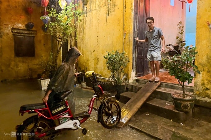
At around 10pm on November 15, the Hoai River rose, flooding almost the entire Bach Dang Street, with the deepest point being about 0.4m. Water continued to flow into the intersections with Bach Dang such as Hoang Van Thu, Le Loi, Chau Thuong Van, causing nighttime business activities to almost be paralyzed.
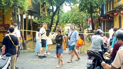
People living in the old quarter urgently moved their belongings, pushed motorbikes and electric bicycles to areas higher than one meter. Many restaurants and cafes closed early to avoid flooding, but some foreign tourists still sat watching the rain, even wading through knee-deep water to walk around the streets.
Locals said that Bach Dang Street is often flooded during heavy rains, when water flows from upstream. This year, Hoi An experienced a historic flood, with the water level on this street rising to 2.5 meters at times. "Although people are used to floods, they are not complacent. At night, many households proactively raise their goods to avoid damage like at the end of October," said Nguyen Anh Cuong.
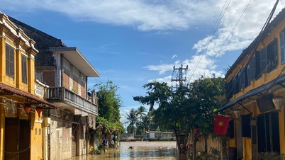
From late October to early November, the old town was continuously submerged in water due to rising floods, causing great damage to souvenir, silk and clothing businesses. It was not until November 8 that Bach Dang Street was completely dry again.
According to the Central Hydrometeorological Station, in the past 24 hours, Da Nang city has had moderate to heavy rain, and some places have had very heavy rain; the total rainfall from 7pm on November 15 to 7pm on November 16 reached 40-80 mm, in mountainous areas and the south of the city 90-140 mm. From tonight to the afternoon of November 18, the communes and wards in the midlands and mountainous areas south of Da Nang are forecast to have heavy to very heavy rain, commonly 150-300 mm, in some places over 400 mm; in the northern mountainous areas 100-200 mm, in some places over 300 mm.
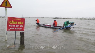
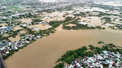
On November 16, heavy rains upstream caused water levels to increase sharply in hydroelectric reservoirs, forcing many reservoirs to release water downstream. By evening, the flow to several large reservoirs continued to increase, causing localized flooding in many low-lying areas in Nong Son and Thuong Duc.
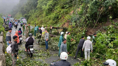
The rain that has lasted for the past 20 days has also caused landslides in mountainous areas. On the morning of November 13, a landslide in Put village, Hung Son commune left three people missing. On the afternoon of November 16, another landslide buried National Highway 40B, Nam Tra My - Tra Linh section. Many people managed to escape, so there were no casualties.
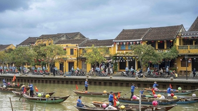
Hoi An Ancient Town was recognized by UNESCO as a World Cultural Heritage in 1999 thanks to the unique architectural and cultural values of the once bustling international trading port of the 16th and 17th centuries. For nearly a month, heavy rains have caused the ancient town to flood many times, disrupting tourism activities - Hoi An's main source of income. Many streets, tourist attractions and boat services on the Hoai River had to be temporarily suspended, the number of visitors decreased significantly, and shops were open for business only due to concerns about sudden floods.
According to VnESource: https://baohaiphong.vn/lu-lai-dang-trong-dem-o-pho-co-hoi-an-526922.html


![[Photo] General Secretary To Lam and National Assembly Chairman Tran Thanh Man attend the 80th Anniversary of the Traditional Day of the Vietnamese Inspection Sector](https://vphoto.vietnam.vn/thumb/1200x675/vietnam/resource/IMAGE/2025/11/17/1763356362984_a2-bnd-7940-3561-jpg.webp)


Comment (0)