
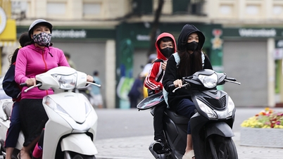
On the morning of September 17, the National Center for Hydro-Meteorological Forecasting said that last night and early this morning, the area from Hue to Khanh Hoa had showers and thunderstorms, some places had heavy rain. The rainfall from 7:00 p.m. on September 16 to 3:00 a.m. on September 17 was over 50mm in some places, such as Quang Dien (Hue) 68.2mm, Ia Kenh (Gia Lai) 88.4mm, Song Hinh ( Dak Lak ) 51.8mm.

The National Center for Hydro-Meteorological Forecasting warns that this afternoon and tonight, September 17, the area from Hue to Lam Dong and the South will continue to have showers and thunderstorms, with common rainfall of 15-30mm, locally over 80mm.
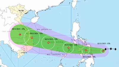
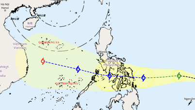
Regarding the tropical depression, at 1:00 a.m. on September 17, the center of the tropical depression was at about 16 degrees North latitude - 122.3 degrees East longitude, in the sea east of Luzon Island (Philippines) with strong winds of level 7 (50-61 km/h), gusting to level 9, moving in the West Northwest direction at a speed of about 15 km/h.

The National Center for Hydro-Meteorological Forecasting forecasts that in the next 24-48 hours, the tropical depression is likely to strengthen into a storm (level 8, gusts of level 10). From September 18 to 19, the storm will have a level 8-9 intensity, gusts of level 11 and is likely to enter the East Sea. The disaster risk level is level 3 for the northeastern sea area of the East Sea.

From tonight, September 17, the northeastern sea area of the East Sea will have winds gradually increasing to level 6-7, gusting to level 9. Near the center of the storm, winds will be level 8, gusting to level 10, waves 2.5-4.5m high (rough seas). Ships in the danger zone should be on guard against thunderstorms, whirlwinds, strong winds and large waves.
Source: https://www.sggp.org.vn/mien-nam-tiep-tuc-mua-gio-dien-rong-post813341.html
![[Photo] General Secretary To Lam receives Singaporean Ambassador Jaya Ratnam](https://vphoto.vietnam.vn/thumb/1200x675/vietnam/resource/IMAGE/2025/11/03/1762171461424_a1-bnd-5309-9100-jpg.webp)
![[Photo] Lam Dong: Close-up of illegal lake with broken wall](https://vphoto.vietnam.vn/thumb/1200x675/vietnam/resource/IMAGE/2025/11/03/1762166057849_a5018a8dcbd5478b1ec4-jpg.webp)
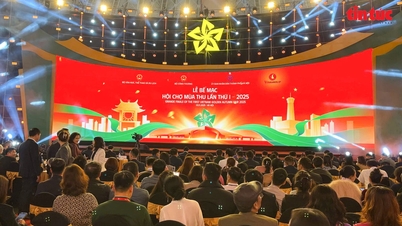
![[Photo] Fall Fair 2025 and impressive records](https://vphoto.vietnam.vn/thumb/1200x675/vietnam/resource/IMAGE/2025/11/03/1762180761230_ndo_br_tk-hcmt-15-jpg.webp)
![[Photo] Prime Minister Pham Minh Chinh receives the Chairman of the Japan-Vietnam Friendship Association in the Kansai region](https://vphoto.vietnam.vn/thumb/1200x675/vietnam/resource/IMAGE/2025/11/03/1762176259003_ndo_br_dsc-9224-jpg.webp)


Comment (0)