
 |
| Heavy rains upstream are causing river water levels to rise. |
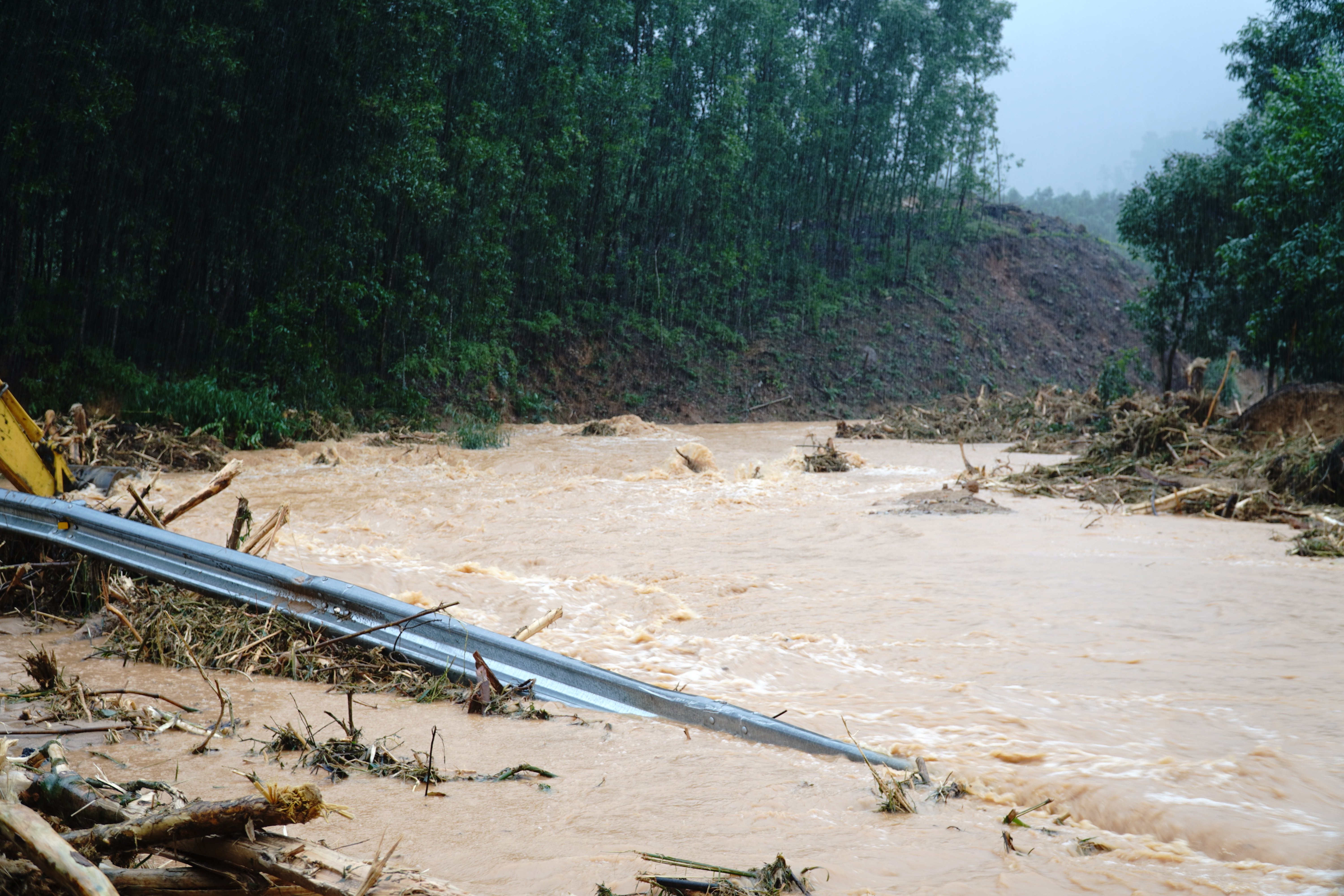
According to monitoring data at 2:00 p.m. on October 29, the water level of the Huong River at Kim Long station was 4.33 m, nearly 1 m higher than alert level III; the Bo River at Phu Oc was 4.12 m and Tu Phu was 4.24 m, both exceeding alert level III by 0.3 - 0.5 m. Thao Long Dam is currently opening all 15 sluice gates to drain water downstream.
Three large reservoirs including Huong Dien, Binh Dien and Ta Trach continue to operate to regulate discharge with very large flows: Huong Dien discharges 2,270 m³/s, Binh Dien 3,437 m³/s, Ta Trach 5,725 m³/s, the highest levels in many days. The water levels of the reservoirs are all close to normal levels, showing that the regulation capacity is nearing its limit.
Compared to the morning of the same day, the water level of the Bo River tended to decrease slightly, while the Huong River increased slightly due to the reduced discharge from the reservoir and heavy rain upstream. The flood peak on October 27 (5.05m on the Huong River; 5.25m on the Bo River) is still the highest in this period, and by the afternoon of October 29, the water level was still 0.8 - 1m higher than the alarm level III, indicating that widespread flooding will continue.
According to the Hue City Hydrometeorological Station, in the past 6 hours (from 8am to 2pm on October 29), there has been very heavy rain in Hue City. Particularly, the areas of Long Quang, Nam Dong, Khe Tre, Loc An, Phu Loc and Chan May - Lang Co recorded heavy to extremely heavy rain. Rainfall measured at some stations: Thuong Nhat 129mm, Huong Phu 170mm, Nam Dong 180mm.
It is forecasted that in the next 6 hours (from 2:00 p.m. to 8:00 p.m.), the entire city of Hue will continue to have heavy to very heavy rain; especially in the areas of Long Quang, Nam Dong, Khe Tre, Loc An, Phu Loc and Chan May - Lang Co, there is a possibility of especially heavy rain.
Total rainfall is generally 50 - 100mm, in some places over 120mm; in the above communes 80 - 150mm, in some places over 200mm.
According to a quick report from the Hue City Department of Construction on the morning of October 28, heavy rain and high floods have caused many National Highways, Provincial Roads and urban roads to be cut off or seriously blocked.
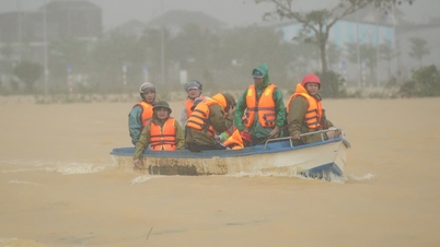
National Highway 49B is deeply flooded, many sections are blocked, and barriers have been put in place to prohibit traffic. National Highway 49 through Kim Quy and Ta Luong passes has landslides, many locations are limited to one lane only; sections Km1+300–Km14+500 are 50–80cm deep in water, prohibiting traffic. National Highway 1 through the center of Hue (Phu Xuan bridge) is 30–80cm deep in water, and traffic must be diverted to a bypass. Ho Chi Minh Highway West branch from A Roang to Km413 is still blocked due to landslides.
Provincial and urban roads were severely affected, many sections in Phu Vang, Quang Dien, Huong Tra, Phong Dien were flooded from 0.3 to 1.2 meters deep, some places had landslides, roadbed subsidence, forcing barriers to prohibit vehicles.
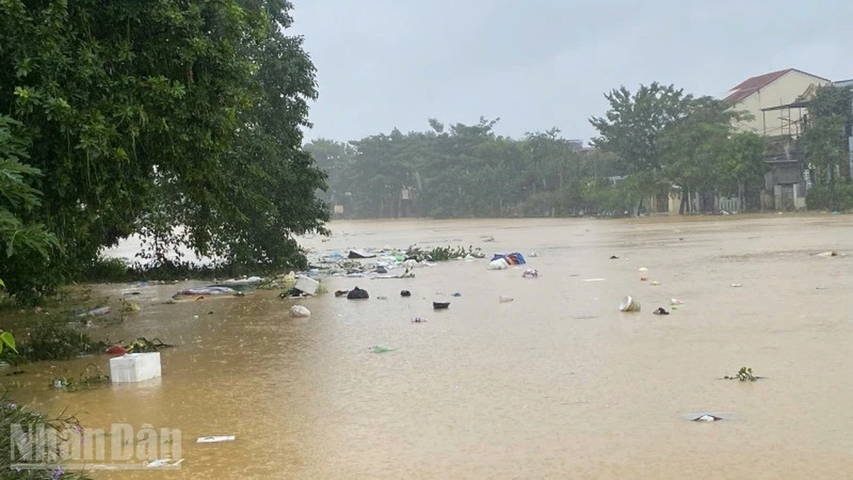
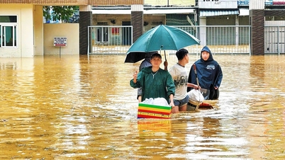
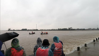
Many inner city areas of Hue such as Phu Xuan, Kim Long, Thuan Hoa, Vy Da, An Cuu are flooded from 0.3 to 1.5 meters, paralyzing traffic. Authorities advise people not to drive or wade through water to avoid the risk of accidents and electric shock.
Source: https://huengaynay.vn/chinh-tri-xa-hoi/theo-dong-thoi-su/mua-lon-chua-dut-ho-chua-tiep-tuc-xa-lu-159338.html
![[Photo] Prime Minister Pham Minh Chinh chaired a meeting to discuss solutions to overcome the consequences of floods in the central provinces.](https://vphoto.vietnam.vn/thumb/1200x675/vietnam/resource/IMAGE/2025/10/29/1761716305524_dsc-7735-jpg.webp)

![[Photo] Hue: Inside the kitchen that donates thousands of meals a day to people in flooded areas](https://vphoto.vietnam.vn/thumb/1200x675/vietnam/resource/IMAGE/2025/10/29/1761738508516_bepcomhue-jpg.webp)

![[Photo] Prime Minister Pham Minh Chinh chaired a meeting to evaluate the operation of the two-level local government model.](https://vphoto.vietnam.vn/thumb/1200x675/vietnam/resource/IMAGE/2025/10/29/1761751710674_dsc-7999-jpg.webp)


![[Live] Concert Ha Long 2025: "Heritage Spirit - Brightening the Future"](https://vphoto.vietnam.vn/thumb/402x226/vietnam/resource/IMAGE/2025/10/29/1761743605124_g-anh-sang-am-thanh-hoanh-trang-cua-chuong-trinh-mang-den-trai-nghiem-dang-nho-cho-du-khach-22450328-17617424836781829598445-93-0-733-1024-crop-1761742492749383512980.jpeg)


Comment (0)