
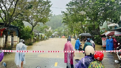
Since the early morning of October 26, heavy rains have continuously occurred in Da Nang city, especially in the highland communes, causing many landslides, cutting off traffic and threatening people's safety. Floods on rivers have risen rapidly, water levels in hydroelectric reservoirs have reached high levels, forcing hydroelectric units to actively operate to regulate flood discharge.
According to the Central Hydrometeorological Station, in the past 6 hours (from 1am to 7am on October 26), the Da Nang area recorded widespread rainfall of 90 to 100mm, with some places recording over 100mm. Some mountainous areas have reached a soil moisture saturation threshold of over 90%, increasing the risk of flash floods, landslides and subsidence.
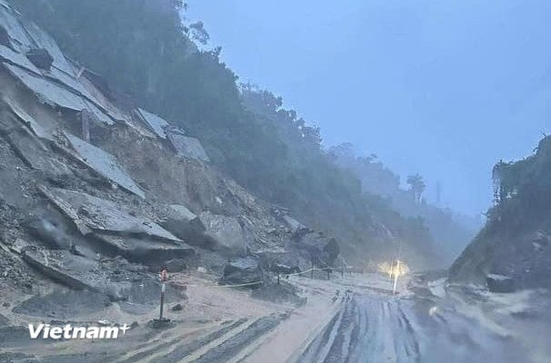
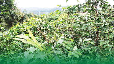
In highland communes such as Tra Tap and Tra Linh, heavy rains have caused serious landslides on many roads, with some roads in Nam Tra My commune alone having more than 10 high-risk landslide points.
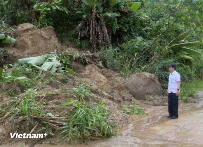
Currently, the inter-commune route from Tra Tap Commune Police Station to the old Tra Cang has been recorded to have been eroded; National Highway 40B section through the 5-storey Waterfall area in Tra Tap Commune has a large amount of rock and soil spilling onto the road surface. Local authorities have advised people not to move through dangerous areas until authorities clear the road.
In particular, at Km84+700 on National Highway 14E in Hiep Duc commune, a serious landslide caused the road to be completely blocked. This area is at risk of further landslides due to prolonged heavy rain. This is the location where the landslide occurred at the end of September. Although the slope had been reinforced with cement concrete, the weak ground caused the structure to break down and continue to slide.
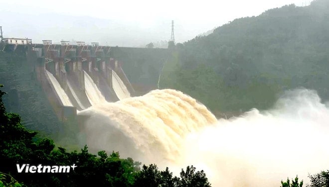
At the same time, the water level at hydroelectric reservoirs in Da Nang increased rapidly. Within 24 hours, Song Tranh 2 reservoir rose by 2m, Dak Mi 4 by 2m, and A Vuong by more than 1.1m.
In response to the above situation, hydropower companies have issued notices to regulate flood discharge according to the 1865 inter-reservoir operation process. Specifically, Dak Mi 4 hydropower plant is expected to discharge from 500 to 2,500 m³/s through the spillway, while Song Tranh 2 will discharge from 1,490 m³/s depending on the water flow into the reservoir. The spillway discharge time of Dak Mi 4 is from 9:00 a.m. and Song Tranh 2 is from 11:00 a.m. today.
On the same day, the Da Nang City Civil Defense Command issued Document No. 131/PTDS, requesting units managing hydroelectric reservoirs in the Vu Gia - Thu Bon river basin, including Dak Mi 4, Song Bung 2, Song Bung 4, A Vuong and Song Tranh 2, to organize reservoir operation and regulation to ensure downstream safety.
According to the direction, the factories must proactively calculate and regulate the overflow discharge to ensure that the reservoir water level does not exceed the allowable limit: Dak Mi 4 is not higher than 253.5m, A Vuong 372m and Song Tranh 2 168m. The required start time of operation is from 12:30 on October 26, 2025, in compliance with the Prime Minister 's Inter-reservoir Operation Procedure 1865/QD-TTg.
A Vuong Hydropower Joint Stock Company announced that at 9:00 a.m., the lake water level reached 371.33 m and will spill over from 2:00 p.m. on October 26, with an expected flow of 600 m³/s, to ensure the water level does not exceed the elevation of 372 m.
The Da Nang Civil Defense Command also requested relevant localities and units to coordinate information and early warning for people in downstream areas to proactively respond.
According to Vietnam+Source: https://baohaiphong.vn/mua-lon-da-nang-gay-sat-lo-nghiem-trong-thuy-dien-canh-bao-dieu-tiet-qua-tran-len-den-2-500-ms-524656.html
![[Photo] General Secretary To Lam received the delegation attending the international conference on Vietnam studies](https://vphoto.vietnam.vn/thumb/1200x675/vietnam/resource/IMAGE/2025/10/26/1761456527874_a1-bnd-5260-7947-jpg.webp)

![[Photo] Nhan Dan Newspaper displays and solicits comments on the Draft Documents of the 14th National Party Congress](https://vphoto.vietnam.vn/thumb/1200x675/vietnam/resource/IMAGE/2025/10/26/1761470328996_ndo_br_bao-long-171-8916-jpg.webp)
![[Photo] Prime Minister Pham Minh Chinh attends the opening of the 47th ASEAN Summit](https://vphoto.vietnam.vn/thumb/1200x675/vietnam/resource/IMAGE/2025/10/26/1761452925332_c2a-jpg.webp)
![[Photo] Enjoy the Liuyang Fireworks Festival in Hunan, China](https://vphoto.vietnam.vn/thumb/1200x675/vietnam/resource/IMAGE/2025/10/26/1761463428882_ndo_br_02-1-my-1-jpg.webp)


Comment (0)