
Taking advantage of this "golden" advantage to form an ecological urban chain is a direction in line with the trend of sustainable development, while affirming the unique urban identity of Dong Nai .
OPENING UP THE URBAN WAY TO THE RIVER
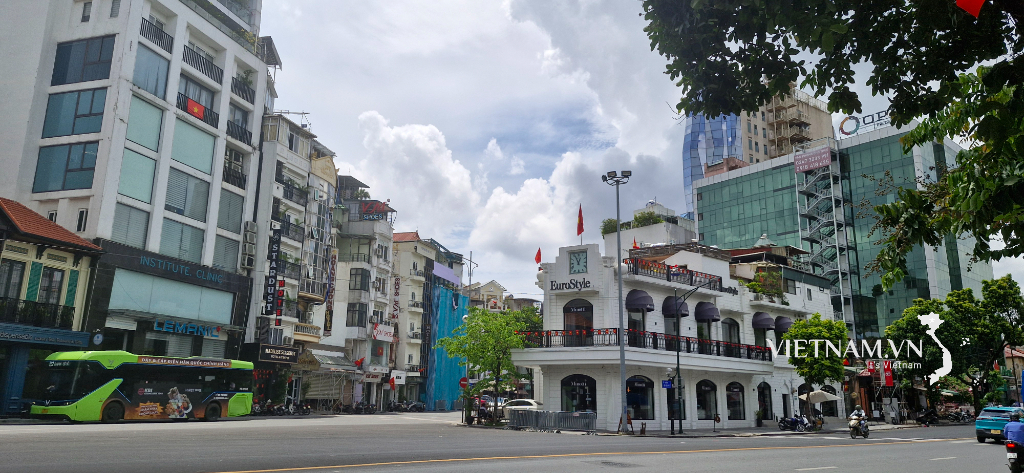
With a length of more than 580km, the Dong Nai River is the longest inland river in Vietnam, of which about 260km passes through the province. With its gentle flow, wide and deep riverbed, the Dong Nai River has brought many values to the socio -economic development of the southern provinces and cities. Notably, it is an abundant source of water for daily life and production, fertile alluvium for agricultural development, helping to balance the forest ecosystem. However, another "privilege" that the river gives to the province is the space for urban development along the river, which has not been exploited adequately.
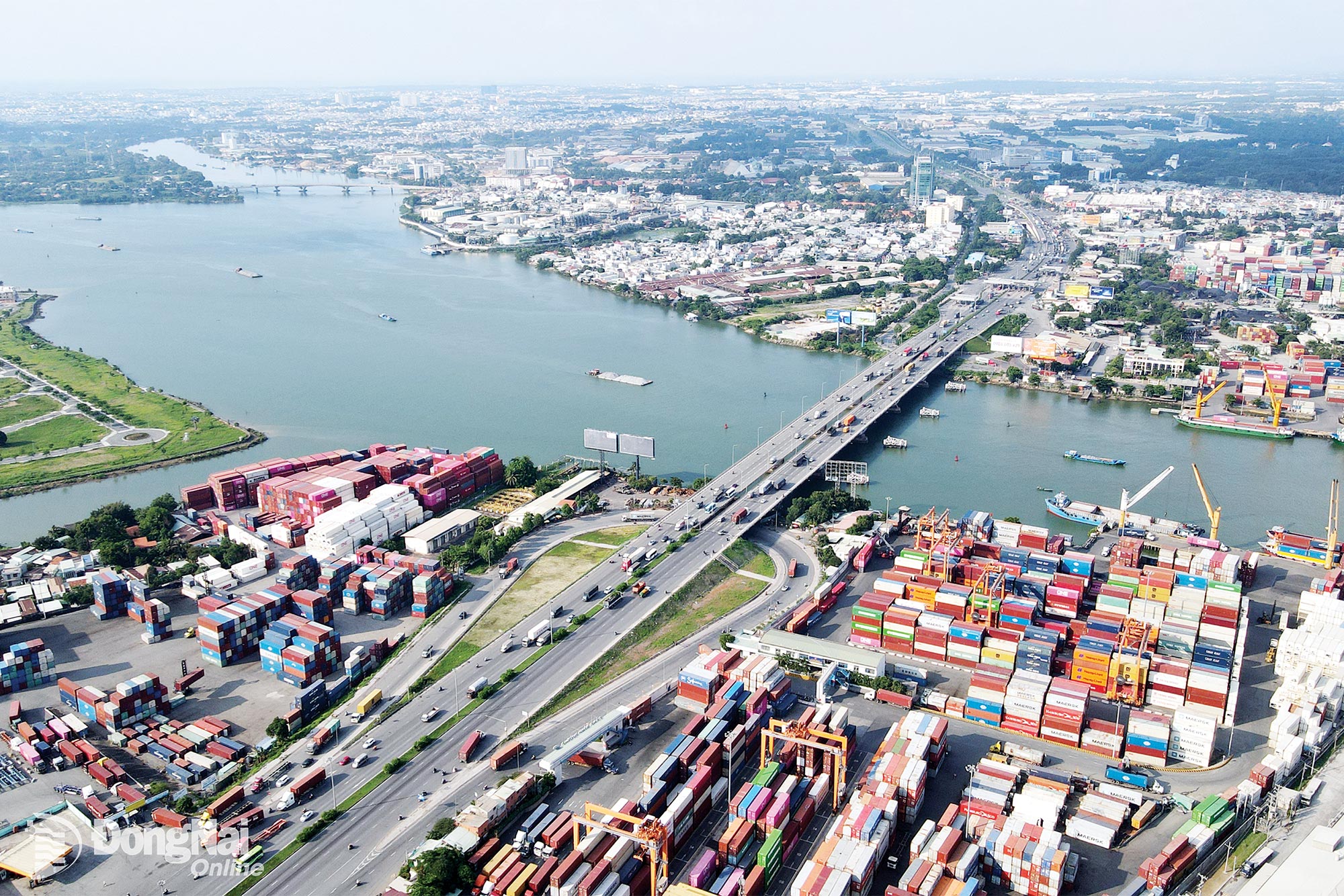 |
| The Dong Nai River section passing through Dong Nai province has many economic, ecological, cultural and landscape values, creating a foundation for sustainable urban development. Photo: Contributor |
According to Provincial Party Committee member, Vice Chairman of the Provincial People's Committee Ho Van Ha, in the midst of a dynamic industrial land and large urbanization, Dong Nai still possesses a rare landscape space surrounded by rivers, especially in urban areas or urban planning areas such as Bien Hoa, Long Thanh, Nhon Trach. However, up to now, the province has not had a riverside urban area worthy of its stature, creating enjoyment value for the community, contributing to landscape improvement and affirming the local identity.
In fact, the province has had a number of large urban projects along the river banks such as: Kim Quy Island (Bien Hoa ward), Aqua City (Long Hung ward), KN Bien Hoa (Phuoc Tan ward), Amata City (An Phuoc commune), or Dai Phuoc ecological urban area (Dai Phuoc commune) ..., but most of these projects are still in the process of implementation. When completed and put into operation, it will help expand the urban space towards the river, forming a chain of modern riverside urban areas, commensurate with the other side of Ho Chi Minh City.
In the provincial planning approved by the Prime Minister, the development of the riverside urban chain is identified as the core of the southern urban - service - industrial area, linked to the Bien Hoa - Long Thanh - Nhon Trach dynamic axis. In the adjusted provincial planning (after the province's merger), the riverside economic corridor continues to be considered one of the three strategic corridors, focusing on exploiting the advantages of river landscapes to develop ecological urban areas, resort tourism and high-end services.
Contributing opinions to the provincial planning (adjustment), the group of experts from the Ho Chi Minh City Institute of Construction Planning stated that Dong Nai has a full range of terrain types and unique ecosystems, from rivers, lakes, waterfalls, forests to high mountains. This diversity is the foundation for forming development dynamics axes associated with the natural environment, towards a multi-centered spatial model, integrating urban - industrial - rural - ecological harmony. According to this group of experts, urban development along the river needs to ensure a balance between expanding construction space and protecting the hydrological system, preventing natural disasters, adapting to climate change and preserving biodiversity.
CREATE GREEN LIVING SPACE
In the context of increasingly rapid urbanization, developing a chain of urban areas along rivers and lakes is an inevitable trend. Not only making the most of the advantages of land resources and natural landscapes, new urban areas along rivers also contribute to "decompressing" the central area of the province, creating more green and sustainable living space for people.
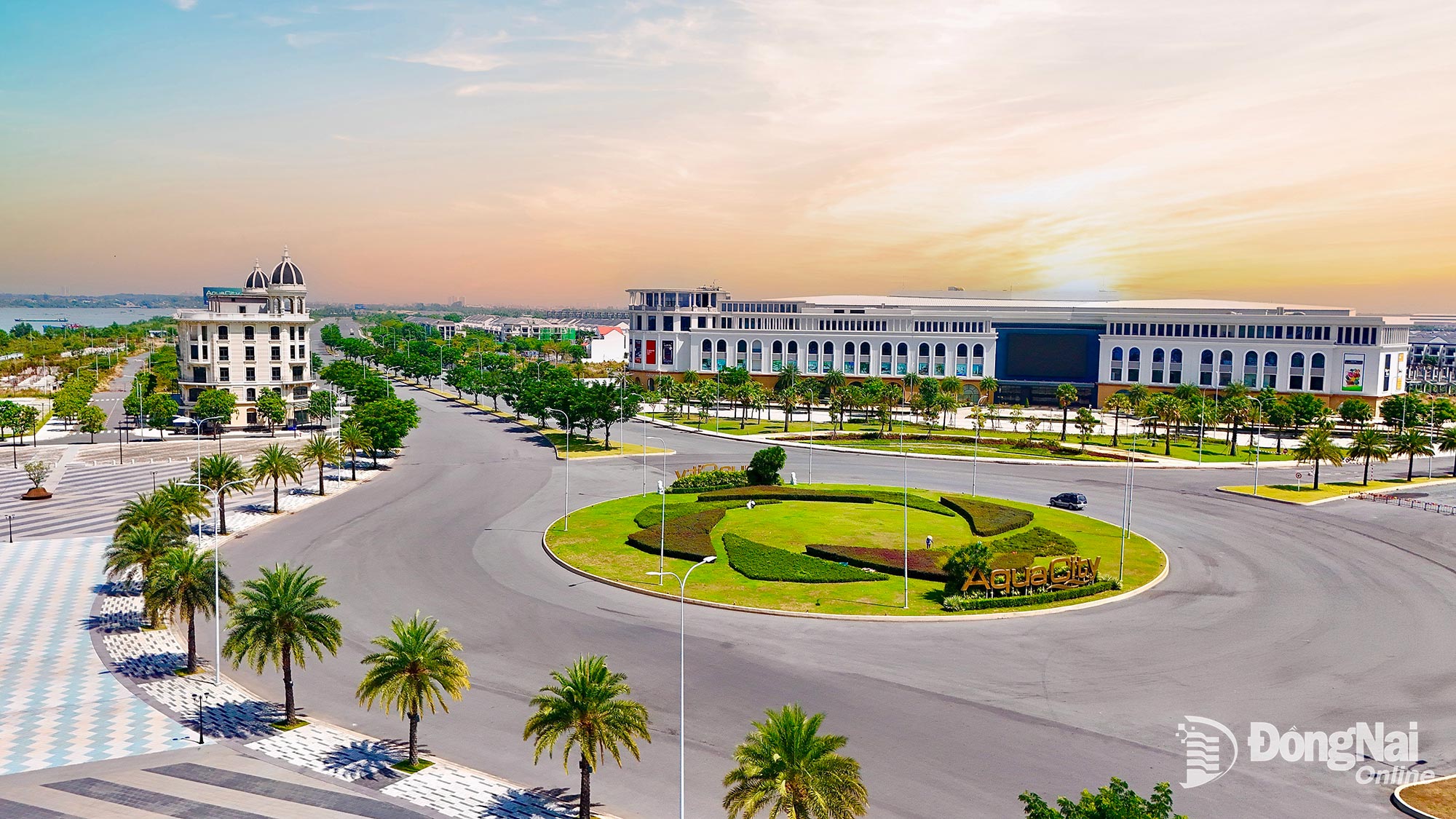 |
| The riverside ecological urban project in Long Hung ward, Dong Nai province is in the process of formation. Photo: Contributor |
A typical example of this is that Dong Nai is converting the function of Bien Hoa 1 Industrial Park - the oldest industrial park in the country, into a riverside urban, commercial and service area.
According to Vice Chairman of the Provincial People's Committee Ho Van Ha, this is not only a turning point in economic and urban development but also has great significance in renovating the riverside landscape. When completed, this area will become a modern, environmentally friendly river city. This is also a concrete step in reducing urban emissions towards the goal of net zero by 2050, creating a quality living space for the community and a new look for Dong Nai province.
Dong Nai is implementing many infrastructure projects directly connecting with Ho Chi Minh City. The proposed Ring Roads 3, 4 and 5, railway lines, and 3 river bridges will open up many development opportunities, shortening the distance with the largest economic center of the country.
To harmonize the goals of urban development and natural environment protection, the province has announced a water resource protection corridor, is implementing a series of riverside road and ecological park projects, along with planning urban wastewater treatment and drainage projects. For riverside urban areas, the province requires strict compliance with approved plans, ensuring low construction density, reserving large areas for trees, water surfaces and public spaces.
According to Mr. Dang Van Thanh, Chairman of TTC Group, the investor of the urban project in Tan Van Islet (Bien Hoa Ward), with the advantage of the surrounding river, the project is invested in a smart ecological model with low construction density, high green ratio, synchronous utilities and application of modern management technology, centralized wastewater treatment.
A representative of Novaland Group, the investor of a riverside urban project in Long Hung ward, said: The project aims to create an ecological living environment, with more than 70% of the area reserved for trees, infrastructure and public utilities. With the characteristic of 32km of natural riverbank surrounding, the project has planned a marina to contribute to the development of green transportation and waterway tourism.
Currently, many large cities in the world have succeeded with the urban development model along rivers and coasts to create sustainable living spaces. This model not only effectively exploits the value of landscapes, promotes tourism and service economy but also contributes to shaping its own identity. With the strategic vision identified in the provincial planning, synchronous implementation of infrastructure projects connecting and protecting water resources, prioritizing green investment attraction, Dong Nai can completely become a pioneer in developing ecological urban areas along rivers.
Hoang Loc
Source: https://baodongnai.com.vn/dong-nai-cuoi-tuan/202510/tan-dung-loi-the-vangde-phat-triendo-thi-sinh-thai-ven-song-1c1133d/
![[Photo] Ho Chi Minh City Youth Take Action for a Cleaner Environment](https://vphoto.vietnam.vn/thumb/1200x675/vietnam/resource/IMAGE/2025/11/04/1762233574890_550816358-1108586934787014-6430522970717297480-n-1-jpg.webp)

![[Photo] Panorama of the Patriotic Emulation Congress of Nhan Dan Newspaper for the period 2025-2030](https://vphoto.vietnam.vn/thumb/1200x675/vietnam/resource/IMAGE/2025/11/04/1762252775462_ndo_br_dhthiduayeuncbaond-6125-jpg.webp)

![[Photo] The road connecting Dong Nai with Ho Chi Minh City is still unfinished after 5 years of construction.](https://vphoto.vietnam.vn/thumb/1200x675/vietnam/resource/IMAGE/2025/11/04/1762241675985_ndo_br_dji-20251104104418-0635-d-resize-1295-jpg.webp)
![[Photo] Ca Mau "struggling" to cope with the highest tide of the year, forecast to exceed alert level 3](https://vphoto.vietnam.vn/thumb/1200x675/vietnam/resource/IMAGE/2025/11/04/1762235371445_ndo_br_trieu-cuong-2-6486-jpg.webp)


Comment (0)