
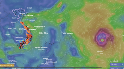
Risk of heavy rain over 60mm/3h
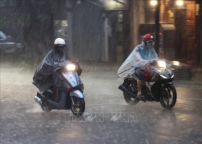
The National Center for Hydro-Meteorological Forecasting said that from the evening of November 7 to the end of November 8, the area from Thanh Hoa to Northern Quang Tri will have widespread rain of 30-60mm, locally over 150mm. In addition, in the evening and night of November 7, the Southern region and Lam Dong will have scattered showers and thunderstorms with rainfall of 10-30mm, locally over 70mm.
Warning of risk of heavy rain over 60mm/3h.
From the night of November 8, heavy rain in the area from Thanh Hoa to Northern Quang Tri tends to decrease. The risk of natural disasters due to heavy rain, tornadoes, lightning, and hail is level 1.
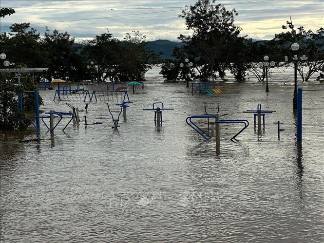
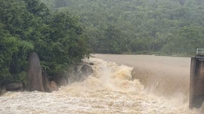
According to information from the National Center for Hydro-Meteorological Forecasting, in the next 24 hours, the flood in the upper Ba River (Gia Lai) at Ayunpa station will continue to decrease and be at alert level 2 - alert level 3; on the Huong River at Kim Long station, the Bo River at Phu Oc station will continue to decrease and be above alert level 1; on the Vu Gia River at Ai Nghia station, the Thu Bon River at Cau Lau station will continue to decrease and be below alert level 1; the downstream Kon River at Thanh Hoa station will decrease below alert level 1. The flood in the downstream Ba River at Phu Lam station will fluctuate below alert level 2, then decrease.
Risk of flooding in low-lying areas along rivers in provinces and cities from Hue city to Dak Lak. High risk of flash floods on rivers and streams and landslides on slopes in provinces and cities from Hue city to Dak Lak. Warning level 2 of natural disaster risk due to floods.
"Warning information is calculated based on the expected operating level of upstream reservoirs. The hydrometeorological agency will update the bulletins when there are changes in the discharge flow of the reservoirs," emphasized Deputy Head of Hydrological Forecasting Department Nguyen Tien Kien.
Flood prevention in low-lying coastal areas in the Southeast region
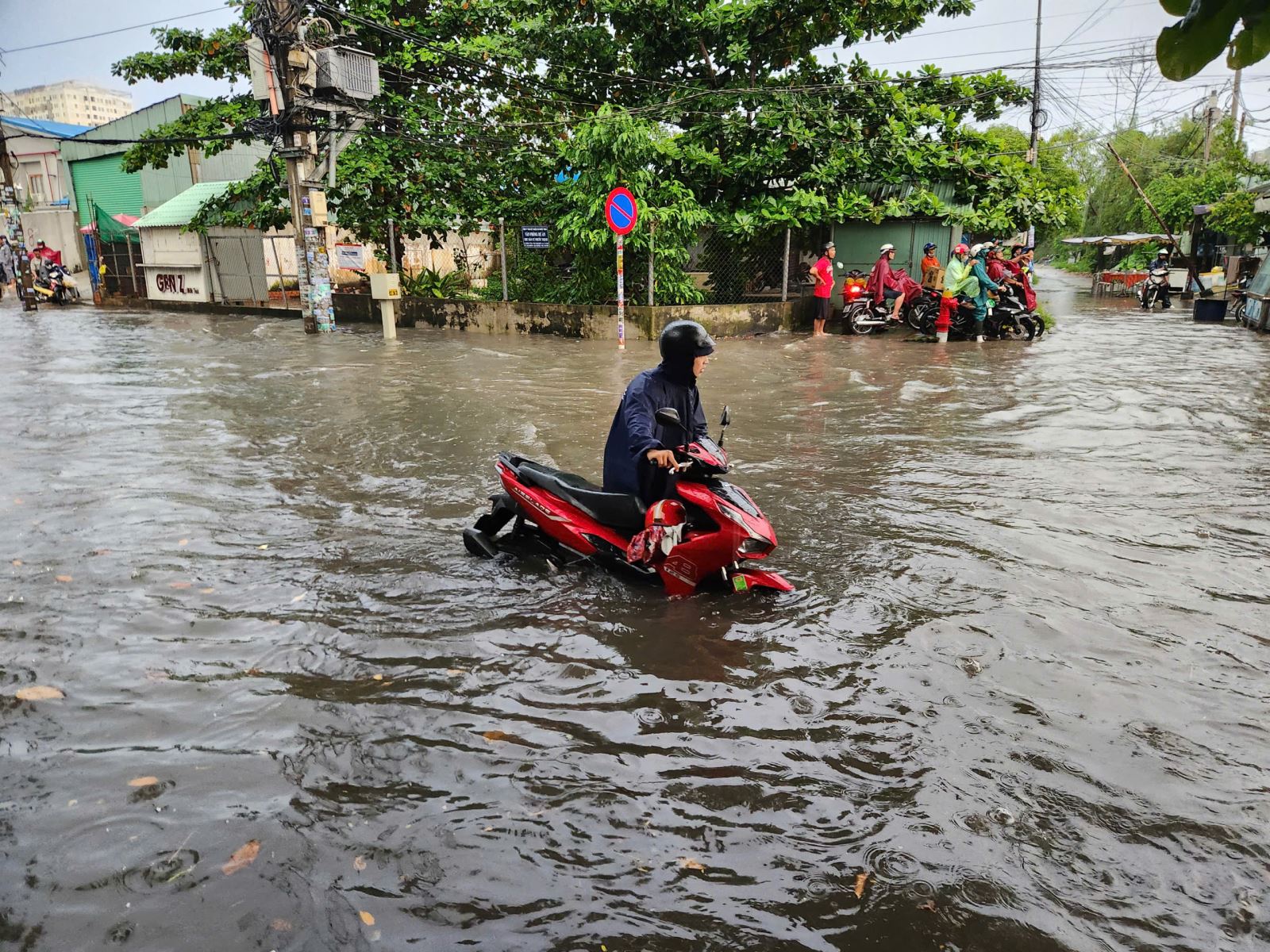
According to the forecast of the National Center for Hydro-Meteorological Forecasting, from the evening of November 7 to November 8, the coastal areas of provinces/cities from Ho Chi Minh City to Ca Mau will have the highest tide level at Vung Tau station of 4.15 - 4.25m. The peak tide time is from 3pm - 5pm and 11pm - 1am. Areas at risk of flooding due to high tides are low-lying areas and areas outside the dike.
Forecast from November 9 - 11: Tide levels in the eastern coastal areas of the South tend to decrease gradually. The highest tide peak of the day at Vung Tau station can reach 4 - 4.1m.
This is a high tide period, the eastern coastal area of the South needs to pay attention to prevent high risks of flooding, dike overflow in low-lying coastal areas, riverside areas, outside the dike affecting traffic, agricultural production, aquaculture, water pollution and people's lives in the eastern coastal area of the South.
Weather in different regions on the night of November 7 and November 8
In the Northwest, there will be scattered rain, cold at night and in the morning, and some places will be freezing. Light wind. Lowest temperature 19-22 degrees Celsius, some places below 19 degrees Celsius. Highest temperature 24-27 degrees Celsius, some places above 27 degrees Celsius.
The Northeast region has scattered rain; in the plains, there will be rain, moderate rain, locally heavy rain, cold at night and in the morning, and cold in the mountainous areas. Northeast wind level 2-3. Lowest temperature 19-22 degrees Celsius, in the mountainous areas, some places below 19 degrees Celsius. Highest temperature 22-25 degrees Celsius, some places above 25 degrees Celsius.
Hanoi has rain, locally heavy rain, cold at night and morning. Northeast wind level 2-3. Lowest temperature 20-22 degrees Celsius. Highest temperature 22-24 degrees Celsius.
Provinces and cities from Thanh Hoa to Hue, in the North there will be moderate rain, heavy rain, locally very heavy rain and thunderstorms; in the South there will be scattered showers and thunderstorms, with the possibility of tornadoes, lightning and strong gusts of wind. North to Northwest wind level 2-3. Lowest temperature 20-23 degrees Celsius. Highest temperature in the North 23-26 degrees Celsius; in the South 27-30 degrees Celsius, some places over 30 degrees Celsius.
The South Central Coast has scattered showers and thunderstorms, with the possibility of tornadoes, lightning, and strong gusts of wind. Southeast wind level 2-3. Lowest temperature 22-25 degrees Celsius. Highest temperature 29-32 degrees Celsius.
The Central Highlands has scattered showers and thunderstorms, with the possibility of tornadoes, lightning, and strong gusts of wind. Southwest wind level 2-3. Lowest temperature 19-22 degrees Celsius. Highest temperature 27-30 degrees Celsius.
The South has scattered showers and thunderstorms; in the afternoon and evening there will be scattered showers and thunderstorms, locally heavy rain, with the possibility of tornadoes, lightning and strong gusts of wind in thunderstorms. Southwest wind level 2-3. Lowest temperature 24-27 degrees Celsius. Highest temperature 29-32 degrees Celsius.
Ho Chi Minh City has scattered showers and thunderstorms; in the afternoon and evening there are scattered showers and thunderstorms, locally heavy rain, with the possibility of tornadoes, lightning and strong gusts of wind during thunderstorms. Southwest wind level 2-3. Lowest temperature 25-27 degrees Celsius. Highest temperature 30-32 degrees Celsius.
Source: https://baotintuc.vn/van-de-quan-tam/thoi-tiet-dem-711-mua-lon-mien-trung-de-phong-trieu-cuong-ven-bien-dong-nam-bo-20251107170410848.htm


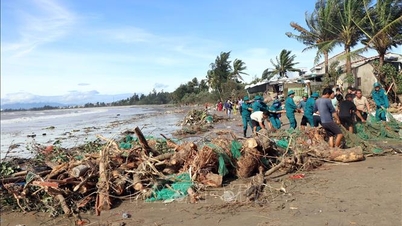
![[Photo] Da Nang: Hundreds of people join hands to clean up a vital tourist route after storm No. 13](https://vphoto.vietnam.vn/thumb/1200x675/vietnam/resource/IMAGE/2025/11/07/1762491638903_image-3-1353-jpg.webp)


Comment (0)