
That marked the birth of Vietnam's Hydrometeorology (HT) industry, a unique science closely linked to people's lives, socio- economic development, national security and defense, and disaster response in the country.
Keeping the data flowing amid bombs and bullets
Hydrometeorological work is an important, regular, long-term, specific, inter-regional, inter-sectoral, cross-border task, holding an important position in the cause of national construction and defense.
During the resistance war against French colonialism (1945-1954), most of the meteorological and hydrological stations in the North had to stop operating due to fierce fighting. The Meteorological Department and many officers of the Hydrometeorological sector went to the Viet Bac resistance zone, both participating in the resistance war and training scientific officers, and preparing professional training materials for future cadres of the sector.

Network of basic hydrological survey stations in the North in the 60s and 70s of the last century. Photo: Document of the Department of Hydrometeorology.
After the Dien Bien Phu victory in 1954, the country entered a period of peace in the North. The hydrometeorological sector was quickly restored to serve the country's construction. From the few stations left by the French colonialists, the monitoring network was expanded along the coastal areas and on major rivers. During this period, many delegations of Soviet and Chinese experts came to help Vietnam build stations, train staff, consolidate and develop basic hydrometeorological surveys.
In 1959, the Hydrological Department was established on the basis of merging the Hydrological Department in the Design Department (Ministry of Water Resources) and the Hydrological Department transferred from the Meteorological Department. Carrying out the task of building the Geophysics Department assigned by the Government and with the help of Poland, the Sa Pa and Phu Lien geophysics stations with seismic, geomagnetic, atmospheric electricity measuring equipment... were built. The stations came into operation before the Delegation of the Meteorological Department in Vietnam was first introduced to the world at the 5th International Geophysics Conference held in Moscow (1958). After 10 years of restoration and development, with the attention and investment of the State and the help of friendly countries, the industry has achieved many important achievements.

A delegation of hydrometeorological officials led by Professor Nguyen Xien went to the Soviet Union in 1968. Photo: Documents of the Hydrometeorological Department.
Entering the period of resistance against the US, the most important and extremely difficult task during this period was to maintain the continuous operation of the network of hydrometeorological stations, while minimizing possible losses, especially to the lives of observers.
Many field stations were set up right in the war zone, wartime measurement procedures were compiled and disseminated urgently. Although nearly 40% of the stations were attacked, not a single station stopped monitoring. Data chains were still maintained regularly, serving the work of forecasting, flood and storm prevention, supporting combat command and protecting production. The courage and steadfast spirit of hydrometeorologists were still passed down through many generations of cadres.
According to Deputy Director of the Hydrometeorological Department Hoang Duc Cuong, at this stage, Vietnam's monitoring network was still rudimentary, mainly located in strategic locations to serve storm and flood warnings or climate research. Staff worked with manual equipment, without computers or data processing software. All operations were recorded by hand, calculated with slide rules or mechanical machines; forecasting was mainly based on knowledge and practical experience. They had to know the weather patterns of each region, carefully observe clouds, wind, temperature, and pressure to infer developments. Communicating information from the center to remote stations was difficult, communication was only via Morse code or shortwave radio.

Observers drop iron water quality monitoring equipment into the river. Photo: Department of Hydrometeorology.
Despite the shortage, hydrometeorological officers still persistently maintain the continuous monitoring system, considering the forecasting and warning of natural disasters as a special task for production, national defense and people's lives. The trust and recognition of society has become a source of encouragement for them to stick with the profession.
Building a nationwide network after unification
After the great victory in the spring of 1975, the country was unified, the General Department of Hydrometeorology was established on the basis of merging the Meteorological Department and the Hydrological Department according to Decree No. 215/CP dated November 5, 1976 of the Government, opening a new and extremely important turning point in the history of the comprehensive development of the Industry. The station network continued to be consolidated and developed nationwide; measures to ensure capacity, quality and gradually modernize basic investigations on hydrometeorology, air and water environment were actively implemented.
The station network was consolidated and expanded nationwide. By the end of the 1980s, the southern provinces had established more than 130 meteorological, hydrological, and oceanographic stations, along with hundreds of rain gauges, air and water quality gauges, stretching from the southwestern border to the Spratly Islands.
 under the Vietnam-Soviet Union tropical meteorology research cooperation program. Photo: Document of the Department of Hydrometeorology.")
In 1989, Soviet experts installed the first MRL-5 weather radar station at Dai Phu Lien (Hai Phong) under the Vietnam-Soviet Union tropical meteorology research cooperation program. Photo: Document of the Department of Hydrometeorology.
However, in the context of the country's long-term resistance war, the network of hydrometeorological stations was often damaged; technical supplies and common measuring devices were old, outdated and constantly lacking, not being supplemented or replaced; the life and working conditions of observers were very difficult. Since 1987, the target program "Ensuring the capacity and quality of basic surveys" was implemented, combining the re-planning of the station network, the development of air and water environmental monitoring stations, the construction of the DK1-7 oceanographic station on the continental shelf and two agricultural meteorological stations in key rice growing areas.
In particular, Directive 249-CT (1991) of the Chairman of the Council of Ministers (now the Prime Minister) created a push, bringing the hydrometeorological sector into a period of innovation. Implementing this important Directive, the General Department of Hydrometeorology has developed a project "Improving the capacity and efficiency of socio-economic services of the hydrometeorological sector". The program, which has been strongly implemented since 1992, has helped improve the quality of the station network and make monitoring activities more effective.
Since the early 1990s, along with the development of digital technology, the hydrometeorological sector has gradually modernized the forecasting system: applying quantitative forecasting models, professional computer networks, satellite image receiving stations, enhancing the ability to forecast storms, heavy rains and many extreme weather patterns.
. Photo: Document of the Department of Hydrometeorology.")
Former Permanent Deputy Prime Minister Nguyen Sinh Hung visited and worked with the National Center for Hydro-Meteorology (2006). Photo: Document of the Department of Hydrometeorology.
The Ordinance on Exploitation and Protection of Hydrometeorological Works passed by the National Assembly in 1994 opened an important legal framework, helping the industry develop more synchronously. Many legal documents were issued, clearly defining the role of Hydrometeorology in state management of natural resources and environment. Entering the 21st century, along with the development of science and technology, the Hydrometeorological sector continued to receive strong investment. The automatic monitoring network is increasingly dense, weather radar systems, rain gauges, water level gauges, satellite images... are integrated synchronously.
Building a modern early warning system
With the nature of a globally synchronous science and technology, it is difficult for a single country to perform well in hydrometeorology. Over the past decades, Vietnam has sought technological support and expert training in cooperation with the Soviet Union and later the Russian Federation, Poland or Germany and international organizations. Thereby, contributing to the modernization of the station network and improving forecasting capacity, especially in the field of climate modeling and early warning.
Currently, Vietnam has established cooperative relationships and regularly shared forecast information with Japan, China, the Philippines, the UK and Europe. For example, during the super typhoon Yagi in 2024, the coordination of data sharing between Vietnam, China and Japan significantly increased the accuracy of forecasting the storm's trajectory and intensity, thereby minimizing damage to people.

United Nations Secretary-General António Guterres visits the hydrometeorology tradition room in 2022. Photo: Khuong Trung.
The World Meteorological Organization (WMO) has selected the Vietnam Hydro-Meteorological Agency as the ASEAN Regional Center for Severe Weather Forecasting and Flash Flood Warning Support, demonstrating recognition of our prestige and capacity in the region.
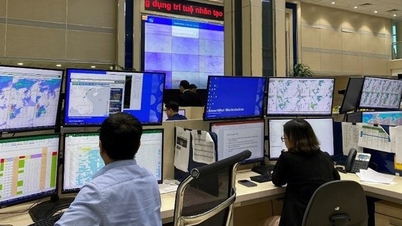
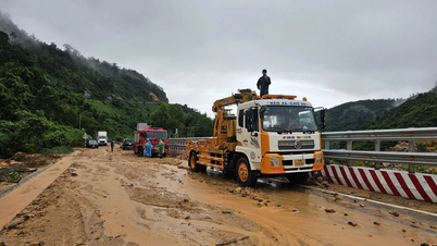
In the context of climate change strongly affecting Vietnam, the hydrometeorological forecasting and warning system is the "first line of defense" in natural disaster prevention. Currently, the national hydrometeorological monitoring system has 2,807 hydrometeorological stations across the country. Hundreds of automatic monitoring stations have been added along with a closely linked information network between the central and local levels, allowing for faster and more accurate warnings.
The forecasting agency has also accessed forecast data sources around the world, and at the same time, applied regional models directly operated by Vietnam to analyze to determine future weather trends and developments. Artificial intelligence (AI) and machine learning technology are also being applied in flood forecasting models, climate data recovery, and smart control systems for decision-making. The digitization of all historical climate data helps significantly improve the accuracy of long-term forecasts, supporting climate change response planning.
From receiving international support, we have become a trusted partner, contributing to the regional and global forecasting system. In the future, when climate change becomes increasingly complex, the hydrometeorological sector will continue to play a key role - providing scientific knowledge to protect life, develop sustainably and consolidate Vietnam's position on the world meteorological map.
Source: https://nongnghiepmoitruong.vn/viet-nhung-trang-su-khi-tuong-thuy-van-cung-dat-nuoc-d784191.html
![[Photo] General Secretary To Lam and National Assembly Chairman Tran Thanh Man attend the 80th Anniversary of the Traditional Day of the Vietnamese Inspection Sector](https://vphoto.vietnam.vn/thumb/1200x675/vietnam/resource/IMAGE/2025/11/17/1763356362984_a2-bnd-7940-3561-jpg.webp)


Comment (0)