
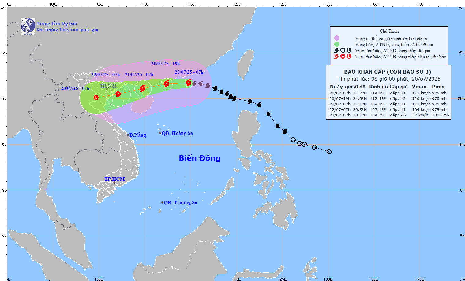
According to the National Center for Hydro-Meteorological Forecasting, the strongest wind near the storm's eye is level 11 (103-117km/h), gusting to level 14; moving in the West-Northwest direction at a speed of about 20-25km/h.
Forecast of storm impact, the northern sea area of the North East Sea has strong winds of level 8-10, near the storm center, level 11-12, gusts of level 15; waves 5-7m high. The sea is very rough.
From the night of July 20, the sea area of the northern Gulf of Tonkin (including the special zones of Bach Long Vi, Co To, and Cat Hai) will have winds gradually increasing to level 6-7, then increasing to level 8-9, the area near the storm's center will have winds of level 10-11, gusting to level 14; waves 2-4m high, the area near the center will have waves of 3-5m. The sea will be very rough.
From July 21, the sea in the southern Gulf of Tonkin will have winds gradually increasing to level 6-7, near the storm center level 8-9, gusting to level 11, waves 2-4m high. The sea will be very rough.
Vessels operating in the above mentioned dangerous areas are susceptible to the impact of storms, whirlwinds, strong winds and large waves.
. Photo: National Center for Hydro-Meteorological Forecasting")
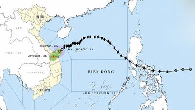
The coastal areas of Hai Phong - Quang Ninh have storm surges of 0.5-1m, water levels at Hon Dau (Hai Phong) are 3.8-4.1m high, at Cua Ong (Quang Ninh) are 4.8-5.2m high. There is a high risk of flooding in low-lying coastal and estuary areas at noon and afternoon on July 22.
On land, from the evening and night of July 21, the wind from Quang Ninh to Thanh Hoa will gradually increase to level 7-9, gusting to level 10-11; further inland, strong wind will increase to level 6-7, gusting to level 8-9; near the storm center, level 10-11, gusting to level 14.
From July 21 to July 23, in the Northern and North Central regions, there is a possibility of widespread heavy rain with common rainfall of 100-200mm, locally over 300mm; in the Northeast, Northern Delta, Thanh Hoa and Nghe An, there will be heavy to very heavy rain with common rainfall of 200-350mm, locally over 600mm. Warning of the risk of heavy rain with intensity of over 150mm/3 hours.
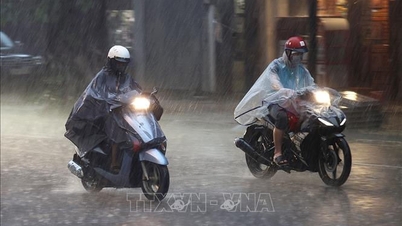
Mekong Delta: Rough seas, people take precautions against tornadoes
On the morning of July 20, the Southern Hydrometeorological Station issued an emergency storm bulletin. Accordingly, it warned of strong winds, large waves, and rising sea levels. People in the Southern region should be on guard against lightning, strong gusts of wind, and tornadoes.

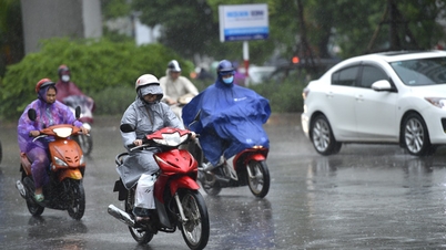
Southern sea area and Ho Chi Minh City (from Lam Dong to Ca Mau) Southwest wind level 5, sometimes level 6, gusting to level 7-8. Wave height 2-3m, rough sea. Sea area from Ca Mau - An Giang and Phu Quoc Southwest wind level 4, sometimes level 5. In both sea areas, the weather has scattered showers and thunderstorms. During thunderstorms, beware of tornadoes and strong gusts of wind.
VINH TUONG
Source: https://www.sggp.org.vn/bao-so-3-wipha-bien-dong-manh-song-cao-5-7m-post804563.html

![[Photo] Prime Minister Pham Minh Chinh chairs conference on breakthrough solutions for social housing development](https://vphoto.vietnam.vn/thumb/1200x675/vietnam/resource/IMAGE/2025/10/24/1761294193033_dsc-0146-7834-jpg.webp)

![[Photo] President Luong Cuong chaired the welcoming ceremony and held talks with United Nations Secretary-General Antonio Guterres](https://vphoto.vietnam.vn/thumb/1200x675/vietnam/resource/IMAGE/2025/10/24/1761304699186_ndo_br_1-jpg.webp)
![[Photo] Prime Minister Pham Minh Chinh and South African President Matamela Cyril Ramaphosa attend the business forum](https://vphoto.vietnam.vn/thumb/1200x675/vietnam/resource/IMAGE/2025/10/24/1761302295638_dsc-0409-jpg.webp)
![[Photo] Solemn funeral of former Vice Chairman of the Council of Ministers Tran Phuong](https://vphoto.vietnam.vn/thumb/1200x675/vietnam/resource/IMAGE/2025/10/24/1761295093441_tang-le-tran-phuong-1998-4576-jpg.webp)


Comment (0)