
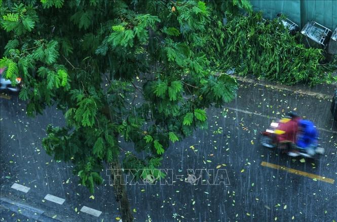
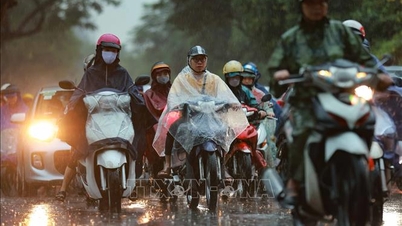
Warning, from now until about 6:45 p.m. on September 19, the above areas will have showers and thunderstorms, then expanding to Ba Dinh, Hoan Kiem, Cua Nam, Tay Ho, Hai Ba Trung and other inner-city areas of Hanoi city. During thunderstorms, there is a possibility of tornadoes, lightning and strong gusts of wind. Natural disaster risk level due to tornadoes, lightning and hail is level 1.
Faced with the above weather conditions, Head of Weather Forecast Department, National Center for Hydro-Meteorological Forecasting Nguyen Van Huong warned that thunderstorms, tornadoes, lightning, and strong gusts of wind pose a potential risk to people's lives and property.
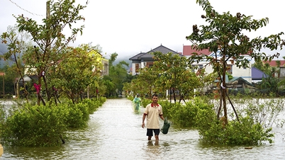
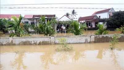
Along with that, the National Center for Hydro-Meteorological Forecasting said that from 5:30 p.m. to 10:30 p.m. on September 19, Hue city will continue to have rain with accumulated rainfall ranging from 20-40 mm, in some places over 60 mm.
Risk warning: flash floods on small rivers and streams, landslides on steep slopes, especially in the following communes/wards: Nam Dong; A Luoi 2, Chan May - Lang Co, Khe Tre, Loc An, Long Quang, Phu Loc.
Level of natural disaster risk due to flash floods, landslides, land subsidence due to heavy rain or level 1 flow.
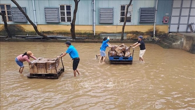
Flash floods and landslides can have very negative impacts on the environment, threaten people's lives; cause local traffic congestion, affect the movement of vehicles; destroy civil and economic works, causing damage to production and socio-economic activities.
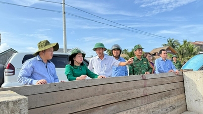
The hydrometeorological agency recommends that local authorities pay attention to reviewing bottlenecks and vulnerable locations in the area to have prevention and response measures.
From 2:00 p.m. to 4:00 p.m. on September 19, Hue city had moderate to heavy rain such as: Ta Rinh Lake 53.8 mm, Huong Son 42 mm,...
Soil moisture models show that some areas of Hue city are near saturation (over 85%) or have reached saturation.
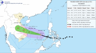
At sea, in the evening and night of September 19, the sea area from Khanh Hoa to Ho Chi Minh City, the sea area west of the Central and Southern East Sea (including the sea area west of Truong Sa special zone) will have strong winds of level 5, sometimes level 6, gusting to level 7-8, rough seas, waves 1.5-3m high.
In addition, from the evening of September 19 to September 20, the eastern sea area of the North and the middle of the East Sea, the Gulf of Tonkin, the sea area from South Quang Tri to Ca Mau, Ca Mau to An Giang and the Gulf of Thailand will have scattered showers and thunderstorms; in particular, the northern sea area of the North East Sea in the evening and night of September 19 will have storms, with the possibility of tornadoes, strong gusts of wind of level 6-7 and waves over 2m high.
The risk level of natural disasters due to strong winds at sea is level 2. All vessels operating in the above areas are at high risk of being affected by tornadoes, strong winds and large waves.
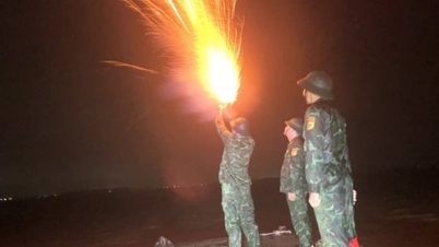
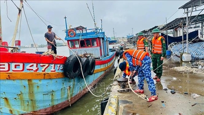
According to the guidance of the Ministry of Agriculture and Environment, to ensure the safety of people and vehicles operating at sea, localities must closely monitor warning and forecast bulletins; promptly notify captains, owners of vehicles and vessels operating at sea to proactively prevent and adjust production plans accordingly, ensuring the safety of people and property; and maintain communication to promptly handle bad situations that may occur.
Source: https://baotintuc.vn/van-de-quan-tam/canh-bao-mua-dong-kem-loc-set-o-ha-noi-va-loc-xoay-gio-giat-manh-tren-nhieu-vung-bien-20250919183627205.htm


![[Photo] Opening of the 14th Conference of the 13th Party Central Committee](https://vphoto.vietnam.vn/thumb/1200x675/vietnam/resource/IMAGE/2025/11/05/1762310995216_a5-bnd-5742-5255-jpg.webp)


![[Photo] Panorama of the Patriotic Emulation Congress of Nhan Dan Newspaper for the period 2025-2030](https://vphoto.vietnam.vn/thumb/1200x675/vietnam/resource/IMAGE/2025/11/04/1762252775462_ndo_br_dhthiduayeuncbaond-6125-jpg.webp)


Comment (0)