
Data for disaster warning and response must be "accurate, complete, clean, and active."
According to Mr. Bui Quang Huy, Deputy Director of the Center for Disaster Prevention and Control Policy and Technology, the model of applying information technology and digital transformation in community-based disaster warning and response is designed with data and people at its center, ensuring close connection between management and implementation on the ground. The central role of the community and social factors such as inclusion of vulnerable groups, gender equality, and prevention of gender-based violence are enhanced through drills, evacuation, and response activities.
Accordingly, the Hatinh -DMS (Disaster Monitoring System) operates in real time, integrating meteorological and hydrological monitoring data, reservoir data, and data from ships, as well as providing timely meteorological warnings. Information and data are managed in a holistic, comprehensive, and inclusive manner, ensuring synchronization, interoperability, and meeting the requirements of being "accurate, complete, clean, and reliable."

MSc. Bui Quang Huy speaks at the workshop sharing the results of "Model of applying information technology and digital transformation to community-based disaster response in the implementation of two-tiered local government". Photo: Phuong Linh.
“Hatinh-DMS supports enhanced monitoring, ensuring uniformity in direction, management, and implementation of disaster response activities among disaster prevention and control forces and the community, while providing warning information, response guidance, and receiving feedback from organizations, businesses, and people.”
In addition, the Disaster Response Planning Software allows provinces and communes to build digital maps such as disaster risk maps, response maps, and safe evacuation maps. Information and data for each subject in the plan are managed in a comprehensive, all-encompassing manner and updated in real time. With data synchronization with Hatinh-DMS and related systems, response forces have unified deployment of disaster prevention and control measures that are closely aligned with reality,” he said.
After a period of operation, Hatinh-DMS has proven its effectiveness in disaster prevention and control at the local level, especially in the context of implementing the two-tiered local government model.
Mr. Ho Quy Phiệt, Deputy Head of the Ha Tinh Irrigation Department, shared: "The system allows for quick, online updates of data and information in communes even during natural disasters, especially important information such as evacuation efforts, flooding, and isolation. All meteorological and hydrological data and information about the system of structures are centrally compiled on one platform, effectively serving command and control operations."
“Leaders at all levels can directly access the system to promptly grasp developments in their areas, thereby providing appropriate and realistic guidance. After a natural disaster, localities immediately update damage data, and the system automatically compiles it across the entire province, ensuring timeliness and accuracy. In particular, people can interact directly with disaster prevention and control officials through the software, and the system also serves as an online data repository for disaster prevention and control, allowing access anytime, anywhere,” he said.

Deputy Head of the Sub-Department Ho Quy Phiệt said the unit plans to develop a mobile application for the Disaster Monitoring System of Ha Tinh province. Photo: Phuong Linh.
Integrating disaster monitoring systems from the central to local levels.
In the coming period, the Ha Tinh Irrigation Sub-Department will continue to update information and data on the system annually, and at the same time develop a plan for managing and operating the provincial disaster monitoring system safely and effectively to serve disaster prevention and control efforts. In addition, the Sub-Department plans to develop a mobile application for the system to support direction, management, and the reception and processing of information directly from the field, emergency response forces, and the community.
To develop and scale up the model, Mr. Bui Quang Huy proposed building a unified architectural framework and data structure, adhering closely to the regulations of the Government, the Ministry of Agriculture and Environment , and the National Steering Committee for Digital Transformation Development. Simultaneously, he suggested issuing regulations for managing, operating, and sharing information among agencies and organizations to ensure data is updated and utilized effectively.

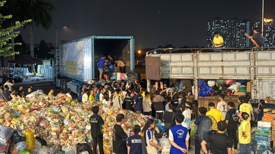
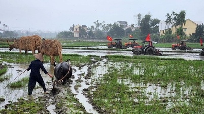
A live-fire exercise simulating the evacuation of residents under a flood scenario was conducted in Cam Due commune. Photo: Nong Thon Moi Newspaper.
The system needs to be developed synchronously on a digital platform, based on which shared functions and data should be clearly defined to ensure interoperability between different levels, while also allowing for customization of specific functions to suit the characteristics of each locality.
“To enhance the effectiveness of disaster response on a large scale, I propose promoting the sharing of information and data for guidance and management between the Vietnam Disaster Monitoring System (VNDMS) and the disaster monitoring systems of the provinces, ensuring uniformity, timeliness, and synchronization. At the same time, we should document the model for provinces to refer to and apply in training and drills for disaster response by the provincial and commune-level Disaster Prevention and Control Steering Committees. This approach contributes to improving the coordination of commune-level disaster prevention and control task forces, strengthening community response capacity, and ensuring the effective integration of content on the inclusion of vulnerable groups and the prevention and control of gender-based violence,” he said.
The Community Fund for Disaster Prevention, in coordination with the Center for Disaster Prevention and Control Policy and Technology, organized a survey and training for commune officials and village heads of 26 villages in Cam Due commune on the use of software for capturing images with coordinates and collecting field information. The content focused on updating the locations of socio- economic infrastructure combined with disaster prevention and control, such as the People's Committee headquarters, cultural centers, schools, and medical facilities; dangerous points and areas at risk of floods, inundation, and landslides; and households requiring priority early evacuation, serving the development of real-time evacuation plans for the locality.
Source: https://nongnghiepmoitruong.vn/cong-dong-la-trung-tam-cua-chuyen-doi-so-ung-pho-thien-tai-d789692.html
![[Live] 2025 Community Action Awards Gala](/_next/image?url=https%3A%2F%2Fvphoto.vietnam.vn%2Fthumb%2F1200x675%2Fvietnam%2Fresource%2FIMAGE%2F2025%2F12%2F16%2F1765899631650_ndo_tr_z7334013144784-9f9fe10a6d63584c85aff40f2957c250-jpg.webp&w=3840&q=75)
![[Image] Leaked images ahead of the 2025 Community Action Awards gala.](/_next/image?url=https%3A%2F%2Fvphoto.vietnam.vn%2Fthumb%2F1200x675%2Fvietnam%2Fresource%2FIMAGE%2F2025%2F12%2F16%2F1765882828720_ndo_br_thiet-ke-chua-co-ten-45-png.webp&w=3840&q=75)
![[Photo] Prime Minister Pham Minh Chinh receives the Governor of Tochigi Province (Japan)](/_next/image?url=https%3A%2F%2Fvphoto.vietnam.vn%2Fthumb%2F1200x675%2Fvietnam%2Fresource%2FIMAGE%2F2025%2F12%2F16%2F1765892133176_dsc-8082-6425-jpg.webp&w=3840&q=75)

![[Photo] Prime Minister Pham Minh Chinh receives Lao Minister of Education and Sports Thongsalith Mangnormek](/_next/image?url=https%3A%2F%2Fvphoto.vietnam.vn%2Fthumb%2F1200x675%2Fvietnam%2Fresource%2FIMAGE%2F2025%2F12%2F16%2F1765876834721_dsc-7519-jpg.webp&w=3840&q=75)


Comment (0)