
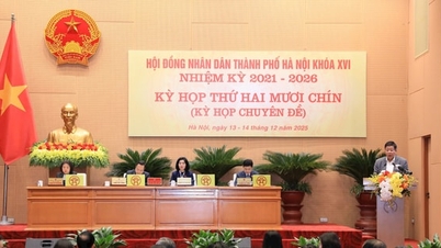
On the morning of December 14th, delegates of the 16th term of the Hanoi City People's Council passed a resolution approving the investment plan for the construction of the Red River Scenic Boulevard.
The Red River Scenic Boulevard construction project is a large-scale project of strategic significance, contributing to the development of the capital city, the Red River Delta region, and the entire country.
The project comprises four independent sub-projects. Sub-project 1 (left bank of the Red River) includes a major traffic artery on the left bank; a landscaped park and recreational area; and land clearance for urban development.
Component Project 2 (right bank of the Red River) includes a major traffic boulevard; a landscaped park and recreational area; and land clearance for urban development. This includes the Phu Thuong ward park project, covering an area of 2 hectares, with an initial estimated capital of approximately 670 billion VND (an independent sub-project initially) to facilitate its commencement.
Component Project 3 is an underground Metro line along the right bank of the Red River, approximately 45 km long, aiming to connect with the city's urban rail system.
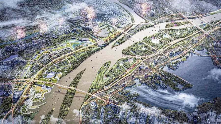
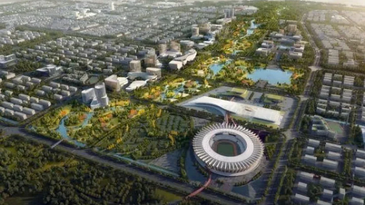
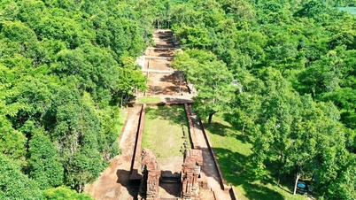
The Red River Scenic Boulevard project has a preliminary total investment of approximately 855,000 billion VND. (Illustrative image).
Component Project 4 is a resettlement urban area, implemented on-site (in the form of high-rise apartment buildings) within the scope of the investment project and may also be implemented on reciprocal land plots used to compensate the investor (in the form of low-rise housing and high-rise apartment buildings).
The preliminary total investment for the overall project is approximately VND 855,000 billion; the specific total investment for each component project will be determined in subsequent steps. The project is expected to be completed in 2030.
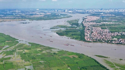
The project site is located along the Red River from Hong Ha Bridge to Me So Bridge, within the administrative boundaries of 19 communes and wards of Hanoi City. Specifically, the right bank of the Red River passes through 12 communes and wards: O Dien, Thuong Cat, Dong Ngac, Phu Thuong, Hong Ha, Vinh Tuy, Vinh Hung, Linh Nam, Hoang Mai, Thanh Tri, Nam Phu, and Hong Van; the left bank of the Red River passes through 7 communes and wards: Me Linh, Thien Loc, Vinh Thanh, Dong Anh, Bo De, Long Bien, and Bat Trang.
The project covers an area of approximately 11,000 hectares, including: an 80km main traffic artery; a 3,300-hectare landscaped park and recreational area; and approximately 2,100 hectares for urban redevelopment.
The project is expected to be implemented under a public-private partnership model, in which the land fund for payment to the project will be determined in the urban redevelopment area within the scope of the overall investment project of the Red River Landscape Boulevard and the aforementioned resettlement urban area; this will be specifically determined during the subsequent implementation process, ensuring compliance with the regulations in Decree No. 257/2025/ND-CP.
The project is expected to be completed by 2030.
To kick things off, an independent sub-project, a public park in Phu Thuong ward, will be implemented first. This sub-project covers approximately 2 hectares, with a preliminary total investment of 670 billion VND, and is scheduled for its groundbreaking ceremony on December 19th.
According to reports and expert opinions, the Red River plays an irreplaceable role in the formation and development of Hanoi – the economic, cultural, and political center of the country. Investing in the construction of the Red River Scenic Boulevard aims to complete the transportation infrastructure system, promote urban development along both banks of the river, and create a modern, sustainable urban landscape that bears the symbolic imprint of the capital city.
The project is considered to be in line with the major policies of the Party and the State, the directives of the Central leadership, and the relevant resolutions on the development of Hanoi.
The City People's Council noted the need to review and avoid duplication with other infrastructure projects, ensure the efficient use of reciprocal land funds, strictly comply with regulations on dikes, flood control, and the environment, and have comprehensive solutions for land clearance and social welfare, creating consensus among the people during the project implementation process…

Source: https://vtcnews.vn/ha-noi-se-co-tuyen-metro-ngam-45km-tai-truc-dai-lo-canh-quan-song-hong-ar992885.html


Comment (0)