

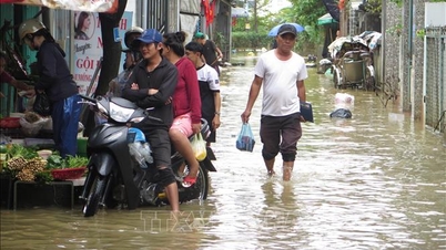
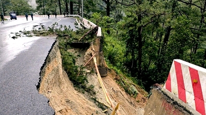
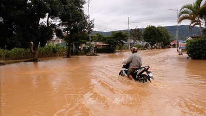
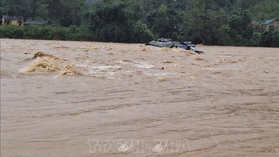
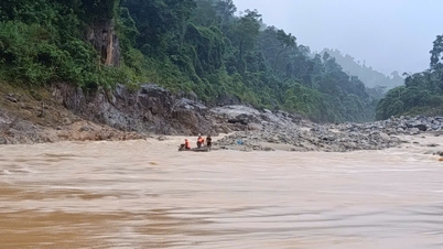
Flood forecast exceeds alert level 3, risk of flash floods, landslides and flooding is threatening downstream areas and urban areas.
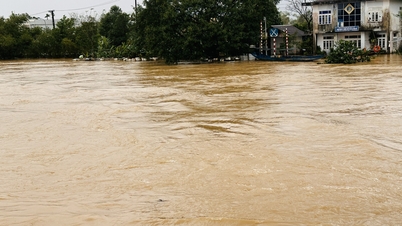
In the past 12 hours, the flood water level on Cai Nha Trang River has been rising rapidly. The water level at 6:00 a.m. on November 17 at Dong Trang Hydrological Station was 9.44m, 0.06m below alarm level 2, and at Dien Phu Station it was 5.51m, 0.01m above alarm level 3.
Similarly, on Cai Phan Rang River, flood water levels are also rising rapidly. The water level at 6am on November 17 at Tan My hydrological station was 37.90m, 0.40m above alert level 3, at Phan Rang station it was 2.52m, 0.02m above alert level 1.
Khanh Hoa Province Hydrometeorological Station forecasts that the flood will peak in the next 1-7 hours. The flood peak in Tan My is expected to be 0.5 - 1.0m above alert level 3 and in Phan Rang at approximately alert level 3. Other rivers and streams in the province are also likely to experience floods at alert levels 2-3, with some rivers even exceeding alert level 3.
Khanh Hoa Province Hydrometeorological Station warns of flood risk level 2. People need to be especially cautious of flash floods and landslides that may occur in mountainous areas, and pay attention to the risk of rain and floods affecting the safety of reservoirs. In addition, downstream areas, riverside areas and urban areas in the downstream areas of Cai Nha Trang River and Cai Phan Rang River are at risk of flooding.
Khanh Hoa Provincial People's Committee requested communes, wards and special zones to closely monitor forecasts and warnings of heavy rain, floods, inundation, flash floods and landslides to provide timely and complete information to people so that they can proactively prevent them. Local authorities organized forces on standby; arranged forces, materials and means to be ready to support people in evacuating people to safe places...
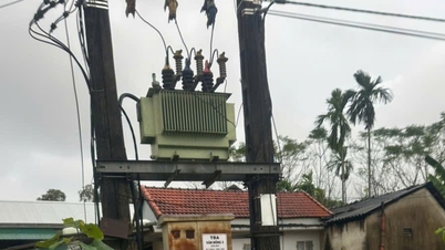
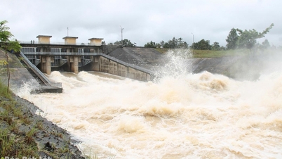
The Department of Agriculture and Environment guides reservoir management units to proactively calculate the amount of incoming water, operate and regulate flood discharge appropriately, ensure water storage for production, safety of works and prevention of flooding in downstream areas...
Xuan Trieu
Source: https://baotintuc.vn/xa-hoi/lu-tren-cac-song-o-tinh-khanh-hoa-dang-len-nhanh-20251117075535770.htm


![[Photo] General Secretary To Lam and National Assembly Chairman Tran Thanh Man attend the 80th Anniversary of the Traditional Day of the Vietnamese Inspection Sector](https://vphoto.vietnam.vn/thumb/1200x675/vietnam/resource/IMAGE/2025/11/17/1763356362984_a2-bnd-7940-3561-jpg.webp)


Comment (0)