
On the same afternoon, the water level on the Luy River at the Luy River station was rising rapidly. The water level measured at the station at 7 p.m. on November 7 was 27.21m, 0.29m below alarm level II.
Warning tonight and tomorrow morning (November 8), flood on Luy River at Luy River station continues to rise, flood peak can reach 29.2m, 0.7m above alarm level III.
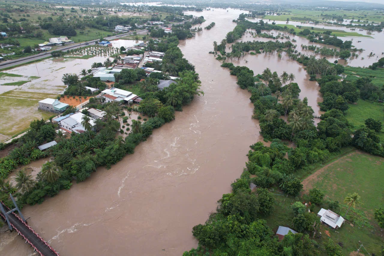
By tomorrow evening (November 8), the flood on the Luy River is likely to gradually decrease to 0.2m below the level II warning. There is a risk of landslides on slopes, embankments, and flooding in low-lying areas along the upper reaches of rivers and streams in the Luy River basin in the following wards and communes: Song Luy, Luong Son, Hong Thai, Bac Binh, and Phan Ri Cua. The flood disaster risk warning level is level 1.
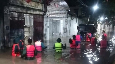
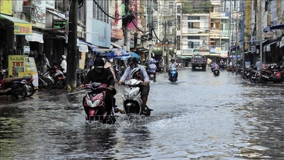
Flood warning, in riverside areas in the Luy River basin, there is a high risk of flash floods and localized inundation. Low-lying areas and residential areas along rivers and streams need to be careful.
Floods can bury, erode, and inundate production land, affect constructions, and cause roads to be flooded, making travel difficult, especially in areas along the Luy River.
Currently, the communes along the Luy River have urgently requested people to evacuate people, livestock, and property to high, safe areas. At the same time, people are advised not to go through flooded areas, overflow bridges, rivers, and streams with strong currents. In addition, the militia, police, and organizations are ready to coordinate to support the evacuation and ensure the safety of the people.
Also on November 7, Lam Dong Province's Hydrometeorological Station forecasted the risk of floods and flash floods in the basins of Luy River, La Nga River, Phan River, Dinh River, Quao River, Cai River, Ca Ty River and small rivers and streams, landslides and land subsidence on steep slopes, mountain passes, positive taluy roads, and traffic routes.
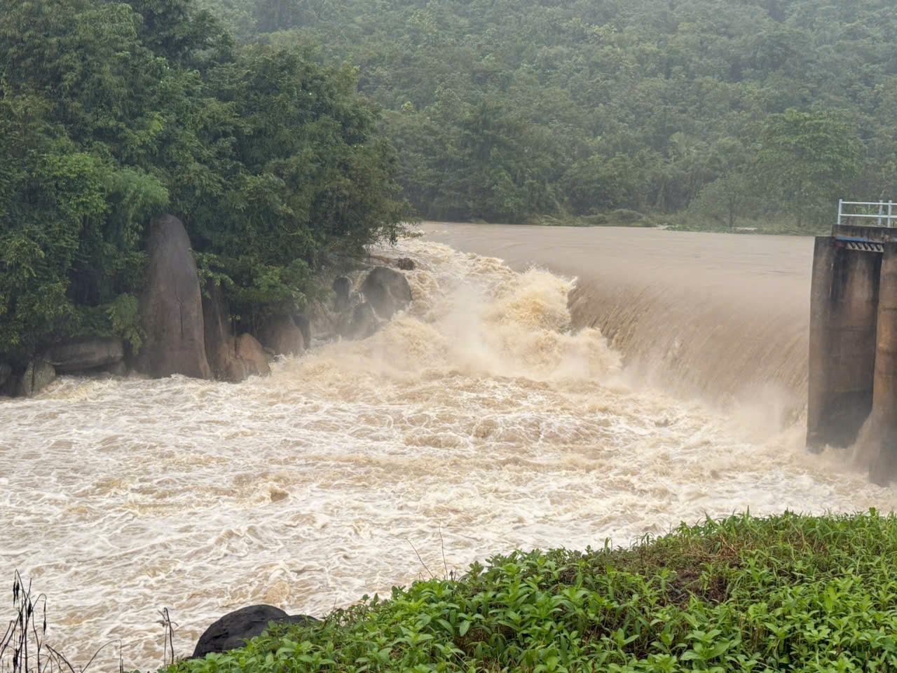
Flash floods and landslides can have very negative impacts on the environment, threaten people's lives; cause local traffic congestion, affect the movement of vehicles; destroy civil and economic works, causing damage to production and socio-economic activities.
From noon to evening of November 7, Lam Dong province had moderate to heavy rain, and in some places very heavy rain. Soil moisture models show that some areas are nearly saturated (over 90%) or have reached a saturated state.
Source: https://baolamdong.vn/lu-tren-song-luy-len-cao-canh-bao-vuot-bao-dong-iii-trong-dem-7-va-8-11-401205.html
![[Photo] "Ship graveyard" on Xuan Dai Bay](https://vphoto.vietnam.vn/thumb/1200x675/vietnam/resource/IMAGE/2025/11/08/1762577162805_ndo_br_tb5-jpg.webp)


![[Video] Hue Monuments reopen to welcome visitors](https://vphoto.vietnam.vn/thumb/402x226/vietnam/resource/IMAGE/2025/11/05/1762301089171_dung01-05-43-09still013-jpg.webp)


Comment (0)