
 |
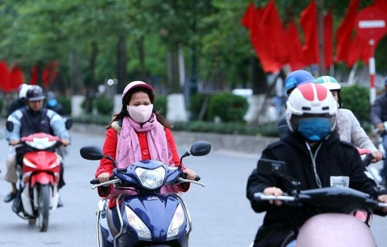
| The North welcomes increased cold air, mountainous areas are cold, some places below 17 degrees Celsius. Illustrative photo. |
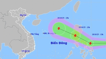
According to the forecast of the National Center for Hydro-Meteorological Forecasting, the cold air mass continues to move southward. In the next 24 to 48 hours (around the morning of October 26), this cold air mass will affect the Northeast region, then affect the North Central region and some places in the Northwest and Central Central regions. Northeast wind inland is strong at level 2-3, coastal areas at level 3-4.
The influence of cold air causes the lowest temperature during this cold air mass in the Northern region, Thanh Hoa and Nghe An to commonly be 19-22 degrees Celsius.
In Hanoi area, the night and morning are cold, the lowest temperature in this cold air mass is commonly from 19-21 degrees Celsius.
At sea from early morning on October 26, in the Gulf of Tonkin, the Northeast wind gradually increased to level 6, gusting to level 7-8, rough seas, waves 1.5-3m high; the sea area north of the North East Sea had strong Northeast wind at level 6, sometimes level 7, gusting to level 8-9, rough seas, waves 3-5m high; the sea area from South Quang Tri to Da Nang city had Northeast wind at level 5, sometimes level 6, gusting to level 7-8, rough seas, waves 2-4m high.
Due to the influence of cold air strengthening combined with disturbances in the upper easterly wind zone, the area from South Quang Tri to Da Nang and the eastern part of the provinces from Quang Ngai to Dak Lak will have moderate rain, heavy rain and thunderstorms, and locally very heavy rain.
Thunderstorms accompanied by tornadoes, lightning, hail and strong gusts of wind can affect agricultural production, break trees, damage houses, traffic works and infrastructure.
Strong winds and gusts, large waves at sea may affect boating and other activities. Colder weather at night and in the morning may affect health.
Source: https://baothainguyen.vn/tai-nguyen-moi-truong/202510/mien-bac-don-khong-khi-lanh-tang-cuong-8f30bb0/

![[Photo] Prime Minister Pham Minh Chinh and United Nations Secretary-General Antonio Guterres attend the Press Conference of the Hanoi Convention Signing Ceremony](https://vphoto.vietnam.vn/thumb/1200x675/vietnam/resource/IMAGE/2025/10/25/1761391413866_conguoctt-jpg.webp)
![[Photo] National Assembly Chairman Tran Thanh Man receives United Nations Secretary-General Antonio Guterres](https://vphoto.vietnam.vn/thumb/1200x675/vietnam/resource/IMAGE/2025/10/25/1761390815792_ctqh-jpg.webp)


![[Photo] Prime Minister Pham Minh Chinh receives United Nations Secretary-General Antonio Guterres](https://vphoto.vietnam.vn/thumb/1200x675/vietnam/resource/IMAGE/2025/10/25/1761390212729_dsc-1484-jpg.webp)


![[Photo] General Secretary To Lam meets with General Secretary and President of Laos Thongloun Sisoulith](https://vphoto.vietnam.vn/thumb/1200x675/vietnam/resource/IMAGE/2025/10/25/1761380913135_a1-bnd-4751-1374-7632-jpg.webp)


Comment (0)