
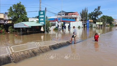
"Unusual rainfall" is the explanation given by Lam Dong authorities for the landslide on Bao Loc Pass, which buried the Madagui Traffic Police Station (belonging to the Lam Dong Provincial Police Traffic Department, Da Huoai District) and killed four people.
Data from the meteorological agency shows that rainfall in the Bao Loc area at the end of July, while not record-breaking, was higher than the multi-year average.
The landslide occurred in Da M'Ri town, Da Huoai district – more than 20 km from the center of Bao Loc city (Lam Dong province). This area is known as one of the "heaviest rainfall centers" in the country, according to the 2021 National Climate Assessment Report of the Ministry of Natural Resources and Environment . Bao Loc's total annual rainfall is 2,949 mm, far exceeding the regional average of 1,921 mm. This highland region also frequently experiences heavy, prolonged rainfall.
Monthly rainfall data for Bao Loc over 30 years

Prior to the landslide, in just 24 hours from the evening of July 29th to July 30th, Bao Loc Pass received 201 mm of rain, equivalent to half the average rainfall for the entire month of July at the Bao Loc station (441.2 mm).
"Such rainfall intensity is very high," said Master's degree holder Nguyen Van Huan, Head of the Forecasting Department at the Central Highlands Regional Meteorological and Hydrological Station. Normally, Vietnam's rainfall is around 5 mm per day; anything over 50 mm is considered heavy rain.
He stated that the heaviest rainfall occurred between 10 AM and 1 PM, just before the landslide that killed four people (2:45 PM). Specifically, 26 mm fell between 10 AM and 11 AM, and 59 mm between 12 PM and 1 PM. Over the three days from July 27th to July 30th, the Bảo Lộc pass absorbed 299 mm of rain, the highest in the country at that time.
"If it rains all day but the heavy rainfall is concentrated in one hour, the risk of landslides is entirely possible in areas with unstable soil structures," Mr. Huan explained.
Areas with peak rainfall at the end of July 2023 across the country.
Although the rainfall on July 30th in Bao Loc was heavy, it did not break any records. Data from 1961-2018 shows that the average daily rainfall in the Central Highlands was 245 mm, with the record being 443 mm in a single day.
Including July, Bao Loc's rainfall was not unusually high, at 565 mm – higher than the multi-year average but not the highest. However, if we include June and July, the rainfall in the area reached 1,179 mm, the highest in the past 30 years.
Heavy rains have caused a series of natural disasters such as landslides and flash floods, resulting in significant losses of both lives and property. From 2005 to the present, natural disasters have claimed 90 lives in Lam Dong province and caused losses exceeding 1,900 billion VND. While casualties tended to decrease from 2009, they have increased again this year.
The Lam Dong Provincial People's Committee announced that in just seven months, nine people have died due to various types of natural disasters – the highest number in 14 years. Of these, six were buried in landslides.
Human and property damage caused by natural disasters in Lam Dong province from 2005 to the present.

Statistics from 2010 to the present show that this province experiences 2 to 5 landslides each year. Meanwhile, in just the past 7 months, 4 landslides have been recorded, causing 6 deaths, indicating an increasing severity of this type of natural disaster.
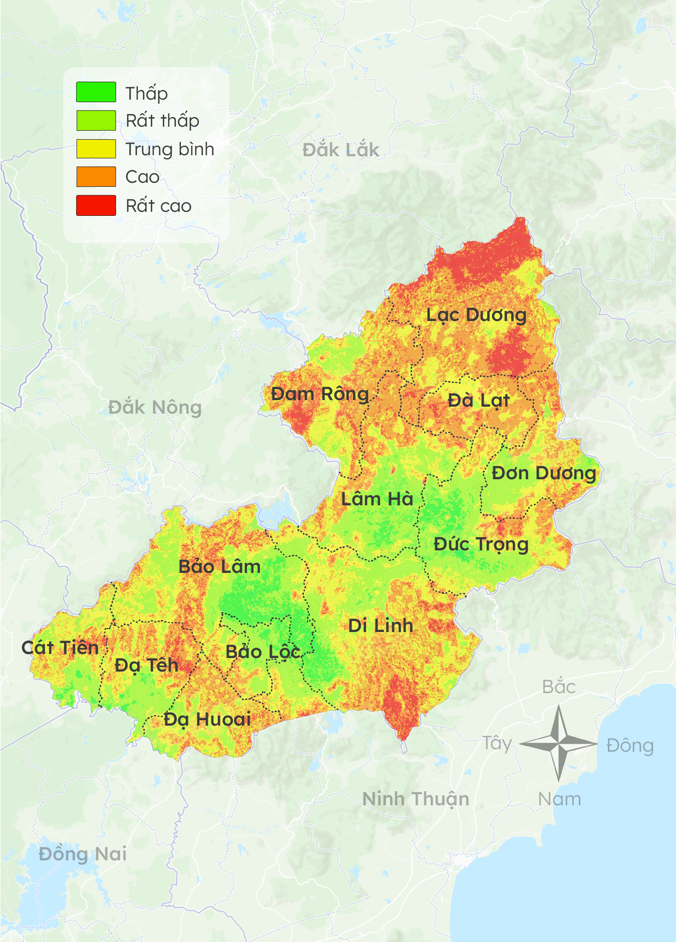
According to the Institute of Geological Sciences and Minerals (Ministry of Natural Resources and Environment), Lam Dong province has 9.79% of its area at very high risk of landslides, with the highest concentration in Lac Duong district (31% of the area). High-risk areas account for 28% of the area, mainly in Dam Rong, Di Linh districts and Da Lat city.
According to the Lam Dong Provincial People's Committee, during the rainy season, landslides are common on mountain passes and sections of hilly areas with steep slopes such as National Highways 20, 27, 28, and Road 723; and in urban areas such as Dran town (Don Duong district), Di Linh town and the communes of Dinh Lac, Tan Nghia, and Gia Hiep (Di Linh district).
Landslide risk zoning map of Lam Dong province.
Average rainfall in 4 regions of Lam Dong province from 1991 to 2022
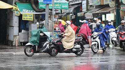
The situation is expected to become even more tense in the coming months, as Lam Dong has only just entered the peak of the rainy season. Data from previous years shows that August and September are when rainfall peaks, bringing with it the risk of landslides in this highland region.
According to Nguyen Van Huan, Head of the Forecasting Department of the Central Highlands Regional Meteorological and Hydrological Station, in August, Lam Dong province in particular and the Central Highlands in general will experience higher-than-average rainfall, with a high risk of continued heavy rain.
Dr. Nguyen Tien Cuong, a landslide expert at Phenikaa University, analyzed that prolonged heavy rainfall causes water to accumulate in the soil, making it soft, reducing its cohesion, and leading to landslides.
"Rain is the direct cause, but human actions have exacerbated it," he said.
Besides rain, weak geological conditions also make landslides more likely. A common cause of changes in soil structure is the conversion of forests into plantations and slash-and-burn agriculture. He cited that in 1945, Vietnam's forest cover was 43%, but due to the effects of war and deforestation, it dropped to only 28% at one point. Currently, the national forest cover has increased to 41%, but most of it consists of newly planted forests, which are sparse and less effective at retaining soil than before. Consequently, the rate of landslides has also increased.
Furthermore, construction projects that did not thoroughly study the geological stability increased the risk of loss of life and property. He cited the example of the Rào Trăng 3 hydropower plant construction site (Thừa Thiên Huế), which had been warned of a high risk of landslides, but was not adequately assessed before construction, leading to the tragic landslide in 2020.
Dr. Hoang Phuc Lam, Deputy Director of the National Center for Meteorological and Hydrological Forecasting, noted that in recent years, heavy rains, thunderstorms, tornadoes, and hailstorms have become increasingly unusual in terms of timing, location, frequency, and intensity. As early as June – when the El Nino period began – the agency warned of the need to prepare for more frequent extreme weather events.
"The weather could become more unpredictable, potentially causing record-breaking heavy rainfall in 24 hours," said Mr. Lam, warning of the continued risk of flash floods and serious landslides in the future.
Content: Thu Hang - Viet Duc - Gia Chinh
Graphics: Hoang Khanh - Thanh Ha
Regarding the data: Lam Dong province has four meteorological stations: Da Lat, Lien Khuong, Bao Loc, and Cat Tien. The rainfall data in this article is taken from the Bao Loc meteorological station – the station closest to the landslide site in Da M'Ri town, Da Huoai district, in the southwestern part of Lam Dong province.
Source link
![[Photo] Prime Minister Pham Minh Chinh holds a phone call with the CEO of Russia's Rosatom Corporation.](/_next/image?url=https%3A%2F%2Fvphoto.vietnam.vn%2Fthumb%2F1200x675%2Fvietnam%2Fresource%2FIMAGE%2F2025%2F12%2F11%2F1765464552365_dsc-5295-jpg.webp&w=3840&q=75)


Comment (0)