
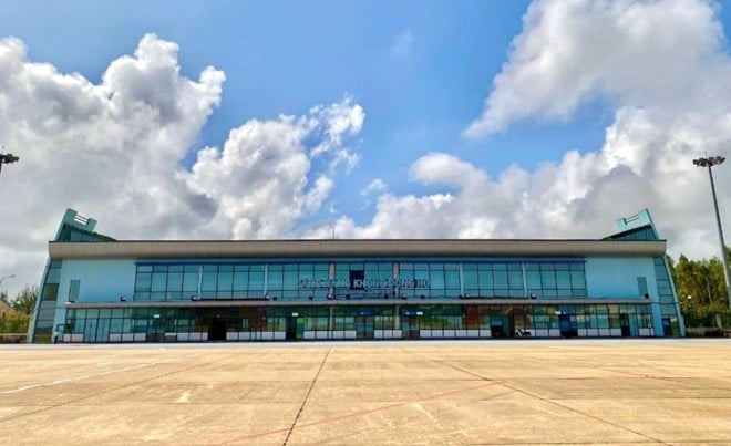
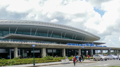
On the morning of September 19th, in an interview with a reporter from Lao Dong Newspaper, Nguyen Thanh Nam, Director of Dong Hoi Airport, stated that Dong Hoi Airport would temporarily suspend operations from 3 PM to 10 PM that day due to the impact of Typhoon No. 4.
“This morning, we expect to handle three normal flights. The airport has deployed measures to secure infrastructure, equipment, and vehicles, and dredge the drainage system. We have notified units to implement response plans for Typhoon No. 4, following the 'four on-the-spot' principle. We have organized standby forces ready to bring the airport back into operation when the typhoon's impact subsides,” Mr. Nam said.
Previously, the Civil Aviation Authority of Vietnam requested the Vietnam Airports Corporation to direct airports located in the area affected by Typhoon No. 4 (Dong Hoi Airport, Da Nang International Airport, Phu Bai International Airport, Chu Lai Airport, and Vinh Airport) to take the lead and coordinate with relevant agencies and units to inspect airport infrastructure and communication systems… to promptly detect and handle any damage (if any) to ensure the safety of facilities and stations, and to ensure safe operation at airports.
Simultaneously, maintain a 24/7 duty roster and proactively update meteorological information to promptly propose appropriate and safe exploitation plans.
Regarding the Vietnam Air Traffic Management Corporation (VATM), the Civil Aviation Authority of Vietnam (CAAV) requests VATM to direct its aviation meteorological agencies to continue regularly monitoring and updating meteorological bulletins to report to the CAAV and the Steering Committee for Disaster Prevention and Search and Rescue in the aviation sector for consideration and decision on airport operations; and to provide timely information to airports, airlines, and relevant agencies and units.
According to the Central Meteorological and Hydrological Center, on the morning of September 19, the tropical depression in the northeastern area of the Hoang Sa archipelago strengthened into a typhoon - the 4th typhoon of 2024.
At 4:00 AM on the same day, the typhoon's center was located at approximately 17.3 degrees North latitude and 109.8 degrees East longitude, 210km northeast of Da Nang and about 260km east of Quang Tri . The strongest winds near the center of the typhoon were at level 8 (62-74km/h), with gusts up to level 10; it was moving mainly westward at a speed of about 20km/h.
As of 4 PM on September 19th, the storm was moving westward at a speed of approximately 20-25 km/h over the coastal waters from Quang Tri to Quang Nam; the strongest winds near the storm's center were at level 8, gusting to level 10; the natural disaster risk level was 3. The affected areas included the western part of the North East Sea (including the Hoang Sa area); the sea area from Nghe An to Quang Ngai (including Ly Son Island, Cu Lao Cham, Con Co, Hon Ngu); and the mainland area from Ha Tinh to Quang Nam.
Source: https://laodong.vn/kinh-doanh/san-bay-dong-hoi-tam-dung-khai-thac-tu-15h-den-22h-ngay-199-1396331.ldo


Comment (0)