
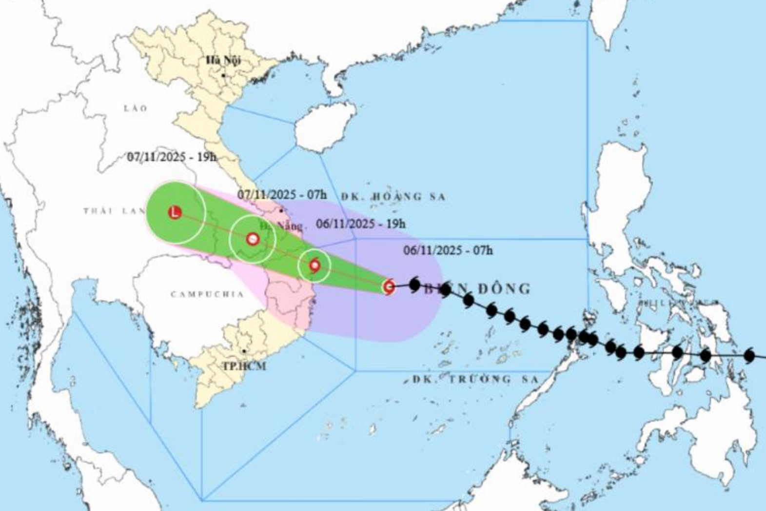
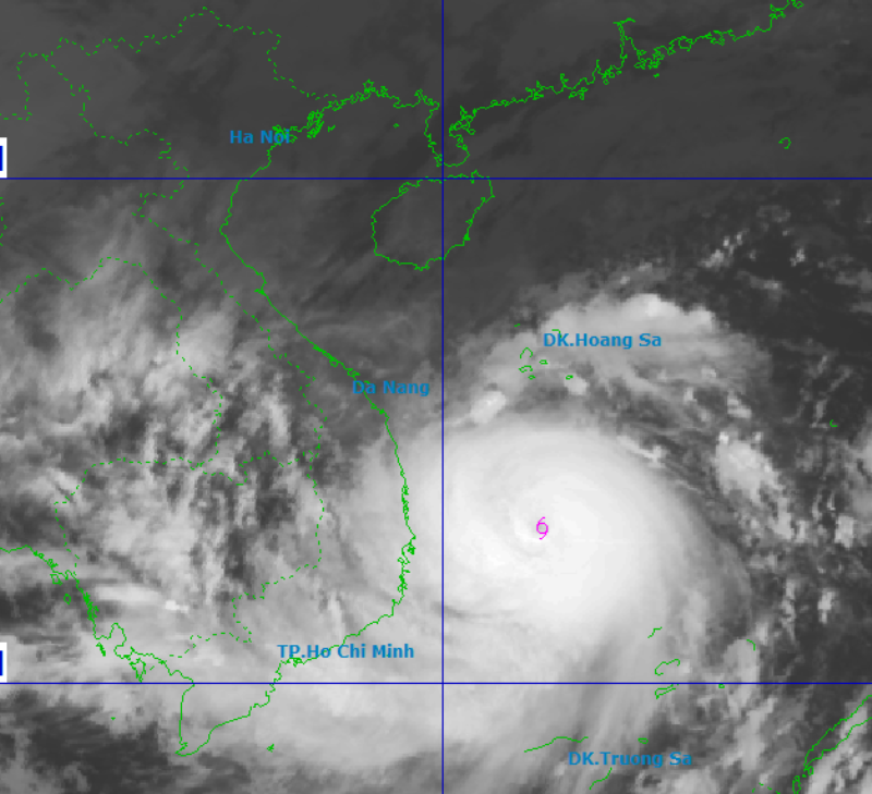
According to the forecast of the National Center for Hydro-Meteorological Forecasting, at 7:00 p.m. on November 6, the eye of the storm was at about 14 degrees north latitude, 109.4 degrees east longitude, on the coastal area from Quang Ngai to Dak Lak with the strongest wind at level 13-14, gusting to level 17.
The storm changed direction and moved west-northwest at a speed of 25-30km/hour, moved inland and gradually weakened into a tropical depression in the southern Laos region.
Due to the storm's influence, the central East Sea area will have strong winds of level 8-11; the area near the storm's eye will have strong winds of level 12-14, gusts of level 17, waves 5-7m high, the area near the storm's eye will have waves of 8-10m high; the sea will be very rough.
From the morning of November 6, the sea area from southern Quang Tri to Khanh Hoa (including Ly Son special zone, Cu Lao Cham island) has winds gradually increasing to level 6-7, then increasing to level 8-11, waves 3-6m high; the area near the storm center has strong winds of level 12-14, gusts of level 17, waves 7-9m high; the sea is very rough.
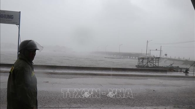
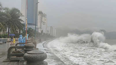
Coastal areas from Hue city to Dak Lak have storm surges of 0.4-0.8m. From the afternoon of November 6, coastal areas from Hue to Dak Lak are on guard against rising sea levels accompanied by large waves causing flooding in low-lying areas, waves overflowing dikes, coastal roads, coastal erosion, and slowing down flood drainage in the area.
All ships, boats, and aquaculture areas in the above-mentioned dangerous areas are strongly affected by storms, whirlwinds, strong winds, big waves, and rising sea levels.
From the evening of November 6, on the mainland from the south of Da Nang city to Dak Lak, the wind will gradually increase to level 6-7, then increase to level 8-9, the area near the storm's eye will have strong winds of level 10-12, focusing on the east of the provinces from Quang Ngai to Gia Lai, gusting to level 14-15; the area from the south of Quang Tri to the north of Da Nang city and the northern area of Khanh Hoa province will have strong winds of level 6-7, gusting to level 8-9.
From the evening and night of November 6, in the west of the provinces from Quang Ngai to Gia Lai, the wind will gradually increase to level 6-7, near the storm's eye, it will be level 8-9, gusting to level 11.
From November 6 to 7, the area from Da Nang city to Dak Lak will have very heavy rain with common rainfall of 200 - 400mm/period, locally over 600mm/period; the area from southern Quang Tri to Hue and the area of Khanh Hoa and Lam Dong provinces will have heavy rain with common rainfall of 150 - 300mm/period, locally over 450mm/period.
From November 8, heavy rain in the above areas tends to decrease.
Warning of risk of rain with intensity greater than 200mm in 3 hours. Due to the influence of wide storm circulation, need to be careful of the risk of thunderstorms, tornadoes and strong gusts of wind both before and during the storm.
[VIDEO] - Mr. Mai Van Khiem, Director of the National Center for Hydro-Meteorological Forecasting, informed about the impact of storm No. 13:
Source: https://baodanang.vn/sang-6-11-bao-so-13-bat-dau-anh-huong-vung-bien-tu-nam-quang-tri-den-khanh-hoa-3309311.html
![[Photo] Prime Minister Pham Minh Chinh receives the delegation of the Semiconductor Manufacturing International (SEMI)](https://vphoto.vietnam.vn/thumb/1200x675/vietnam/resource/IMAGE/2025/11/06/1762434628831_dsc-0219-jpg.webp)

![[Photo] Closing of the 14th Conference of the 13th Party Central Committee](https://vphoto.vietnam.vn/thumb/1200x675/vietnam/resource/IMAGE/2025/11/06/1762404919012_a1-bnd-5975-5183-jpg.webp)


Comment (0)