
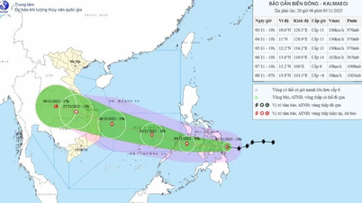
Specifically, there were 76 flooded locations, 48 landslide locations, 3,446 households/8,840 people were flooded; 253 households/985 people were isolated and cut off; 65 schools with 17,719 students had to temporarily stop going to school.
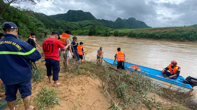
Currently, units and localities are continuing to deploy forces to guard and arrange barriers and warning signs at underground locations, flooded spillways, isolated areas, landslide risk points, and dangerous areas to ensure safety for people and vehicles.
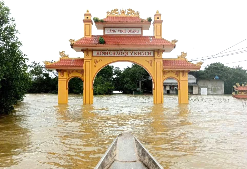 |
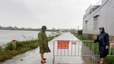
| Vinh Quang village, Le Ninh commune was completely isolated due to floods. |
On national highways, there are 6 flooded locations, specifically, National Highway 9B at underground Km41+900, Km43+700 (Kim Ngan commune) is flooded 0.2m; National Highway 9C at Km2+300-Km8+300 (Le Thuy commune) is flooded 0.2-0.6m; National Highway 49C section Km9+00-Km16+00 (Trieu Binh, Trieu Phong communes) is flooded 50-70cm, Km33+600-Km34+080 (Vinh Dinh commune) is flooded 30-50cm, Km37+050-Km41+076 (My Thuy commune) is flooded 40-60cm. Provincial roads have 17 flooded locations from 0.3-1.1m in Phong Nha, Ninh Chau, Le Thuy, Tan My, Ba Long, Khe Sanh, Trieu Binh, Vinh Dinh communes...
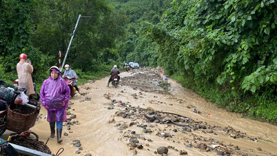
There are 53 inter-village and inter-commune roads with flooding depths of 0.5-5m in Le Ninh, Le Thuy, Phong Nha, Ninh Chau, Vinh Dinh, and Dakrong communes; especially in Ba Long commune, there are 14 flooded points, the deepest of which is up to 5m.
Nguyen Hoang
Source: https://baoquangtri.vn/xa-hoi/202511/toan-tinh-con-hon-120-diem-ngap-lut-sat-lo-1684c14/
![[Photo] Comrade Nguyen Duy Ngoc holds the position of Secretary of the Hanoi Party Committee](https://vphoto.vietnam.vn/thumb/1200x675/vietnam/resource/IMAGE/2025/11/04/1762234472658_a1-bnd-5518-8538-jpg.webp)
![[Photo] Panorama of the Patriotic Emulation Congress of Nhan Dan Newspaper for the period 2025-2030](https://vphoto.vietnam.vn/thumb/1200x675/vietnam/resource/IMAGE/2025/11/04/1762252775462_ndo_br_dhthiduayeuncbaond-6125-jpg.webp)

![[Photo] The road connecting Dong Nai with Ho Chi Minh City is still unfinished after 5 years of construction.](https://vphoto.vietnam.vn/thumb/1200x675/vietnam/resource/IMAGE/2025/11/04/1762241675985_ndo_br_dji-20251104104418-0635-d-resize-1295-jpg.webp)
![[Photo] Ca Mau "struggling" to cope with the highest tide of the year, forecast to exceed alert level 3](https://vphoto.vietnam.vn/thumb/1200x675/vietnam/resource/IMAGE/2025/11/04/1762235371445_ndo_br_trieu-cuong-2-6486-jpg.webp)
![[Photo] Ho Chi Minh City Youth Take Action for a Cleaner Environment](https://vphoto.vietnam.vn/thumb/1200x675/vietnam/resource/IMAGE/2025/11/04/1762233574890_550816358-1108586934787014-6430522970717297480-n-1-jpg.webp)


Comment (0)