
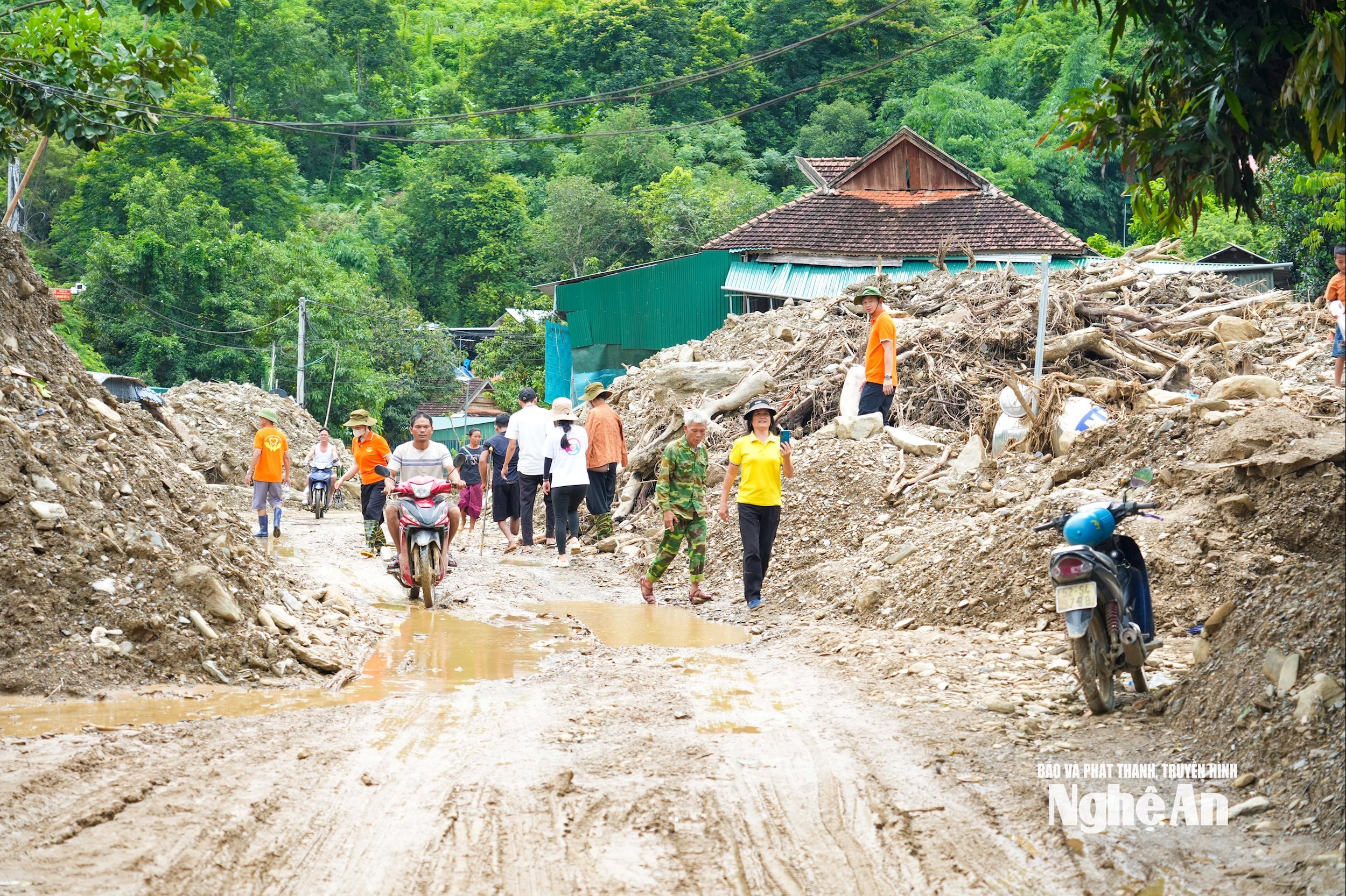
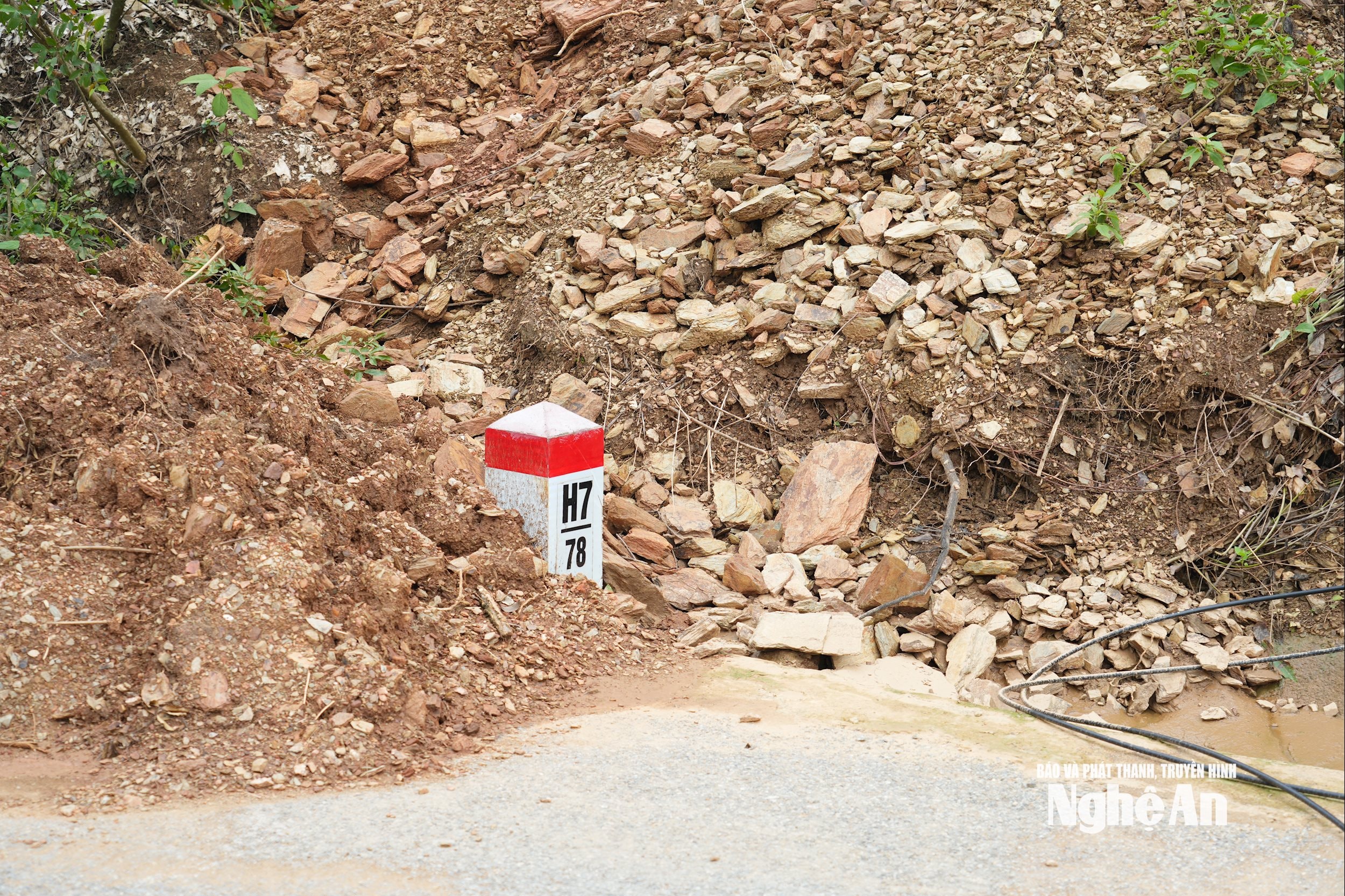
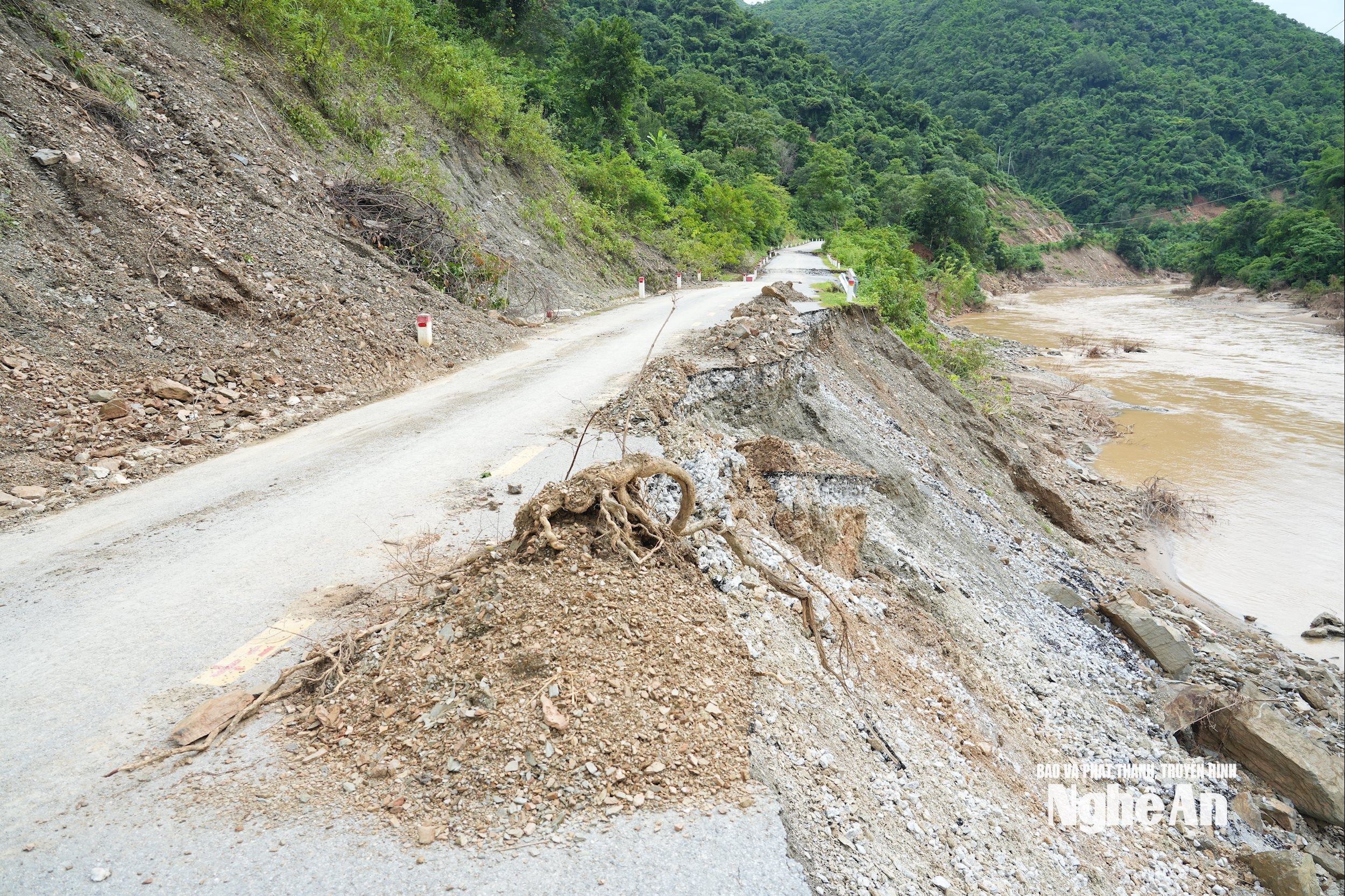
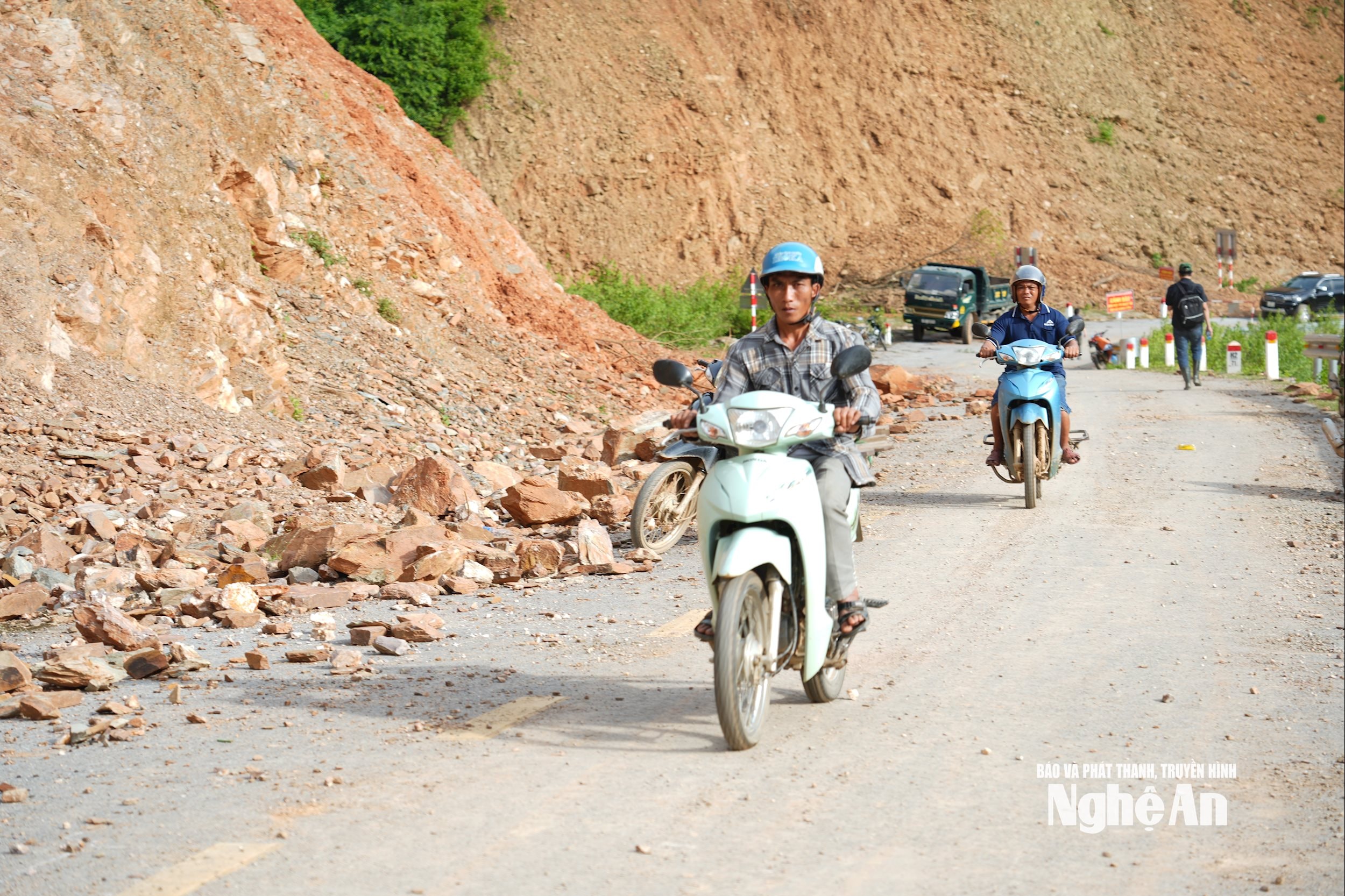
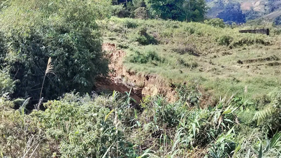
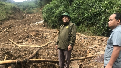
On provincial road 543D, through Ta Do village, soil, rocks, and mud are overflowing along both sides of the road and currently the road clearance is only done by manual tools, making the road narrow and difficult to travel. Just a little rain, the huge amount of soil, rocks, and mud around will bury the road again.
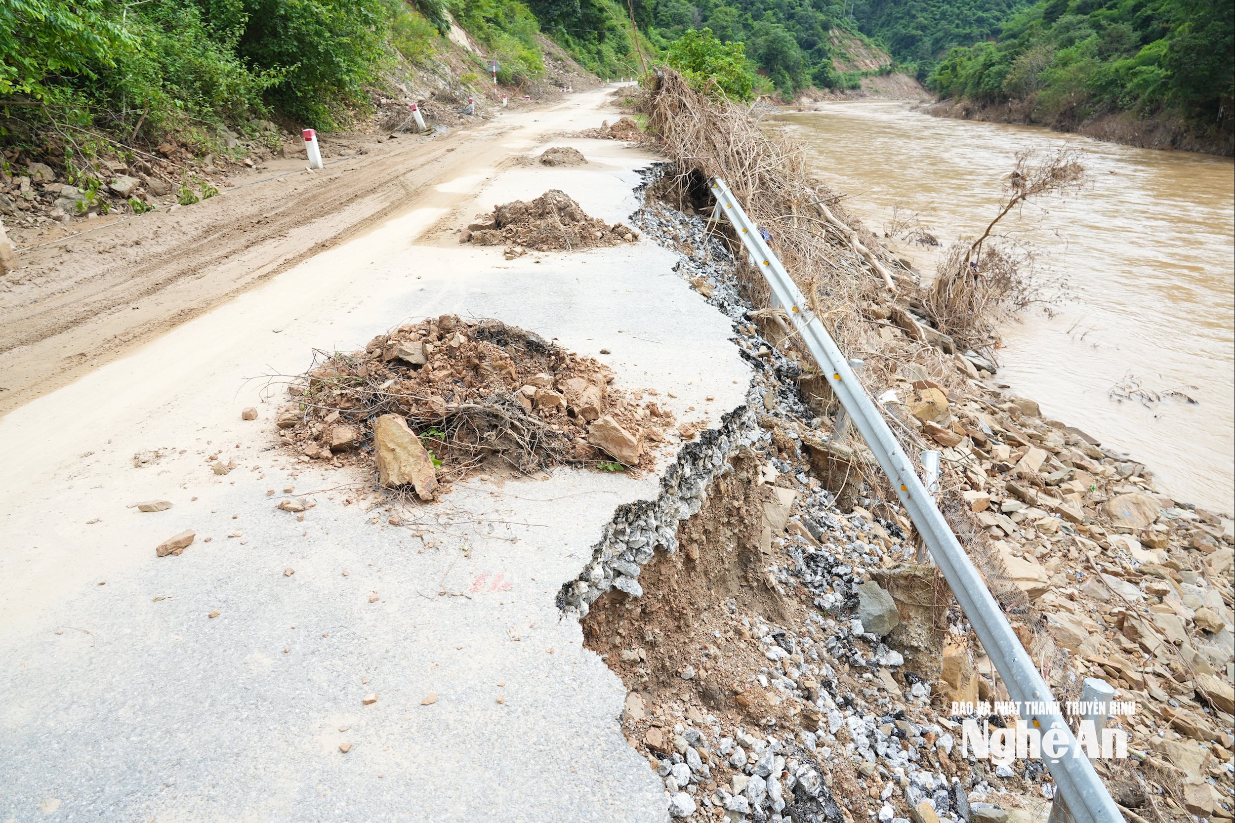
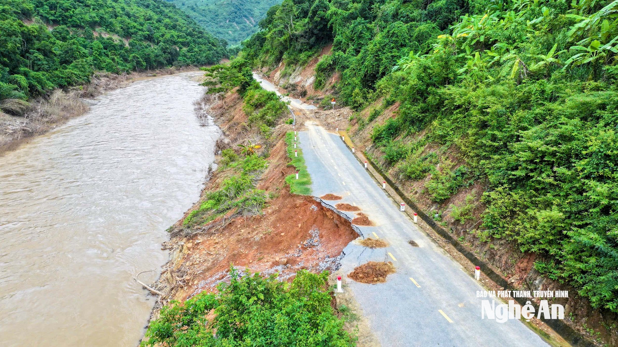
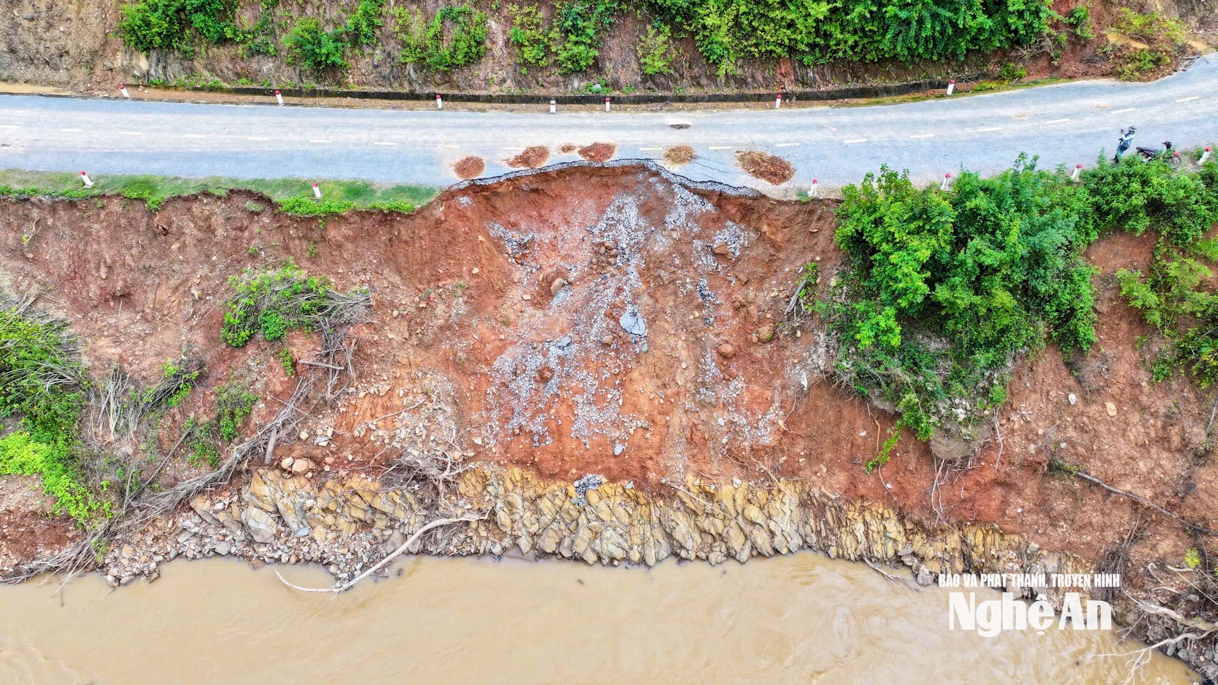
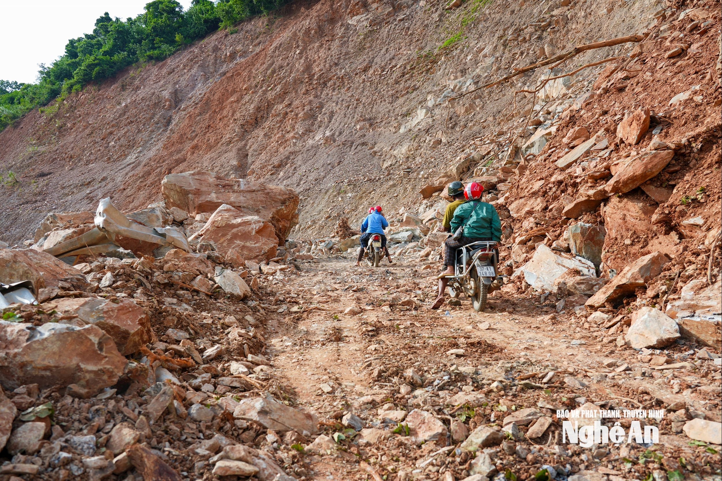
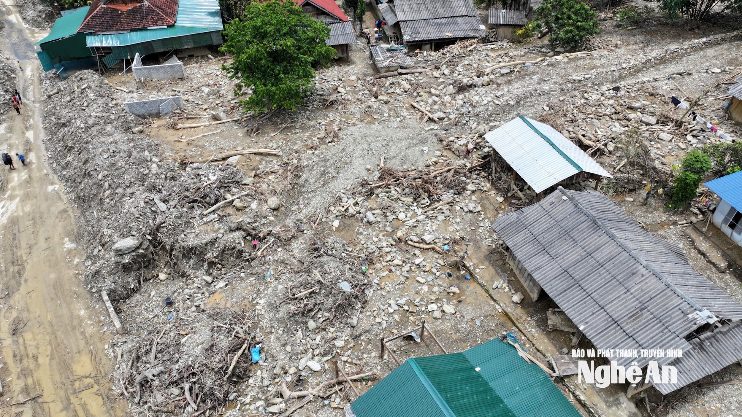
The 15km section from the Muong Tip Commune People's Committee headquarters to the old Muong Ai Commune People's Committee headquarters has up to 20 heavily eroded spots. At the landslide spots, half of the road surface has been eroded away on the Nam Mo River side.
The 4km section from Muong Tip Commune People's Committee headquarters to Ta Do village has 15 points with severe landslides on the positive slope, and half of the road surface on the negative slope along Nam Mo River has also been eroded.
Roads in Muong Tip commune were also severely eroded: The road to the two resettlement areas of Vang Phao and Co My, more than 13 km long, had 30 landslides; the section from Xop Phong village to Ai Khe cluster, Huoi Khe village, more than 10 km long, had 2 broken sections and many landslides; the road to the old Huoi Khoi, Huoi Phe, old Cha Lat, Huoi Khi villages, more than 18 km long, had 40 landslides.
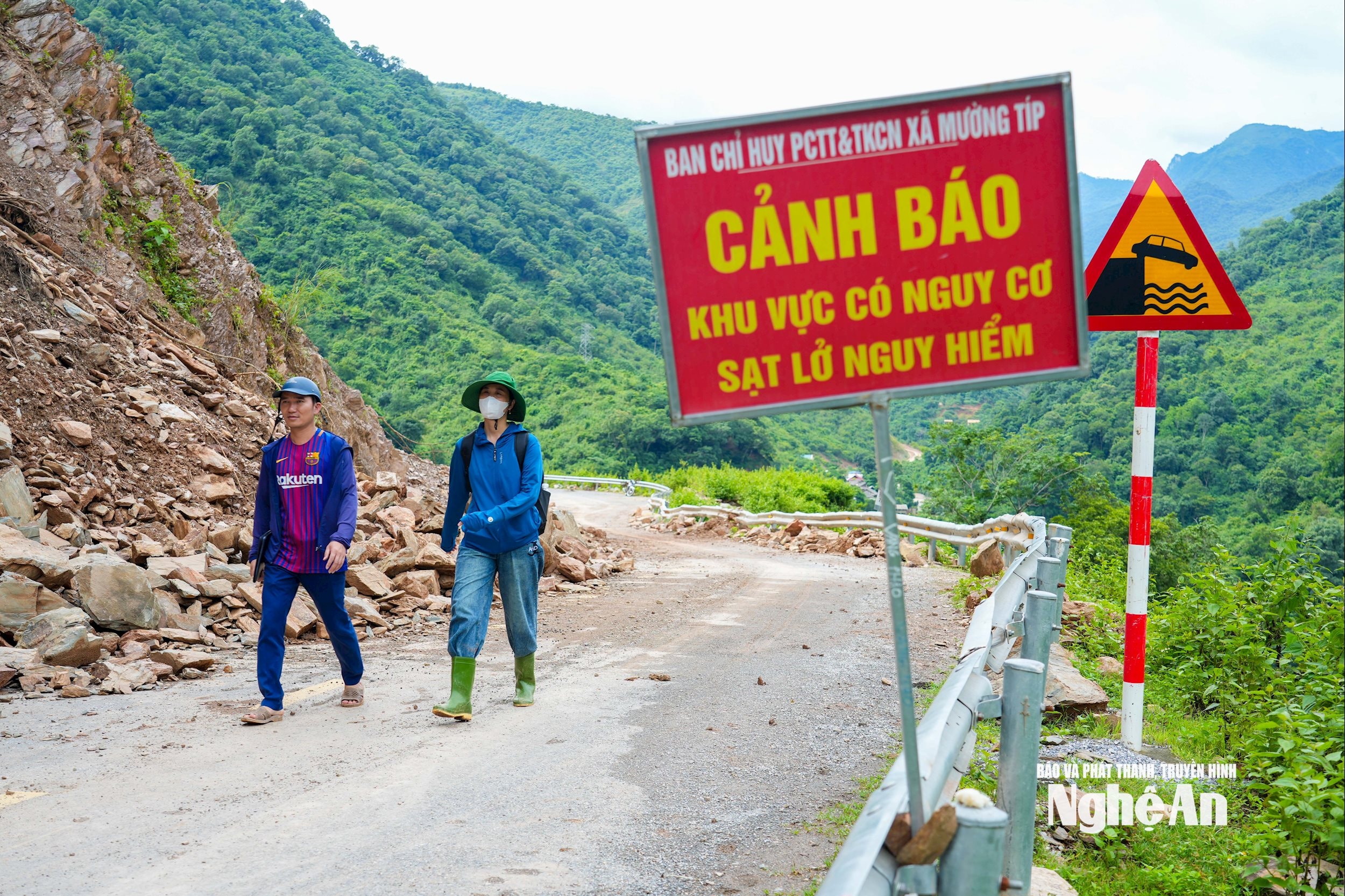
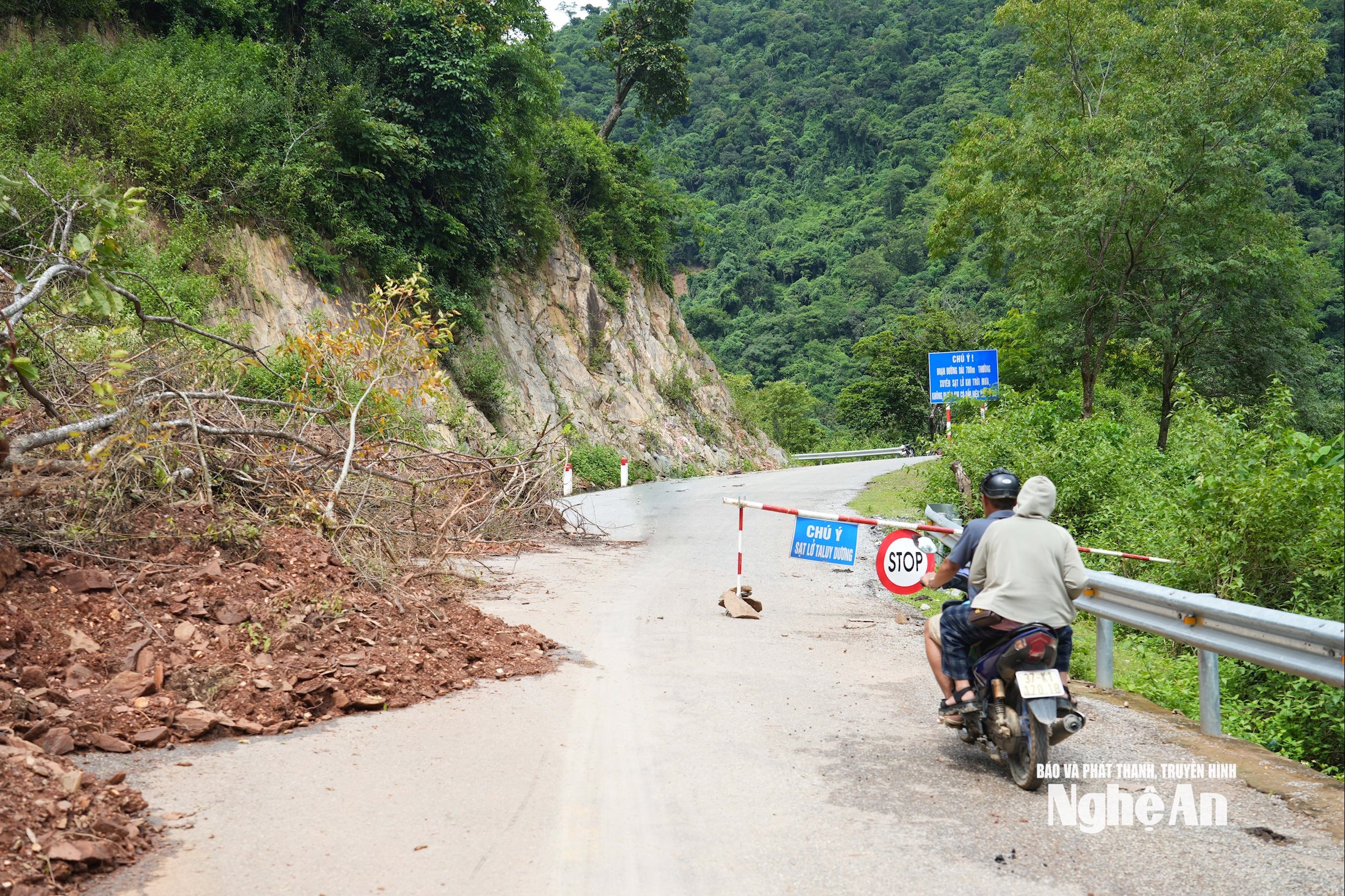
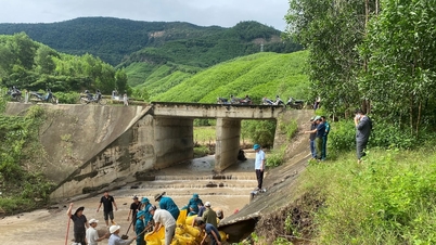
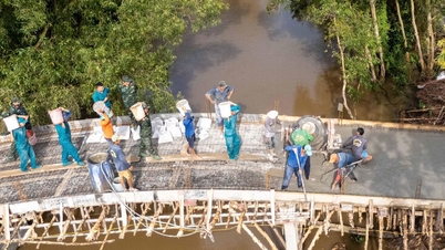
To gradually overcome the consequences, recently Muong Tip commune has mobilized machinery, all forces of the commune's agencies, police, border guards, forces of Na Ngoi commune to support and people from the villages in the area to repair roads, dredge, clear rocks, fallen trees to clear traffic... At the points where rocks fell, Muong Tip commune organized to build fences, set up checkpoints to prevent people and vehicles from passing, and put up warning signs for people to know and avoid.
Muong Tip Commune has also actively coordinated with the Provincial Road Management Unit 543D to overcome landslide locations, focusing on human resources and vehicles to prioritize motorbike routes so that supply forces can access affected areas more easily.
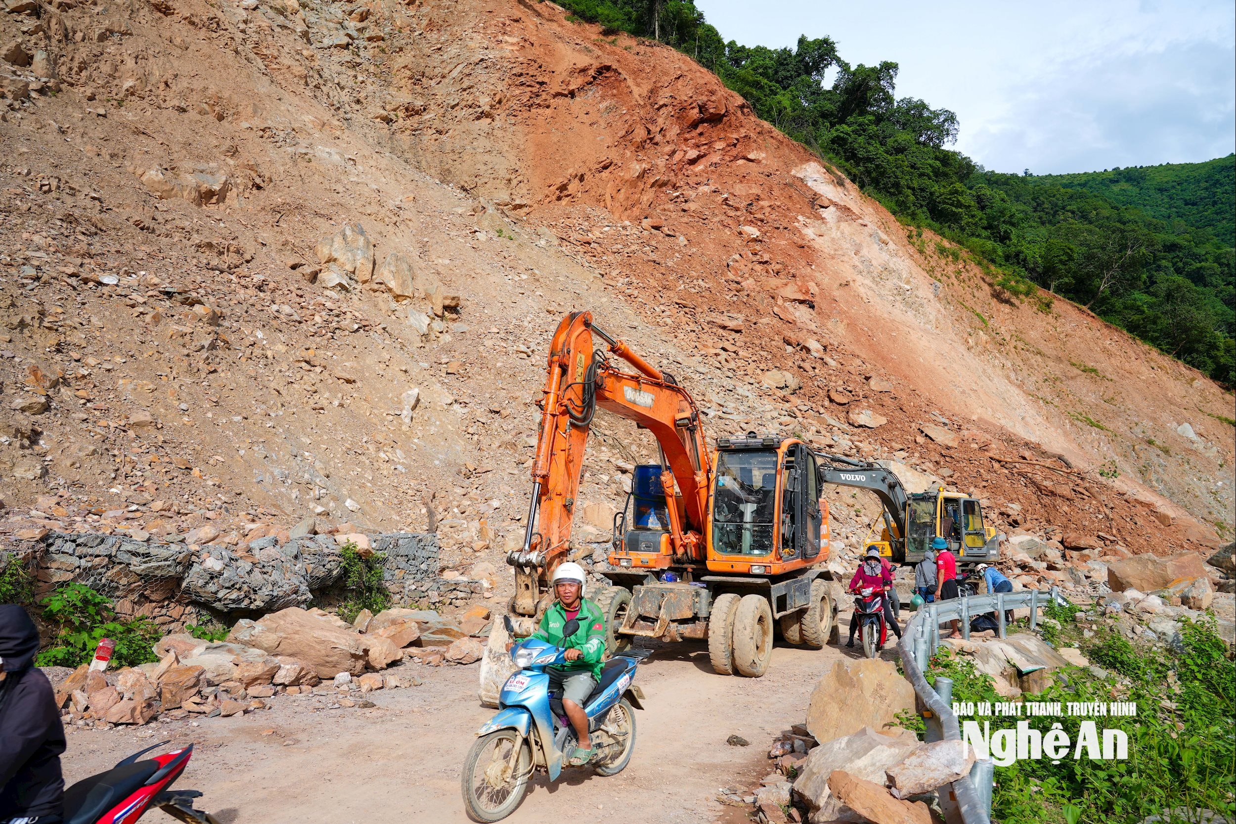
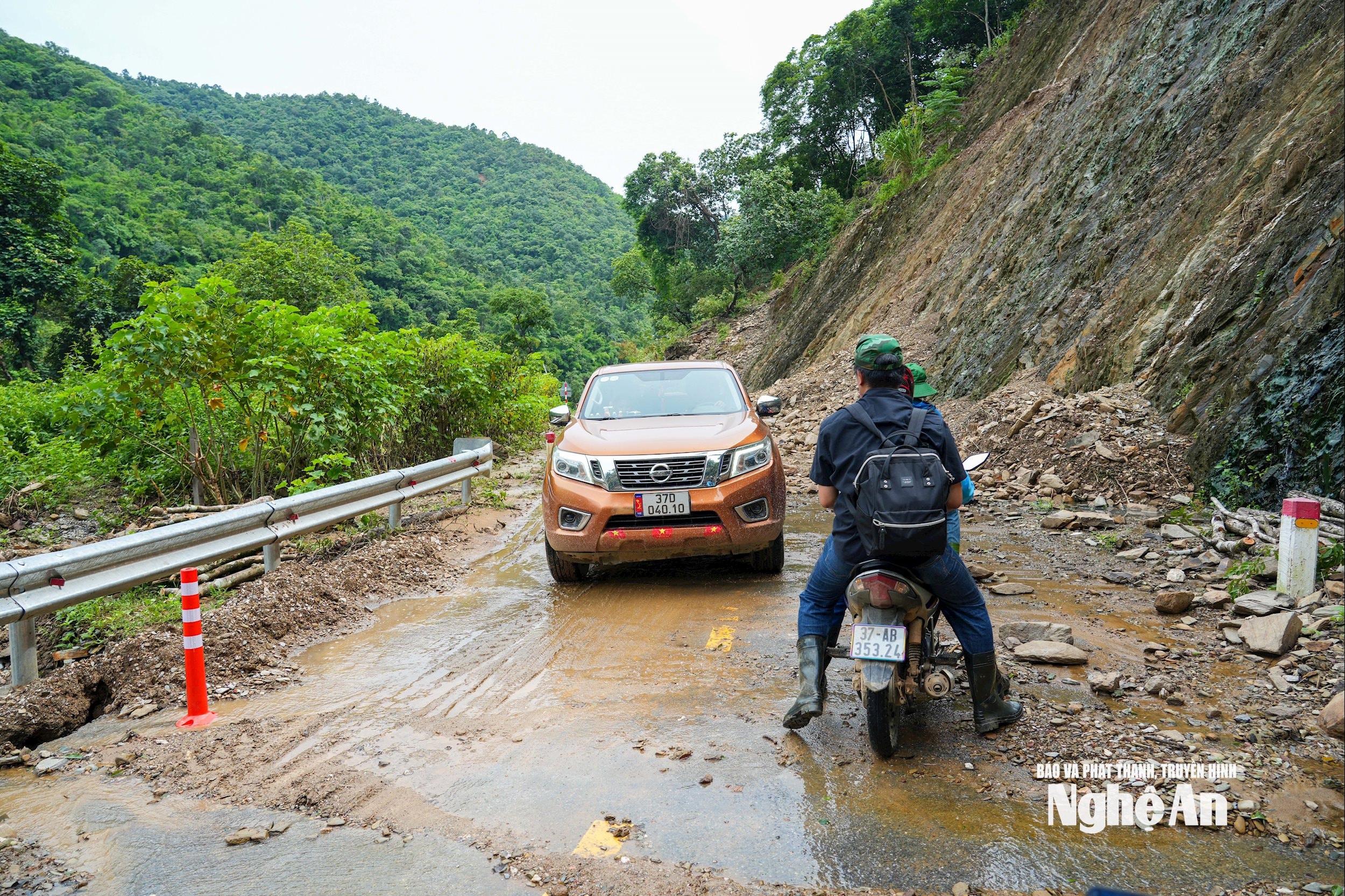
As of August 7, the entire provincial road 543D has basically been cleared, motorbikes and high-chassis cars can travel. However, people traveling on the road also need to be extremely careful, because there are still potential risks of unsafety due to the possibility of continued landslides and falling rocks...
To ensure traffic safety, Muong Tip commune is requesting all levels and sectors to direct the management unit of route 543D to increase human resources and machinery to continue construction, handle landslides and road loss points; create conditions for vehicles to clean up and transport large volumes of soil and rocks that are burying Ta Do village... In particular, there is a solution to overcome the section of route Km70 +400 (Xop Tip village area) that often has landslides and rolling rocks, which is very dangerous./.
Source: https://baonghean.vn/hon-100-diem-sat-lo-tai-xa-muong-tip-nghe-an-sau-bao-so-3-can-tro-phuong-tien-vao-don-dep-ban-ta-do-10303989.html
![[Photo] Opening of the 14th Conference of the 13th Party Central Committee](https://vphoto.vietnam.vn/thumb/1200x675/vietnam/resource/IMAGE/2025/11/05/1762310995216_a5-bnd-5742-5255-jpg.webp)


![[Photo] Panorama of the Patriotic Emulation Congress of Nhan Dan Newspaper for the period 2025-2030](https://vphoto.vietnam.vn/thumb/1200x675/vietnam/resource/IMAGE/2025/11/04/1762252775462_ndo_br_dhthiduayeuncbaond-6125-jpg.webp)


Comment (0)