
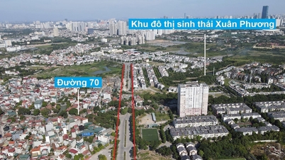
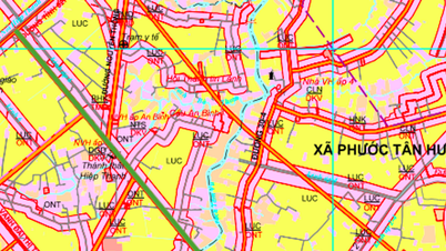
Overview of traffic planning of Tam Vu commune
According to the land use planning adjustment map to 2030 of Chau Thanh district, Long An province, Tam Vu commune is oriented to develop a number of new traffic routes to strengthen connectivity and promote socio-economic development. Tam Vu commune has a strategic location, being an important traffic hub in the region.
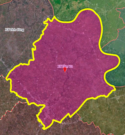
Below are details of three notable routes that will be opened in the near future according to the approved plan.
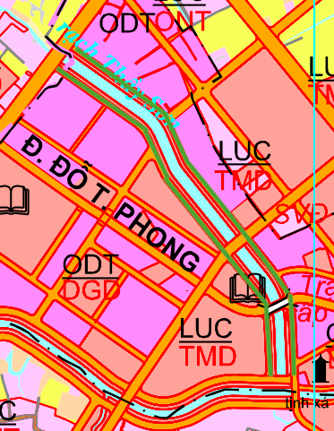
New routes planned to 2030
1. Road along Thay Son canal
The planning includes two road sections running along Thay Son canal and crossing Provincial Road 827. Each section is expected to be about 1 km long. When completed, this route will create a new riverside traffic axis, reducing the load on existing roads and facilitating people's travel and transportation of goods.
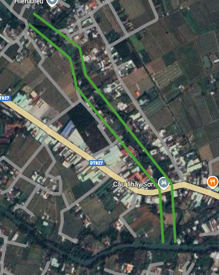
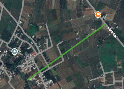
2. Parallel route to the Ring Road
A new route of about 1 km long will be built parallel to the existing Ring Road. This route passes through the area near Thay Son Bridge, helping to divide traffic and create a parallel connecting corridor, supporting the Ring Road axis in traffic between areas.
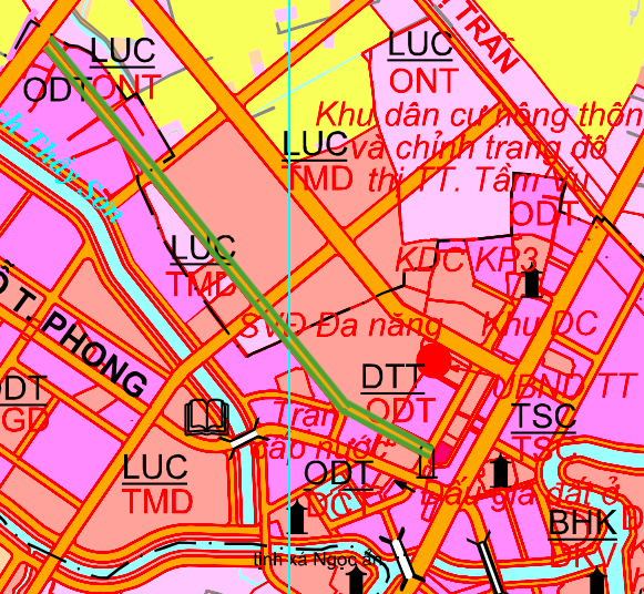
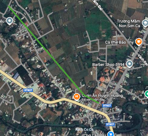
3. Route connecting the Ring Road and Thay Son Canal
This route is planned to run perpendicular to the Ring Road, with a length of about 650 m. The starting point of the route is on the Ring Road and the end point connects to Thay Son canal. This is an important horizontal connecting route, helping to directly connect the residential area along the canal with the main traffic axis, the Ring Road.
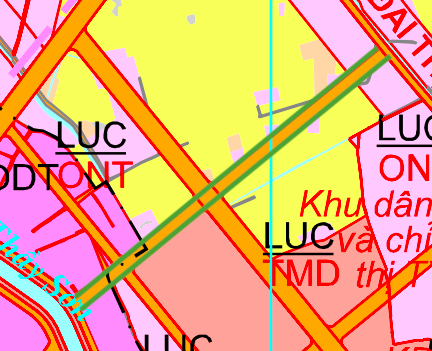
Note: The diagrams in the article are drawn relatively, based on information from the Land Use Planning Adjustment Map to 2030 of Chau Thanh district, Long An province. Planning information may change according to adjustment decisions of competent authorities.
Source: https://baolamdong.vn/long-an-quy-hoach-3-tuyen-duong-moi-tai-xa-tam-vu-403421.html
![[Photo] General Secretary To Lam and National Assembly Chairman Tran Thanh Man attend the 80th Anniversary of the Traditional Day of the Vietnamese Inspection Sector](https://vphoto.vietnam.vn/thumb/1200x675/vietnam/resource/IMAGE/2025/11/17/1763356362984_a2-bnd-7940-3561-jpg.webp)


Comment (0)