
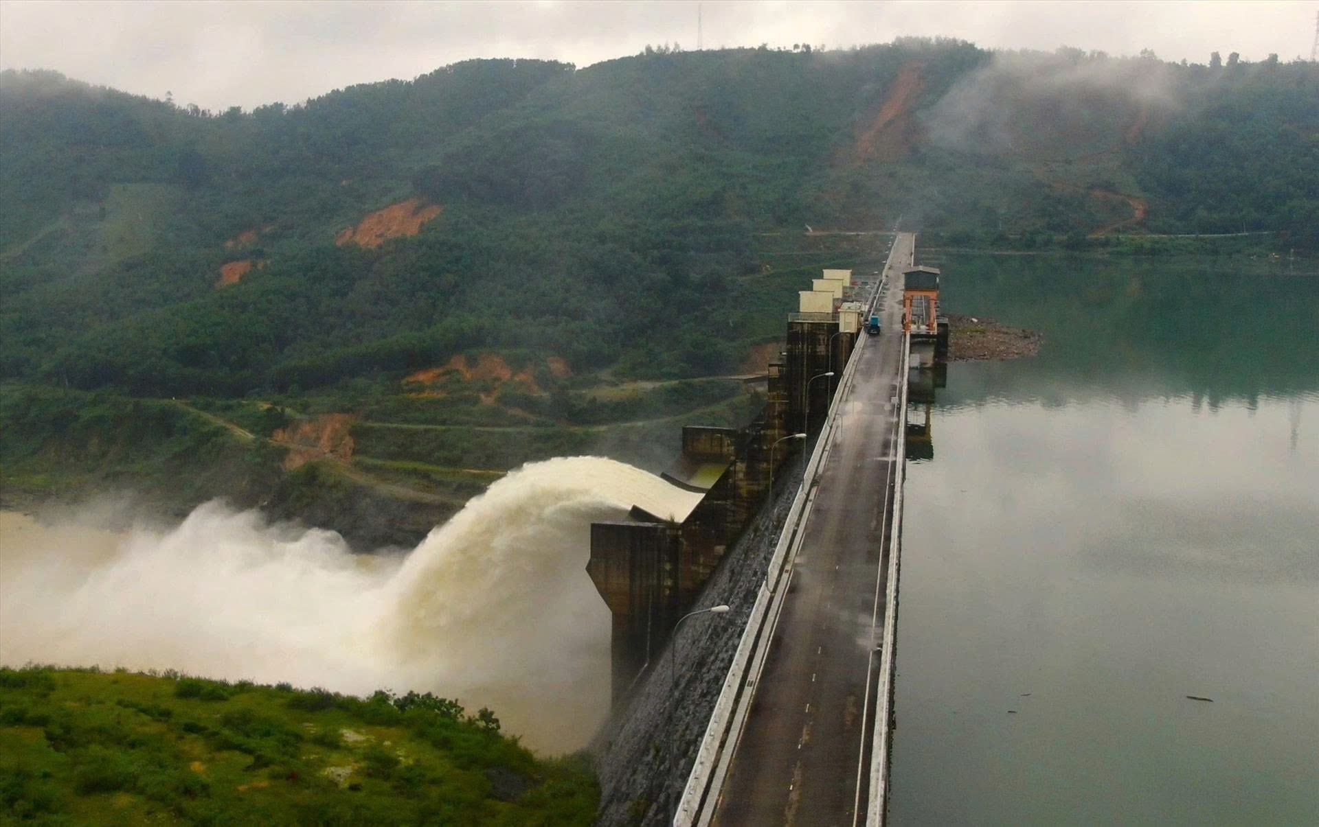
Currently, the total flood flow through hydroelectric reservoirs to the Vu Gia and Thu Bon rivers has decreased to below 5,000m³/s. At 9:00 a.m. on November 3, the total flood flow was 4,484m³/s, much lower than the highest total flood flow of 6,253m³/s at 6:00 a.m. the same day.
At 8:00 a.m. on November 3, the flood on Vu Gia River at Hoi Khach was at 17.08m, 0.58m higher than alert level 3 and was decreasing; at Ai Nghia it was at 9.74m, 0.74m above alert level 3 and was rising slowly.
Flood on Thu Bon River at Nong Son is at 15.65m, above BĐ3 is 0.65m and is falling; at Hiep Duc is 21.35m and is falling; at Giao Thuy is 8.66m, below BĐ3 is 0.14m; at Cau Lau is 4.28m, above BĐ3 is 0.28m; at Hoi An is 2.39m, above BĐ3 is 0.39m and is rising.
Cam Chau area in Hoi An Dong ward is flooded 1.46m deep; Dong Binh village (Duy Vinh) in Nam Phuoc commune is 1.42m deep; Kieu Chau village (Duy Son) in Duy Xuyen commune is 1.86m deep; Cam Kim in Hoi An ward is 0.79m deep; under Do bridge (Thang Long road) in Cam Le ward is 1m deep; Le Son 2 village in Hoa Tien commune is 1.15m deep...
Some areas are also being flooded by Cu De and Tuy Loan rivers such as: Loc My (Hoa Bac) in Hai Van ward, 1.4m deep; Nam Yen (Hoa Bac) in Hai Van ward, 0.92m deep; Thai Lai village (Hoa Nhon) in Ba Na commune, 0.82m deep; Thach Nham Tay village (Hoa Nhon) in Ba Na commune, 1.17m deep; Hoa Phuoc village (Hoa Phu) in Hoa Vang commune, 0.87m deep.
In addition, due to heavy rain, some areas in the city center are being flooded locally such as: Alley 161 Me Suot Street in Hoa Khanh Ward is flooded 1.05m deep; Da Son 2 Street in Hoa Khanh Ward is flooded 0.51m...
According to the forecast of the Central Hydrometeorological Station, from now until the afternoon of November 3, there will be heavy to very heavy rain concentrated in the northern localities of the city; in which the eastern region will have common rainfall of 60 - 100mm, some places higher than 130mm, in the west it will be common 30 - 70mm.
Southern localities have common rainfall of 10 - 30mm, some places higher than 50mm.
From the afternoon to the evening of November 3, the flood on Vu Gia - Thu Bon river continued to rise, then peaked, the flood peak on Vu Gia river at Ai Nghia on BĐ3 was from 1.01 - 1.02m; on Thu Bon river at Cau Lau and Hoi An on BĐ3 was from 0.6 - 0.7m; Tam Ky river was at the same level as BĐ3.
From the night of November 3 to the morning of November 4, flood on Vu Gia - Thu Bon River continued to remain at level below BĐ3 to above BĐ3; Han River and Tam Ky River at level BĐ2 to above BĐ2.
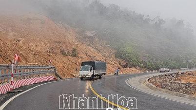
Widespread deep flooding occurred in low-lying areas along rivers, inundation in urban areas, especially in the following communes and wards: Que Phuoc, Nong Son, Duy Xuyen, Thu Bon, Xuan Phu, Thanh My, Thuong Duc, Ha Nha, Phu Thuan, Vu Gia, Dai Loc, Go Noi, Dien Ban, Dien Ban Tay, Dien Ban Bac, Hoa Tien, Hoi An, Hoi An Tay, Hoi An Dong, Nam Phuoc, Duy Nghia, An Thang, Que Xuan, Ban Thach, Huong Tra, Tam Xuan, Tam Ky, Hoa Tien, Hoa Xuan, Ngu Hanh Son...
High risk of flash floods and landslides on steep slopes and river banks in mountainous areas of Da Nang city.
Source: https://baodanang.vn/lu-thuong-nguon-giam-ha-du-con-dang-va-rut-cham-3309038.html
![[Photo] Ca Mau "struggling" to cope with the highest tide of the year, forecast to exceed alert level 3](https://vphoto.vietnam.vn/thumb/1200x675/vietnam/resource/IMAGE/2025/11/04/1762235371445_ndo_br_trieu-cuong-2-6486-jpg.webp)

![[Photo] Panorama of the Patriotic Emulation Congress of Nhan Dan Newspaper for the period 2025-2030](https://vphoto.vietnam.vn/thumb/1200x675/vietnam/resource/IMAGE/2025/11/04/1762252775462_ndo_br_dhthiduayeuncbaond-6125-jpg.webp)
![[Photo] Ho Chi Minh City Youth Take Action for a Cleaner Environment](https://vphoto.vietnam.vn/thumb/1200x675/vietnam/resource/IMAGE/2025/11/04/1762233574890_550816358-1108586934787014-6430522970717297480-n-1-jpg.webp)

![[Photo] The road connecting Dong Nai with Ho Chi Minh City is still unfinished after 5 years of construction.](https://vphoto.vietnam.vn/thumb/1200x675/vietnam/resource/IMAGE/2025/11/04/1762241675985_ndo_br_dji-20251104104418-0635-d-resize-1295-jpg.webp)


Comment (0)