
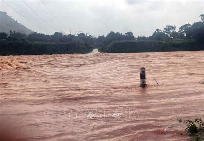
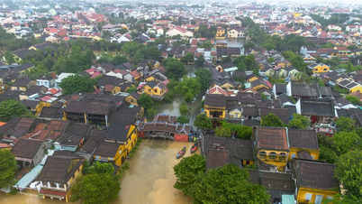
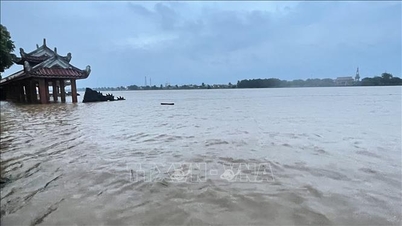
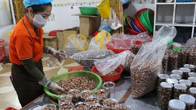
Heavy rains have caused 8 points and 6 routes in mountainous areas and low-lying areas of Quang Tri province to be flooded and partially isolated; of which, Ba Long commune has 5 points flooded at Ba Long spillway bridge, 2m deep; Ta Lang bridge, 1.9m deep; Tran Thon 5 bridge, 1.8m deep; Khe Vo bridge, 1.7m deep and Thu Lu bridge, 0.6m deep. Dakrong commune has 3 points flooded from 1 - 1.5m deep at Da Do bridge, Ly Ton bridge and Chan Ro bridge.
In Nam Hai Lang commune, there are 6 roads along the O Lau river in low-lying areas (Cang area) including villages: An Tho, Phu Kinh, Hoi Dien, My Chanh, Hung Nhon, Cau Nhi, flooded 1-1.2m deep and the water level continues to rise.
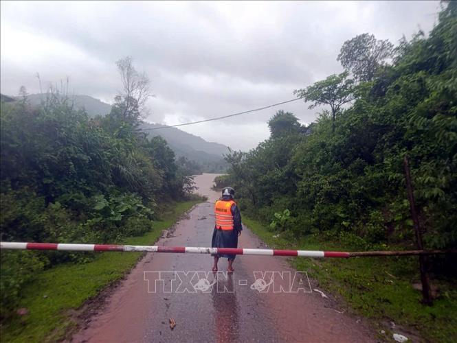
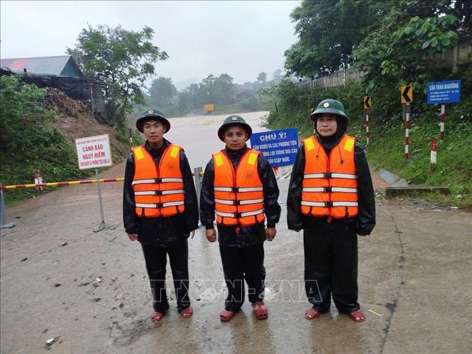
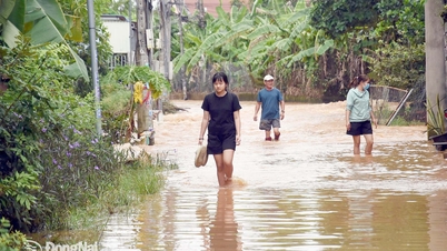
Local authorities and Border Guard forces have proactively deployed guards and placed barriers and warning signs at flooded and isolated underground and spillway locations, landslide-prone areas, and dangerous areas... to ensure the safety of people and vehicles; at the same time, they are ready to deploy plans to evacuate people from dangerous areas when bad situations occur.
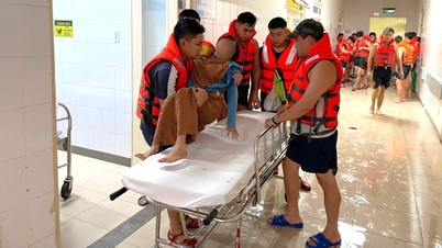
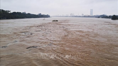
According to the forecast from October 27-28, the whole Quang Tri province will have moderate rain, heavy rain, and some places will have very heavy rain, with total rainfall ranging from 50-150mm, and over 200mm in some places. Quang Tri province has directed units and localities to closely monitor the development of floods and rains, regularly update information, and promptly direct response. Localities in downstream areas, along rivers, and low-lying areas proactively evacuate people from dangerous areas, ensuring the safety of people's lives and property.
In addition, relevant sectors and units inspect and review the dam system, irrigation works, flood discharge operation plans, and prepare rescue forces and vehicles when situations arise. Currently, Quang Tri province has 11 dams operating spillways to regulate the water level according to the process, including: Ai Tu, Khe May, Nghia Hy, Da Mai, Tan Kim, Phu Dung, Truc Kinh, Ha Thuong, Kinh Mon, Bao Dai, Bau Nhum). All dams are operating safely.
Source: https://baotintuc.vn/xa-hoi/quang-tri-co-nhieu-tuyen-duong-cau-tran-bi-ngap-gay-chia-cat-cuc-bo-20251027101736060.htm
![[Photo] The 5th Patriotic Emulation Congress of the Central Inspection Commission](https://vphoto.vietnam.vn/thumb/1200x675/vietnam/resource/IMAGE/2025/10/27/1761566862838_ndo_br_1-1858-jpg.webp)

![[Photo] National Assembly Chairman Tran Thanh Man receives Chairman of the House of Representatives of Uzbekistan Nuriddin Ismoilov](https://vphoto.vietnam.vn/thumb/1200x675/vietnam/resource/IMAGE/2025/10/27/1761542647910_bnd-2610-jpg.webp)
![[Photo] Party Committees of Central Party agencies summarize the implementation of Resolution No. 18-NQ/TW and the direction of the Party Congress](https://vphoto.vietnam.vn/thumb/1200x675/vietnam/resource/IMAGE/2025/10/27/1761545645968_ndo_br_1-jpg.webp)


Comment (0)