
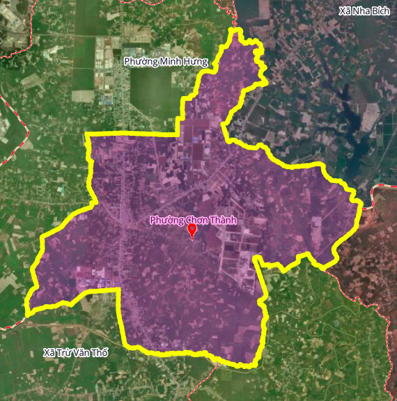
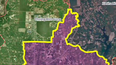
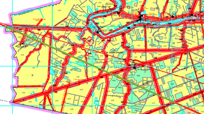
According to the revised land use planning map for Chơn Thành town, Bình Phước province, up to 2030, Chơn Thành ward will have several additional important roads to complete the transportation network and promote socio-economic development in the locality.
1. Road parallel to National Highway 14 (AH17)
This road is planned to run parallel to AH17 (National Highway 14), with a length of approximately 1.2 km. Its location is near the former Thanh Tam Ward Health Station and People's Committee, contributing to reducing traffic congestion on the main road and enhancing internal connectivity.
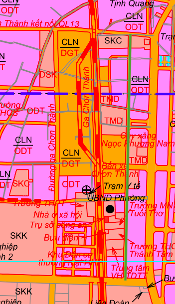
2. Chơn Thành Station Route
This is a route serving the future Chơn Thành railway station area. This route runs parallel to the aforementioned Route 1 and has a similar length, approximately 1.2 km. The formation of this route plays a crucial role in connecting the railway infrastructure with the town's road transport network.

3. Roads parallel to the Ho Chi Minh Highway
Another notable route, approximately 2.3 km long, runs almost parallel to the Ho Chi Minh Highway. Its starting point is on AH17, near Thanh Tam Market. Upon completion, this route will create a new traffic artery, sharing traffic volume and connecting the eastern part of the ward.

Note: The diagrams in this article are drawn relatively based on the Land Use Planning Adjustment Map to 2030 of Chơn Thành town, Bình Phước province. Planning information may change according to decisions of the relevant authorities.
Source: https://baolamdong.vn/quy-hoach-chon-thanh-3-tuyen-duong-sap-mo-tai-trung-tam-410106.html


Comment (0)