
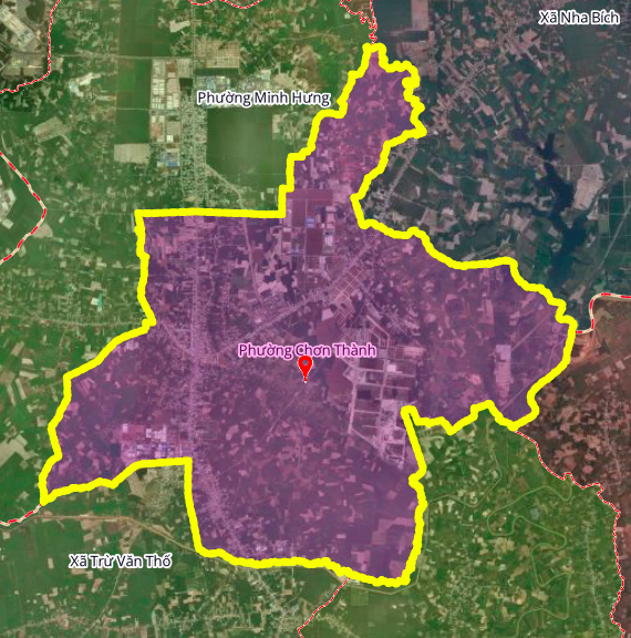
According to the revised land use planning map for Chơn Thành town, Bình Phước province, up to 2030, the locality will have many more important transportation routes. In particular, Chơn Thành ward, the central area, will have three major planned routes, including two expressways and one main connecting road.
Chơn Thành Ward is an administrative unit belonging to Chơn Thành town, Bình Phước province. Geographically, the ward borders Minh Hưng Ward and Nha Bích commune to the north; Nha Bích, Phước Thành, and An Long communes to the east; An Long and Trừ Văn Thố communes to the south; and Minh Hưng Ward to the west.
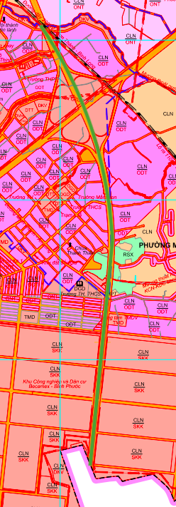
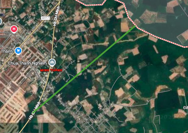
1. Thu Dau Mot – Chon Thanh – Hoa Lu Expressway
This expressway is part of the transportation network connecting the Southern key economic region. The section passing through Chơn Thành ward is approximately 5 km long and is planned to cut across Minh Thành – An Long road, near Thanh Thiền pagoda. This road is expected to shorten travel time and promote regional connectivity.
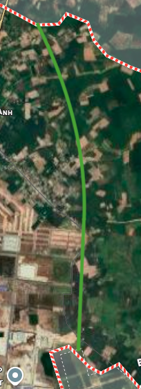
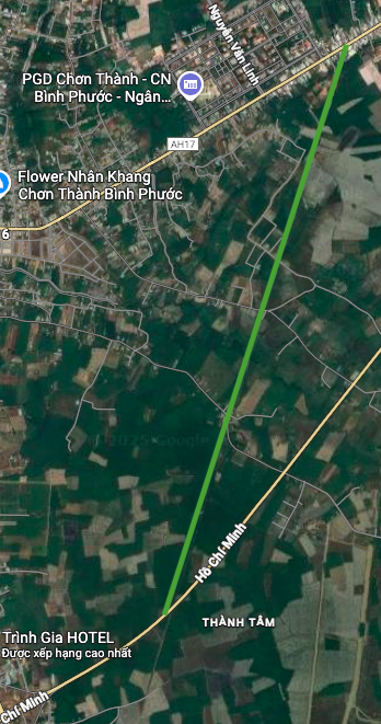
2. Dak Nong – Chon Thanh Expressway
This is the second expressway passing through the ward, playing a crucial role in connecting the Central Highlands with the Southeast region. The section through Chơn Thành ward is approximately 2.3 km long, running almost perpendicular to the Thủ Dầu Một – Chơn Thành – Hoa Lư expressway. The starting point of this section is located on the Ho Chi Minh Highway, contributing to the completion of the national expressway network.
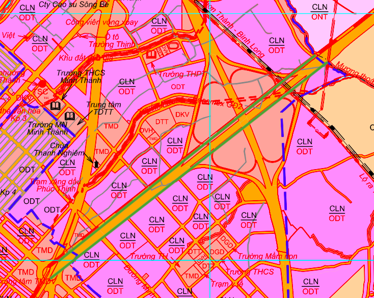
3. The road connecting National Highway 13 (AH17) and Ho Chi Minh Highway
Besides the two expressways, an important inner-city road, approximately 5 km long, is also planned. This road starts at AH17 (National Highway 13), near the town park square in Chơn Thành, and ends connecting to the Ho Chi Minh Highway, near the Thành Tâm market area. The road is intended to become a major transportation artery, relieving congestion on existing routes.
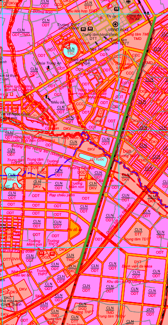
Note: The diagrams in this article are drawn based on information from the Land Use Planning Adjustment Map to 2030 of Chơn Thành town, Bình Phước province, and are for reference only.
Source: https://baolamdong.vn/quy-hoach-chon-thanh-lo-trinh-3-tuyen-duong-lon-den-2030-410049.html
![[Photo] Prime Minister Pham Minh Chinh attends the Conference summarizing and implementing tasks of the judicial sector.](/_next/image?url=https%3A%2F%2Fvphoto.vietnam.vn%2Fthumb%2F1200x675%2Fvietnam%2Fresource%2FIMAGE%2F2025%2F12%2F13%2F1765616082148_dsc-5565-jpg.webp&w=3840&q=75)


Comment (0)