
Move very fast
At 1 p.m. this afternoon (September 22), the center of super typhoon Ragasa was about 140km north of Luzon Island, Philippines.
This storm is still maintaining its terrible strength with the strongest wind near the center of the super storm at level 17 (202-221km/h), gusting above level 17, making it the strongest storm in the world in 2025, and surpassing super storm Yagi in 2024.
It is forecasted that tonight (September 22), Ragasa will enter the East Sea, becoming storm number 9 with an intensity of about level 17, gusting above level 17.
During the first two days of entering the East Sea, the storm continued to move west-northwest at a very fast speed, traveling about 20-25km per hour and maintaining the strength of a super typhoon. It was not until around September 24, when it approached China's Leizhou Peninsula, that the storm began to weaken.
At 1 p.m. on September 24, about 230km east of Leizhou Peninsula (China), the storm maintained level 15-16, gusting to level 17.
.")
Satellite image of storm Ragasa early this afternoon (September 22).
The National Center for Hydro-Meteorological Forecasting said that the most likely scenario now is that from around the afternoon of September 24, the storm will change direction to the west-southwest, moving very quickly, 20-25km per hour, entering China's Leizhou peninsula and then entering the Gulf of Tonkin around the evening of September 24.
On September 25, the storm continued to move west-southwest at a fast speed of about 20km/h, operating in the Gulf of Tonkin, towards the sea area of Quang Ninh - Ninh Binh . At 1:00 p.m. on September 23, the center of the storm was in the sea area from Quang Ninh to Ninh Binh with a strong intensity of level 12-13, gusting to level 16.
During the night of September 25 and 26, the storm moved west-southwest, traveling about 20km per hour, entering the mainland of the North and North Central regions of our country with continued weakening intensity.
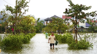
Storm Ragasa is forecast to cause strong gusts of wind and heavy rain in the North and North Central regions. However, the specific intensity will depend largely on the storm's path as well as its interaction with cold air. Therefore, the storm's development is still unpredictable, so it is necessary to constantly update the latest forecasts.
Beware of thunderstorms early before the storm
At sea, due to the influence of super typhoon Ragasa, the sea area north of the North East Sea gradually increased to level 8-9, then increased to level 10-14, the area near the center of the super typhoon passed level 15-17, gusting above level 17, waves over 10m high, rough seas.

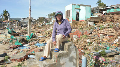
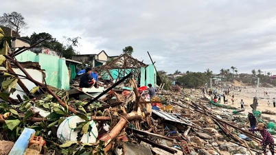
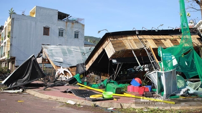
An area of the Philippines affected by typhoon Ragasa. Photo: DD News.
From September 24, the wind in the Gulf of Tonkin will gradually increase to level 6-7, then increase to level 8-10, the area near the storm center will be level 11-13, gusting over level 16, waves 5-7m high, and the sea will be very rough. Ships operating in the above-mentioned dangerous areas are likely to be affected by storms, whirlwinds, very strong winds, and very large waves.
The National Center for Hydro-Meteorological Forecasting has paid special attention to the phenomenon of thunderstorms and tornadoes occurring when the storm is still 300-400km from the mainland in the coastal area from Quang Ninh to Da Nang . This is an extremely dangerous weather phenomenon that has caused great damage such as what happened with storm Yagi in 2024 or storm Wipha last July.
Super Typhoon Ragasa, which formed from a low pressure off the coast of the Philippines, intensified into a typhoon on September 18. Thanks to very favorable conditions, the storm "exploded" to level 9, becoming the strongest typhoon in the world in 2025 to date, and one of the strongest super typhoons ever to operate in the East Sea.
According to Tien Phong Newspaper
Source: https://baotuyenquang.com.vn/xa-hoi/202509/sieu-bao-ragasa-di-chuyen-rat-nhanh-huong-ve-quang-ninh-ninh-binh-fe75b81/

![[Photo] Da Nang: Hundreds of people join hands to clean up a vital tourist route after storm No. 13](https://vphoto.vietnam.vn/thumb/1200x675/vietnam/resource/IMAGE/2025/11/07/1762491638903_image-3-1353-jpg.webp)


Comment (0)