

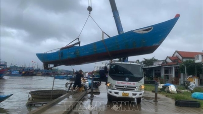
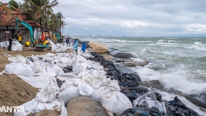
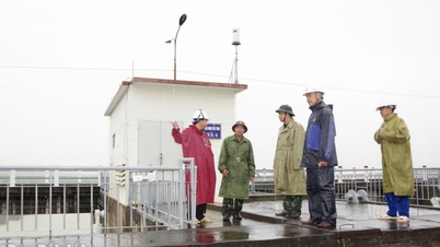
Storm No. 13 approaches land, causing heavy rain and strong winds in the Central region. Illustrative photo.
Agriculture Radio welcomes new day everyone!
Dear people, storm number 13 still maintains its direction of movement and intensity. The storm moves faster and is about 450 km East Southeast of Quy Nhon ( Gia Lai ).
According to the National Center for Hydro-Meteorological Forecasting, at 4:00 a.m. this morning, the eye of the storm was at about 13.3 degrees North latitude; 113.3 degrees East longitude, with the strongest wind near the eye of the storm at level 14 (150-166 km/h), gusting to level 17. Moving in the West Northwest direction, at a speed of about 30 km/h.
It is forecasted that by 4:00 p.m. this afternoon, the storm will be about 120km east of Quy Nhon, with winds near the center remaining at level 14, gusting to level 17. The sea area from Quang Ngai to Dak Lak (including Ly Son special zone) is at level 4 disaster risk. The sea area from South Quang Tri to Da Nang city (including Cu Lao Cham island) and Khanh Hoa; mainland South Quang Tri to Da Nang city, the east of the provinces from Quang Ngai to Dak Lak, the north of Khanh Hoa province is at level 3 disaster risk.
Due to the impact of the storm, the central East Sea area has strong winds of level 8-11, the area near the storm's eye has strong winds of level 12-14, gusts of level 17, waves 5-7m high, the area near the storm's eye has waves of 8-10m high; the sea is very rough.
From this morning, the sea area from South Quang Tri to Khanh Hoa (including Ly Son special zone, Cu Lao Cham island) will have stronger winds of level 6-7, then increase to level 8-11, waves 3-6m high, the area near the storm center will have strong winds of level 12-14, gusts of level 17, waves 7-9m high; the sea will be very rough.
Warning: From this afternoon, coastal areas from Hue city to Dak Lak are warned of rising sea levels of 0.4-0.8m accompanied by large waves causing flooding in low-lying areas, waves overflowing dikes, coastal roads, coastal erosion, slowing down flood drainage in the area. All ships, boats, and aquaculture areas in the above-mentioned dangerous areas are strongly affected by storms, whirlwinds, strong winds, large waves, and rising sea levels.
On land from the South of Da Nang city to Dak Lak, winds gradually increase to level 6-7, then increase to level 8-9, in the area near the storm's eye, winds will increase to level 10-12 (focusing on the East of Quang Ngai-Gia Lai provinces), gusting to level 14-15; in the area from the South of Quang Tri to the North of Da Nang city and the North of Khanh Hoa province, winds will increase to level 6-7, gusting to level 8-9.
From tonight and tonight, in the West of the provinces from Quang Ngai to Gia Lai, the wind will gradually increase to level 6-7, near the storm's eye it will be level 8-9, gusting to level 11.
From today to tomorrow, the area from Da Nang city to Dak Lak will have very heavy rain with common rainfall of 200-400mm/period, locally over 600mm/period; the area from South Quang Tri to Hue city, Khanh Hoa and Lam Dong will have heavy rain with common rainfall of 150-300mm/period, locally over 450mm/period. From November 8, heavy rain in the above areas will tend to decrease.
From November 7-8, the area from North Quang Tri to Thanh Hoa will have moderate to heavy rain with common rainfall of 50-150mm/period, locally very heavy rain over 200mm/period.
Warning of risk of heavy rain over 200mm/3 hours
Due to the influence of the wide storm circulation, it is necessary to guard against the risk of thunderstorms, tornadoes and strong gusts of wind both before and during the storm's landfall.
Hanoi capital today, no rain, cold morning and night, sunny afternoon. Northeast wind level 2-3, lowest temperature 19 - 21 degrees Celsius.
The Northwest and Northeast regions have rain in some places, cold in the morning and at night, less cloudy in the afternoon, sunny. Lowest temperature 18 - 21 degrees Celsius, mountainous areas have some places with slight cold below 17 degrees Celsius.
The area from Thanh Hoa to Hue has a clear differentiation: the North has scattered rain at night, the South has heavy to very heavy rain from this afternoon with whirlwinds, lightning and strong gusts. From the afternoon, the wind will gradually increase to level 6-7, gusting to level 8-9. It is cold in the early morning. The lowest temperature is 19 - 22 degrees Celsius.
The South Central Coast is the epicenter of the impact, with very heavy rain from the afternoon, strong winds of level 8-9, up to level 12 near the storm center, gusting to level 14-15. High waves and rough seas. Lowest temperature 22-25 degrees Celsius.
The Central Highlands has showers and thunderstorms, locally heavy rain; from the afternoon there will be heavy to very heavy rain, with the possibility of tornadoes, lightning and strong gusts of wind in thunderstorms. Northwest wind level 3-4, in the North at night the wind will gradually increase to level 6, gusting to level 8. Lowest temperature 19 - 22 degrees Celsius.
The Southern region and Ho Chi Minh City still maintain the transitional weather: scattered thunderstorms in the late afternoon, heavy rain in some places. During thunderstorms, be alert for tornadoes, lightning, and gusts of wind. Lowest temperature 23 - 26 degrees Celsius.
Dear friends, with the rapid and complex developments of storm No. 13, today is a key day that requires special attention in agricultural, aquaculture and livestock production.
In the Central Central and Central Highlands, where the storm center or the edge of strong circulation is located, people need to urgently: Reinforce barns, cover them tightly, and avoid direct winds. Ensure that feed troughs and water troughs are not flooded or overturned when the wind is strong; In low-lying areas along rivers such as Quang Ngai, Binh Dinh, and Phu Yen, harvest rice and crops that are ripe or close to harvest early, and avoid long-term flooding; Fish ponds and shrimp ponds should reduce stocking density, lower pond water levels, reinforce dikes, and move aquaculture cages away from areas with strong currents and large waves; In vegetable growing areas such as Lam Dong, if the new crop has not been planted yet, it should be postponed for at least 3-4 days after the storm to avoid heavy rains causing soil erosion.
In the North, taking advantage of the dry weather, farmers can clean their barns and reinforce their thatched roofs before the next northeast monsoon arrives at the end of the week. Vegetable growing areas such as Gia Lam, Dong Anh, Hai Duong, and Hung Yen can plant mustard greens, spinach, and lettuce, but be sure to cover them with plastic to avoid the cold at night.
In the South, localized unseasonal rains in the evening can easily cause yellow leaves and brown spots on fruit trees. It is necessary to check for good drainage around the base and increase organic matter to keep the soil loose.
Agriculture Radio wishes you a productive day. See you in the next newsletter!
Source: https://nongnghiepmoitruong.vn/thoi-tiet-nong-vu-ngay-6-11-2025-trung-trung-bo-mua-lon-va-gio-manh-d782599.html
![[Photo] Closing of the 14th Conference of the 13th Party Central Committee](https://vphoto.vietnam.vn/thumb/1200x675/vietnam/resource/IMAGE/2025/11/06/1762404919012_a1-bnd-5975-5183-jpg.webp)


Comment (0)