
Sunscreen and face masks are essential items for people when commuting. (Photo: Vu Quang/VNA)

According to the National Center for Meteorological and Hydrological Forecasting, on September 4th, both day and night, the northern provinces will continue to experience hot weather, while the central, Central Highlands, and southern regions will have showers and thunderstorms, with some areas experiencing heavy to very heavy rainfall.
The weather in specific areas is as follows:
Hanoi, the capital city
- Cloudy, hot during the day; scattered showers and thunderstorms in the evening and at night. Light wind.
- The lowest temperature will be between 26-28 degrees Celsius, and the highest between 34-36 degrees Celsius.
Northwestern region
- Cloudy with sunny periods, some areas experiencing hot weather; scattered showers and thunderstorms in the evening and at night. Light winds.
- The lowest temperature will be between 24-27 degrees Celsius, with some areas below 23 degrees Celsius; the highest temperature will be between 32-35 degrees Celsius, with some areas above 35 degrees Celsius.
Northeast region
- Cloudy with sunny periods, some areas experiencing hot weather; scattered showers and thunderstorms in the evening and at night. Light winds.
- The lowest temperature will be between 25-28 degrees Celsius, with some mountainous areas experiencing temperatures below 24 degrees Celsius; the highest temperature will be between 32-35 degrees Celsius, with some areas exceeding 35 degrees Celsius.
The area from Thanh Hoa to Hue
- Cloudy, with scattered showers and thunderstorms in some areas, especially in the South in the late afternoon and evening with scattered showers and thunderstorms in some places. Light winds. There is a possibility of tornadoes, lightning, and strong gusts of wind during thunderstorms.
- The lowest temperature will be between 24-27 degrees Celsius, and the highest between 31-34 degrees Celsius, with some areas exceeding 34 degrees Celsius.
South Central Coastal Region
- Cloudy skies with scattered showers and thunderstorms, locally heavy rain in some areas. Light winds in the North, southwest winds of force 2-3 in the South. Tornadoes, lightning, and strong gusts of wind are possible during thunderstorms.
- The lowest temperature will be between 24-27 degrees Celsius, and the highest between 30-33 degrees Celsius, with some areas exceeding 33 degrees Celsius.
Central Highlands region
- Cloudy, with scattered showers and thunderstorms in some areas; showers and scattered thunderstorms in the afternoon and evening, with locally heavy rain. Southwesterly winds at 2-3 Beaufort. There is a possibility of tornadoes, lightning, and strong gusts of wind during thunderstorms.
- The lowest temperature will be between 20-23 degrees Celsius, and the highest between 28-31 degrees Celsius.
Southern Vietnam
- Cloudy, with scattered showers and thunderstorms in some areas; particularly in the afternoon and evening, there will be showers and scattered thunderstorms, with locally heavy rain. Southwesterly winds of force 2-3. During thunderstorms, there is a possibility of tornadoes, lightning, hail, and strong gusts of wind.
- The lowest temperature will be between 23-26 degrees Celsius, and the highest between 30-33 degrees Celsius, with some areas exceeding 33 degrees Celsius.
Ho Chi Minh City
- Cloudy, with scattered showers and thunderstorms in some areas; showers and scattered thunderstorms in the afternoon and evening, with locally heavy to very heavy rain. Southwesterly winds of force 2-3. There is a possibility of tornadoes, lightning, hail, and strong gusts of wind during thunderstorms.
- The lowest temperature will be between 25-27 degrees Celsius, and the highest between 31-33 degrees Celsius, with some areas exceeding 33 degrees Celsius.
Sea weather
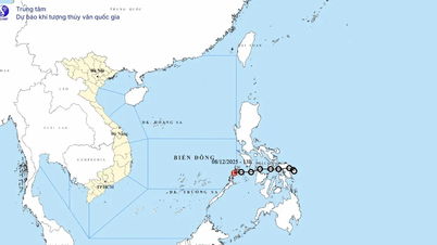
According to the National Center for Meteorological and Hydrological Forecasting, the tropical convergence zone currently has its axis at approximately 14-17 degrees North latitude, connected to a low-pressure area in the central part of the East Sea.
At 1 AM, the low-pressure area was located at approximately 15.5-16.5 degrees North latitude and 111.5-112.5 degrees East longitude.
Scattered showers and thunderstorms are expected in the sea areas from Da Nang to Ca Mau, from Ca Mau to An Giang, the Gulf of Thailand, the eastern part of the North East Sea, and the central part of the East Sea.
The forecast for September 4th, both day and night, indicates that the aforementioned areas, including the sea areas from Da Nang to Ca Mau, Ca Mau to An Giang, the Gulf of Thailand, the eastern part of the North East Sea, and the central and southern East Sea (including the Truong Sa archipelago), will continue to experience scattered showers and thunderstorms.
Warning: During thunderstorms, there is a possibility of tornadoes, strong gusts of wind (level 6-7), and waves over 2 meters high.
Ship operations in these areas are at risk from cyclones, strong winds, and high waves.
Local authorities and fishermen need to closely monitor weather developments to proactively take measures to ensure safety.
According to Vietnamplus
Source: https://www.vietnamplus.vn/thoi-tiet-ngay-49-bac-bo-nang-nong-cuc-bo-nguy-co-mua-lon-tai-phia-nam-post1059733.vnp
Source: https://baolongan.vn/thoi-tiet-ngay-4-9-bac-bo-nang-nong-cuc-bo-nguy-co-mua-lon-tai-phia-nam-a201877.html


![[Image] Close-up of the newly discovered "sacred road" at My Son Sanctuary](/_next/image?url=https%3A%2F%2Fvphoto.vietnam.vn%2Fthumb%2F1200x675%2Fvietnam%2Fresource%2FIMAGE%2F2025%2F12%2F13%2F1765587881240_ndo_br_ms5-jpg.webp&w=3840&q=75)


Comment (0)