
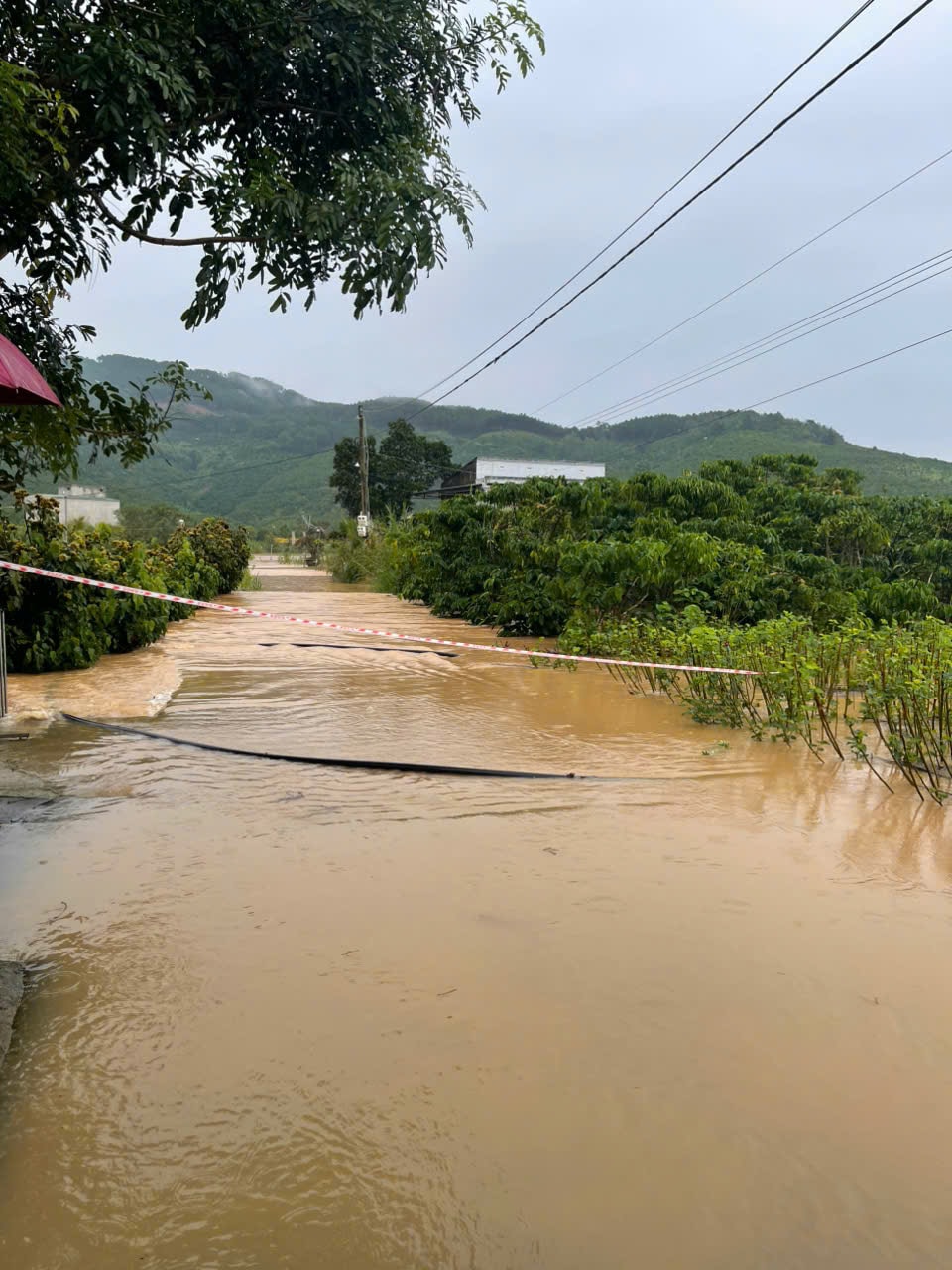
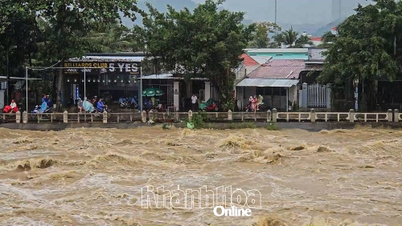
Specifically, at Thanh Binh 3 Iron Bridge area, across Cam Ly stream, the flooding is about 200m long, the deepest point is about 1.5m, the water is flowing fast, and is forecast to rise further.

The branch road of Zone 7 (next to Binh Thanh market) in Thanh Binh 2 was also flooded about 1-1.5m deep, about 50m long; including 1 household in the flooded area. Currently, the forces have supported the evacuation of the flooded household out of the dangerous area.
The Civil Defense Command of Dinh Van Lam Ha commune has directed functional forces to deploy rescue work, put up ropes and warning signs at the above locations.
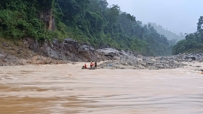
According to the forecast of Lam Dong Hydrometeorological Station, in the next 6-12 hours (noon, afternoon today), the flood on Cam Ly River will continue to rise and peak. At Thanh Binh station, the flood peak is likely to reach 833.80m, 0.80m above the alarm level III; compared to the historical flood peak at a level 0.45m lower.
In the next 12 - 24 hours (tonight, tomorrow morning), flood on Cam Ly River is likely to gradually decrease and remain at a level below alert level III from 0.40 - 0.20m.

Faced with the forecast of complicated developments of rain and floods in the coming days, the Civil Defense Command of Dinh Van Lam Ha commune requested people to regularly monitor weather information and proactively contact in case of unexpected natural disasters so that the Commune People's Committee can grasp and promptly deploy effective rescue measures.
The Military Command of Dinh Van Lam Ha commune has also provided a hotline for people in affected areas to quickly contact for rescue when necessary.
Source: https://baolamdong.vn/xa-dinh-van-lam-ha-tam-thoi-cam-nguoi-dan-va-phuong-tien-luu-thong-tren-mot-so-doan-duong-bi-ngap-sau-403339.html


![[Photo] General Secretary To Lam and National Assembly Chairman Tran Thanh Man attend the 80th Anniversary of the Traditional Day of the Vietnamese Inspection Sector](https://vphoto.vietnam.vn/thumb/1200x675/vietnam/resource/IMAGE/2025/11/17/1763356362984_a2-bnd-7940-3561-jpg.webp)


![[Photo] Lam Dong: Urgently declare emergency situation...](https://vphoto.vietnam.vn/thumb/402x226/vietnam/resource/IMAGE/2025/11/17/1763373171762_cdn-nhandan-vn-images-22f099ca8bc7ae81aa2a8d3416a84bf86af888fb71358dd0bda5d8598bbd8fa94443612225ad0e15b65fbbfd6ecc79d791d561cfe84da2cd9c765694c25efc35-_ndo_br_4.jpeg)


Comment (0)