
As a locality frequently affected by natural disasters, Hue City is promoting the application of science and technology, improving reservoir operation procedures, and enhancing early warning capabilities, aiming to build a city that is more resilient to extreme storms and floods.

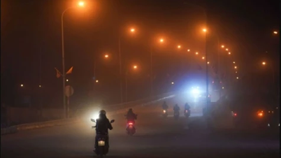
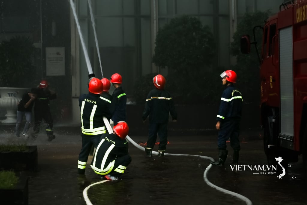
During the heavy rains and floods at the end of October 2025, for the first time, people in Hue heard sirens blaring in the city center and residential areas. Mr. Dang Van Hoa, Head of the Irrigation and Climate Change Sub-Department (Department of Agriculture and Environment), said that since 2024, the city has installed four high-powered loudspeaker systems to serve disaster warning purposes, and has also issued a set of three levels of warning regulations. At the highest level, the system emits five siren blasts, each lasting 30 seconds, with a 5-second interval and repeated no more than three times, used to warn of floods exceeding alarm level III, emergency storms, or tsunamis.
Since 2024, the city has installed four high-powered loudspeaker systems for disaster warnings and issued a three-level alert system. At the highest level, the system emits five siren blasts, each lasting 30 seconds, spaced five seconds apart and repeated no more than three times, to warn of floods exceeding alert level III, emergency storms, or tsunamis. Mr. Dang Van Hoa, Head of the Irrigation and Climate Change Sub-Department (Department of Agriculture and Environment) |
On the afternoon of October 26th, when the Civil Defense Command activated the warning loudspeakers and increased the alert level in the early morning of October 27th, the people of central Hue had time to prepare and were not caught off guard by the flood, whose water level was only slightly lower than the historic flood of November 1999 that killed 350 people.
“I was driving when I heard the siren blaring. At first, I didn't know what was happening, then I received a call about a major flood. Looking at the map on the Hue-S app, I saw the Perfume River rising rapidly, so I immediately moved my car to higher ground. By evening, Hue was submerged,” said Nguyen Man, a taxi driver on Le Duan Street.
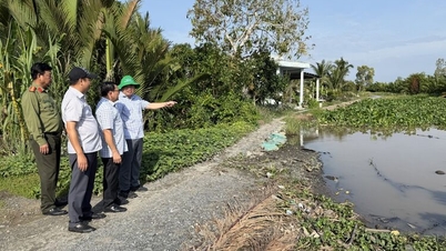
At the control center, bulletins on the water levels of the Huong and Bo rivers, and the discharge rates from the Ta Trach, Binh Dien, and Huong Dien reservoirs are continuously broadcast. People at home or at evacuation points can monitor the information on their phones, while local authorities activate a system to receive text messages requesting emergency assistance. In recent years, Hue has invested heavily in an automated flood monitoring system.
Simultaneously, the interconnected reservoir management system supported by JICA has connected three major reservoirs in the Huong-Bo river basin. Data from X-band radar, cameras, and water level sensors is continuously updated, helping the Command Center to regulate water levels effectively and minimize damage to downstream areas.
According to Vice Chairman of the People's Committee of Hue City, Hoang Hai Minh, the city uses the 10-day forecast from the National Center for Meteorological and Hydrological Forecasting to operate the reservoirs. This allows the reservoirs sufficient time to lower water levels to accommodate floods, proactively reducing and controlling the impact when releasing water downstream. Hue is also experimenting with a "multi-channel, multi-layered" communication model including warning loudspeakers, SMS messages, government fanpages, mobile applications, and social media, to ensure no citizen is left out of the information coverage, according to the Director of the Department of Science and Technology, Nguyen Xuan Son. However, the October 2025 flood revealed some limitations: Widespread power outages caused many warning stations and cameras to stop working, and disrupted transmissions resulted in slow data updates. The city is considering supplementing backup power, installing solar panels, using LoRa networks, and reinforcing antenna systems capable of withstanding level 12 winds at vulnerable points to ensure communication in all situations.
Signals of proactively adapting cities.
In suburban areas like Hoa Chau ward, Mr. Tran Van Nhan (62 years old) still maintains the habit of climbing onto the "tra" (a small attic near the roof) whenever he hears news of heavy rain. "Every house in Hue used to have a tra to store rice, valuables, and protect against floods," he said, "but in 1999, the water rose so quickly that as soon as I climbed up with my child, the water reached the roof, and I had to cut through the tiles to let it drain. That's when I realized that old experiences sometimes don't work anymore."
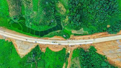
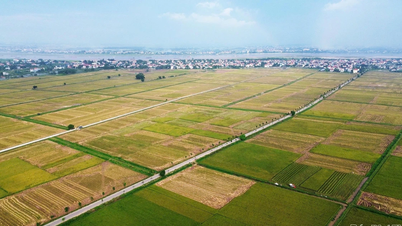
After four consecutive floods in the last 20 days of 2025, many residents admitted that "floods now are unlike before." Urbanization has changed the flood map: many new roads, residential areas, and dikes have diverted water flow; some areas are flooded more deeply, while others drain faster. In Quang Dien, an area that was once heavily flooded, the water now recedes quickly thanks to the canal system leading to Tam Giang lagoon; while some new residential areas are flooded up to 70cm. Many roads, such as Vo Van Kiet, have become temporary "dikes," causing a difference of up to half a meter in water levels on either side.
Older generations acknowledge that traditional knowledge is no longer accurate enough. "It's raining upstream while it's scorching hot down here; without checking your phone, you wouldn't know what to expect," said Ms. Le Thi Thao from An Cuu ward. Meanwhile, younger generations are learning to "live with data": Each storm is updated hourly, with flood maps and traffic information.
“These kids are faster at using apps than they are at watching TV. Once, during a flood, after checking their phones, they shouted, ‘Q is coming: use Q to go!’ and dragged the whole family to an evacuation point. When we got there, I realized that it had been raining heavily upstream, the reservoir was full, and it had lost its ability to regulate water levels, so we had to move to higher ground to be safe,” Mr. Nhan recounted.
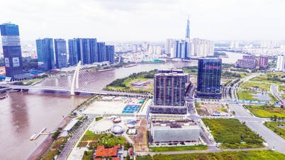
The city of Hue is currently adjusting its urban planning towards adaptation: opening more regulating lakes, improving the drainage system, and relocating residents from vulnerable areas. Schools and community centers on the outskirts of the city have been selected as temporary evacuation points. 26 years after the historic 1999 flood, Hue has shifted from a passive to an active approach in disaster response. From sirens to minute-by-minute data transmissions, the city is taking its first steps on the journey to building a climate-resilient urban environment.
In a land where floods strike every year, the sound of warning sirens will no longer be a sound of fear, but a signal of a city proactively adapting, becoming more prepared for nature and for its own future.
According to nhandan.vn
Source: https://baodongthap.vn/xay-dung-do-thi-thich-ung-bien-doi-khi-hau-a234045.html


![[Photo] Prime Minister Pham Minh Chinh attends the Conference summarizing and implementing tasks of the judicial sector.](/_next/image?url=https%3A%2F%2Fvphoto.vietnam.vn%2Fthumb%2F1200x675%2Fvietnam%2Fresource%2FIMAGE%2F2025%2F12%2F13%2F1765616082148_dsc-5565-jpg.webp&w=3840&q=75)


Comment (0)