

TPO - The Kien My Bridge on National Highway 19B, spanning the Kon River (Phu Phong town, Tay Son district, Binh Dinh province), has been in use since 1997. Currently, changes in the water flow under the bridge have caused erosion at 11 bridge piers.
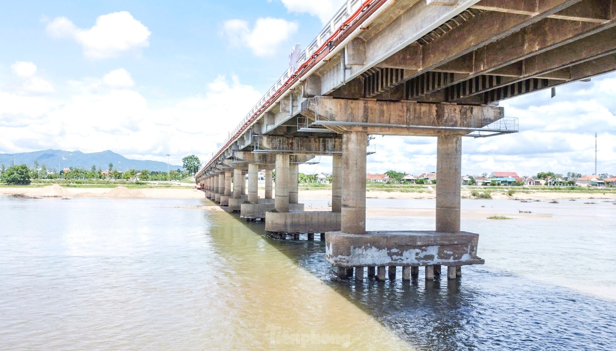 |
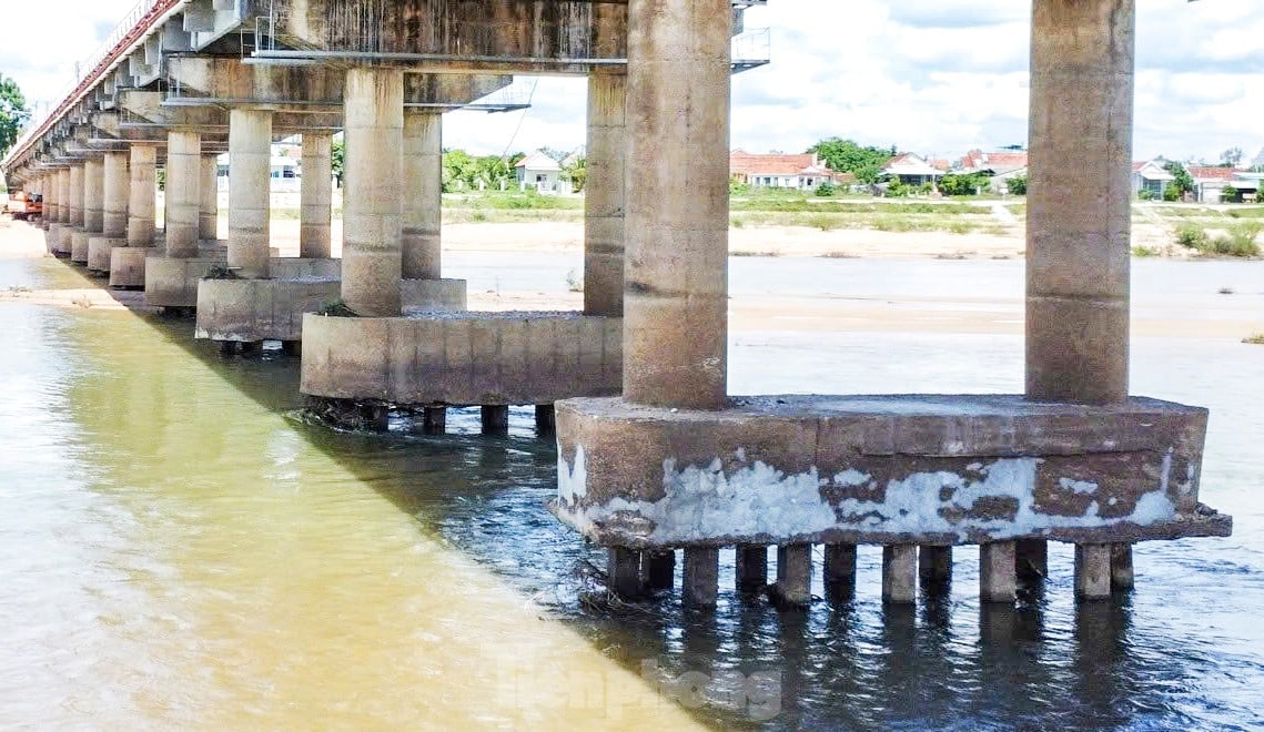
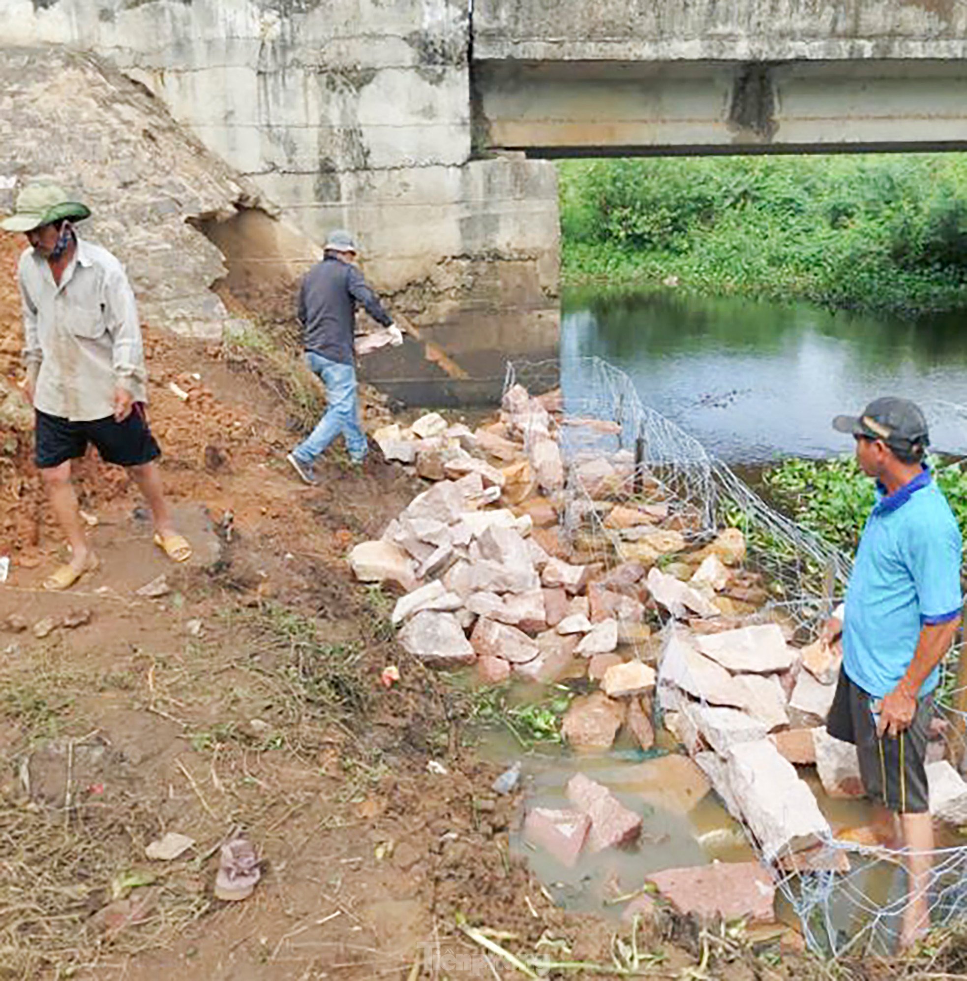
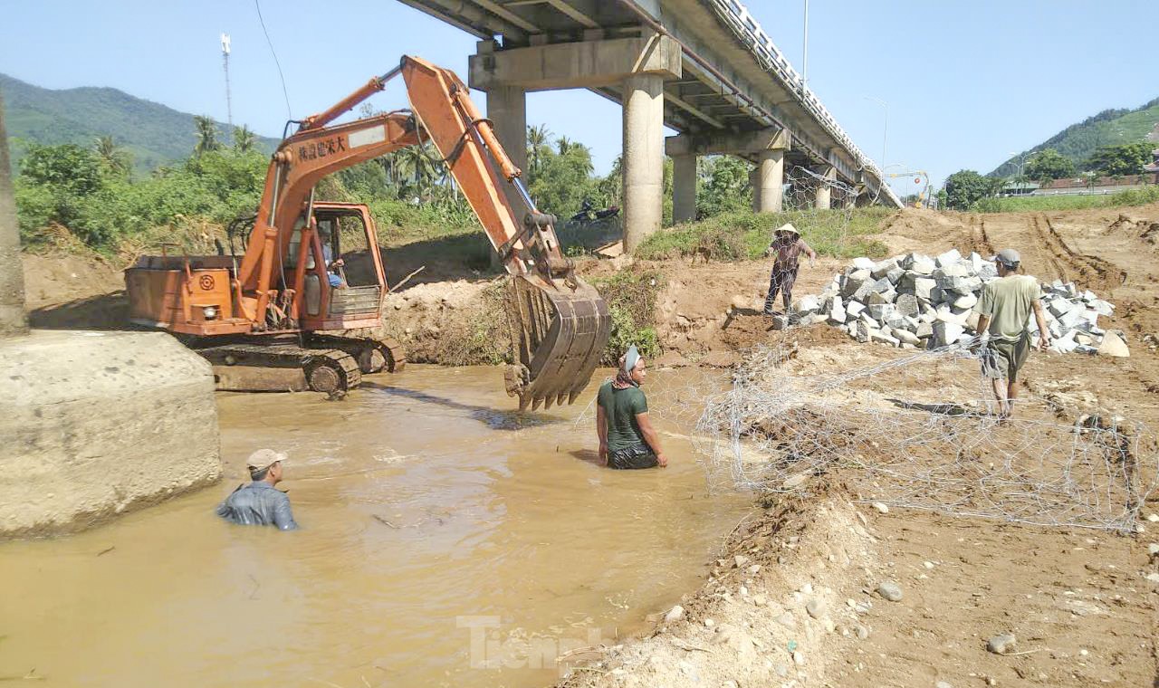
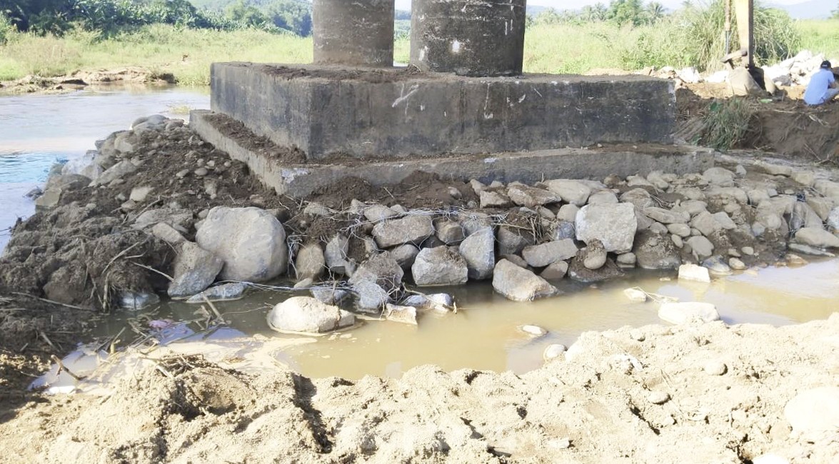
| Changes in the water flow beneath the Kien My bridge have caused erosion at 11 bridge piers, with erosion ranging from 0.5 to 1.8 meters. Photo: Truong Dinh |
 |
  |
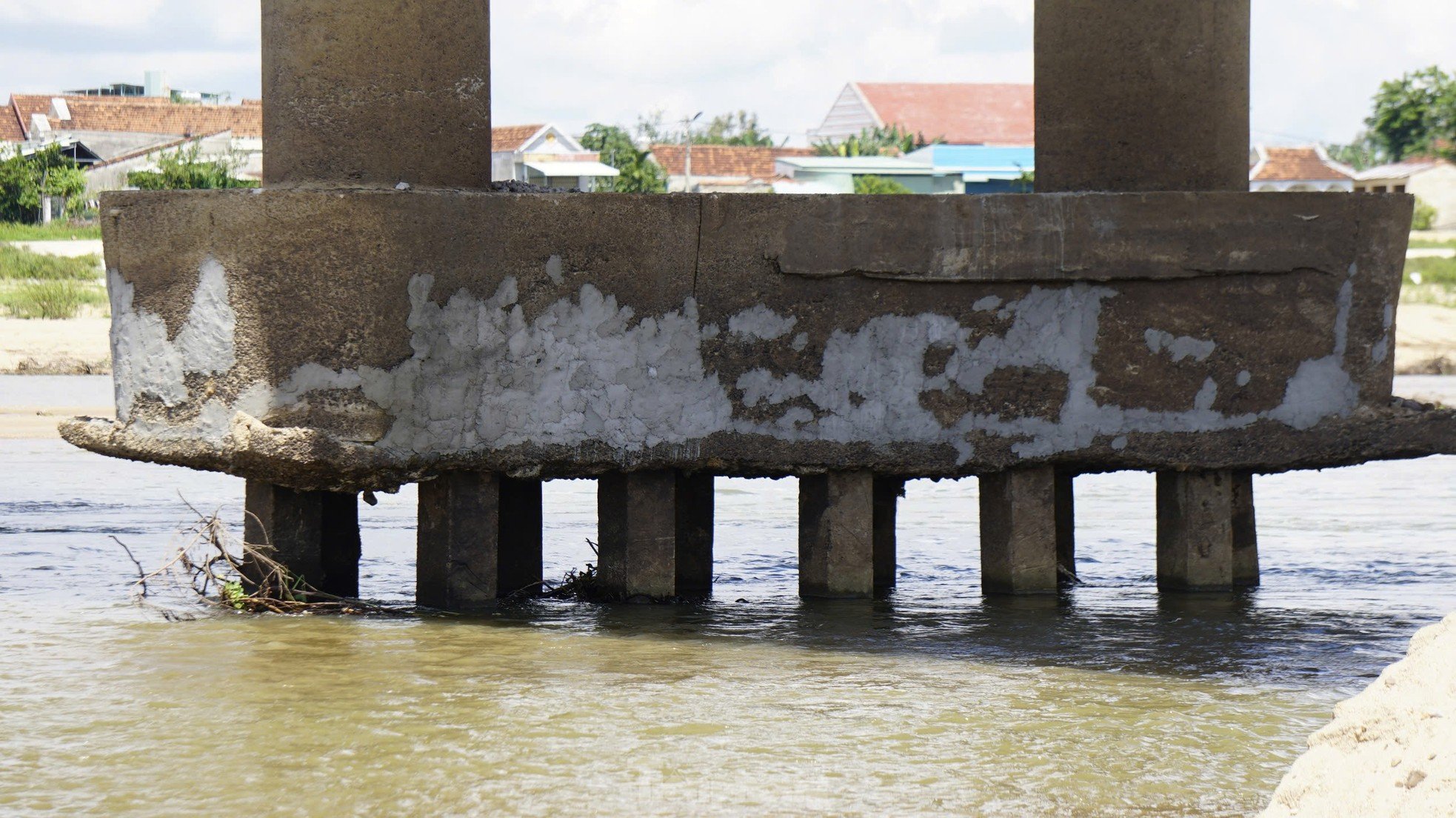
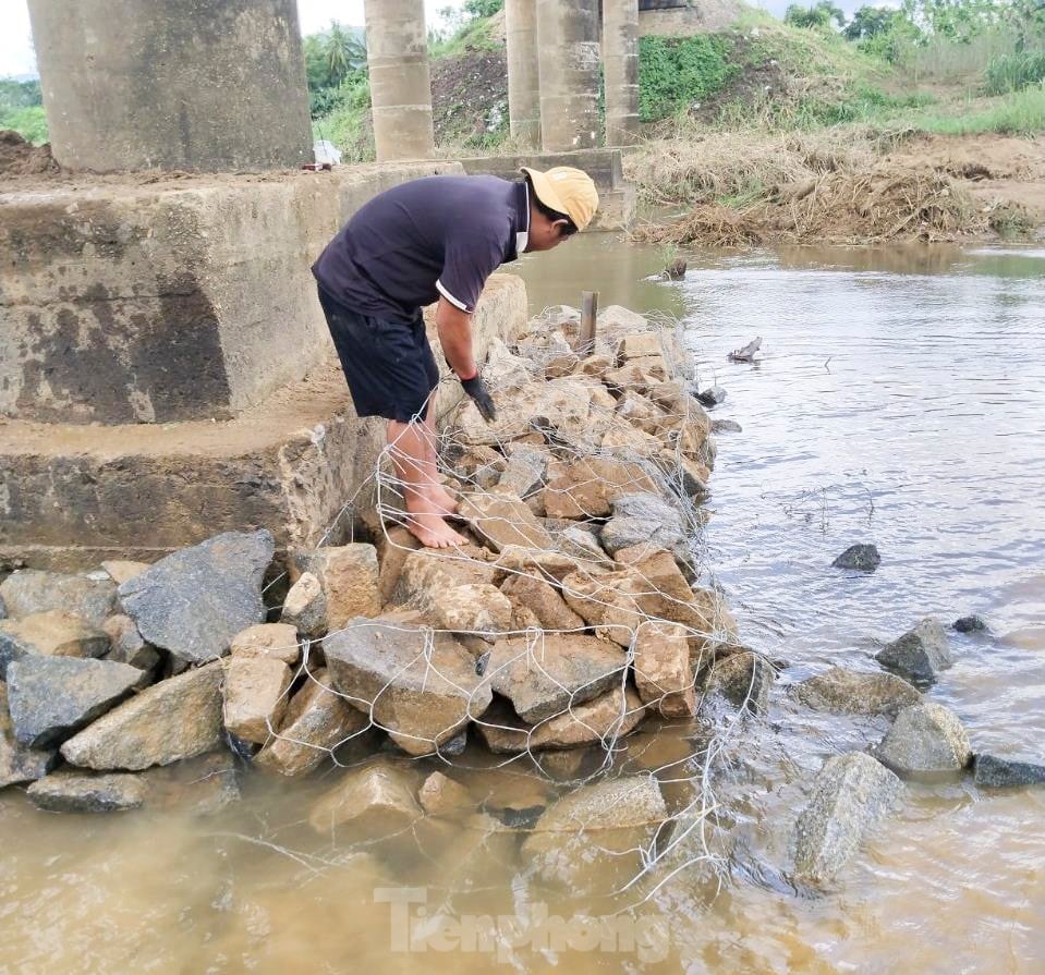
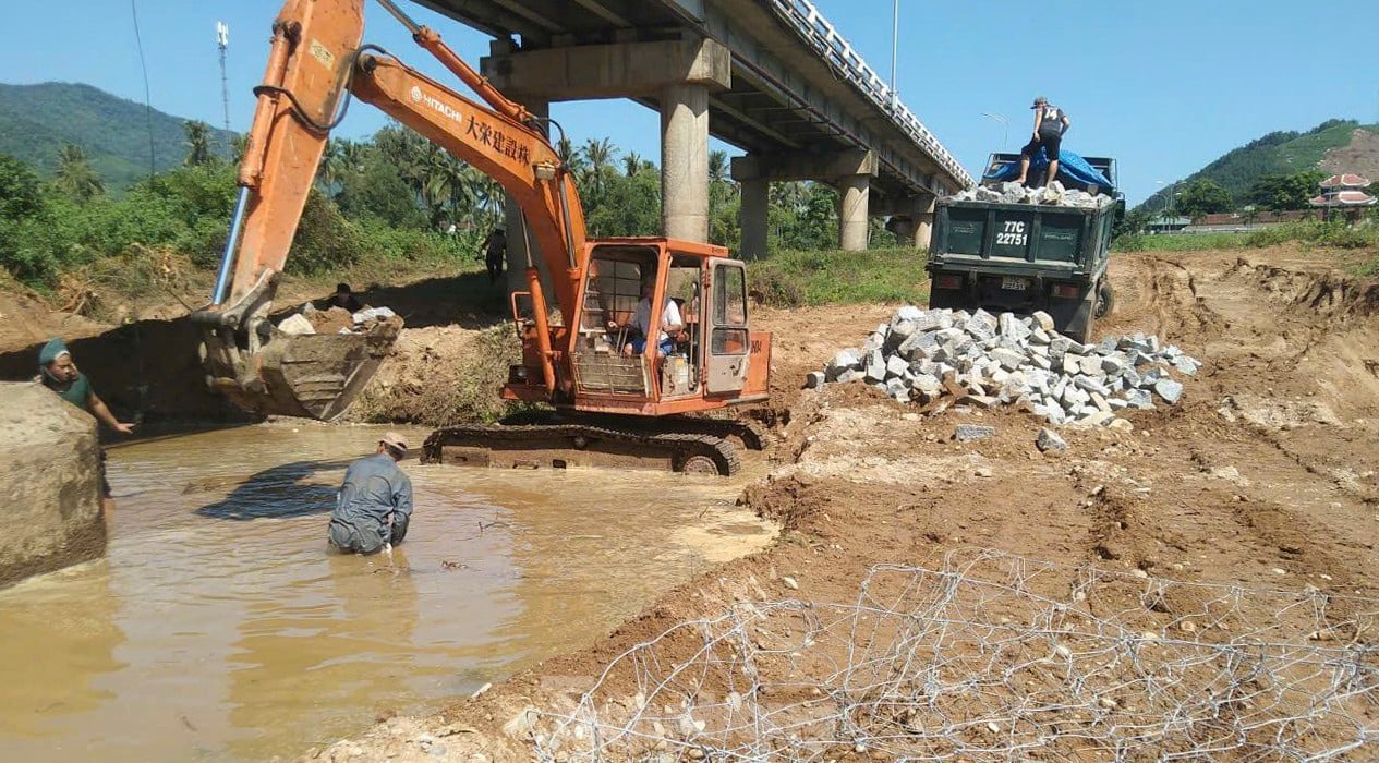
In addition, the piers of the Kien My bridge show signs of damage, with many pieces of concrete broken off. Currently, the relevant units are carrying out reinforcement work. For the piers that have been eroded, the Department of Transport is leveling the ground and bringing sand back in to create a flat surface. Regarding the two central piers of the bridge, they are seeking opinions on reinforcement measures. Photo: Truong Dinh |
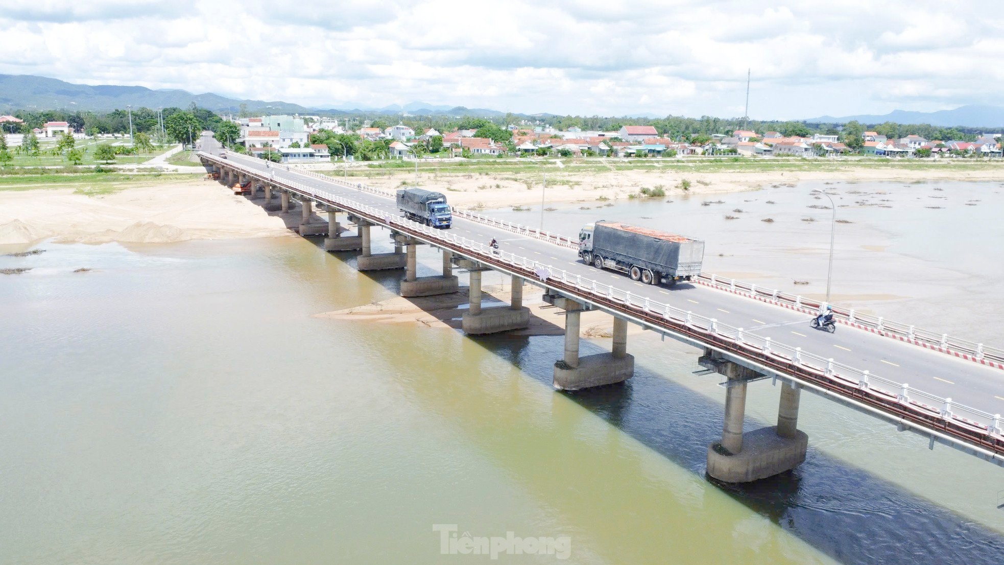 |
The Kien My Bridge is approximately 547 meters long. Since its opening, the bridge has undergone two repairs and maintenance. Photo: Truong Dinh |
 |
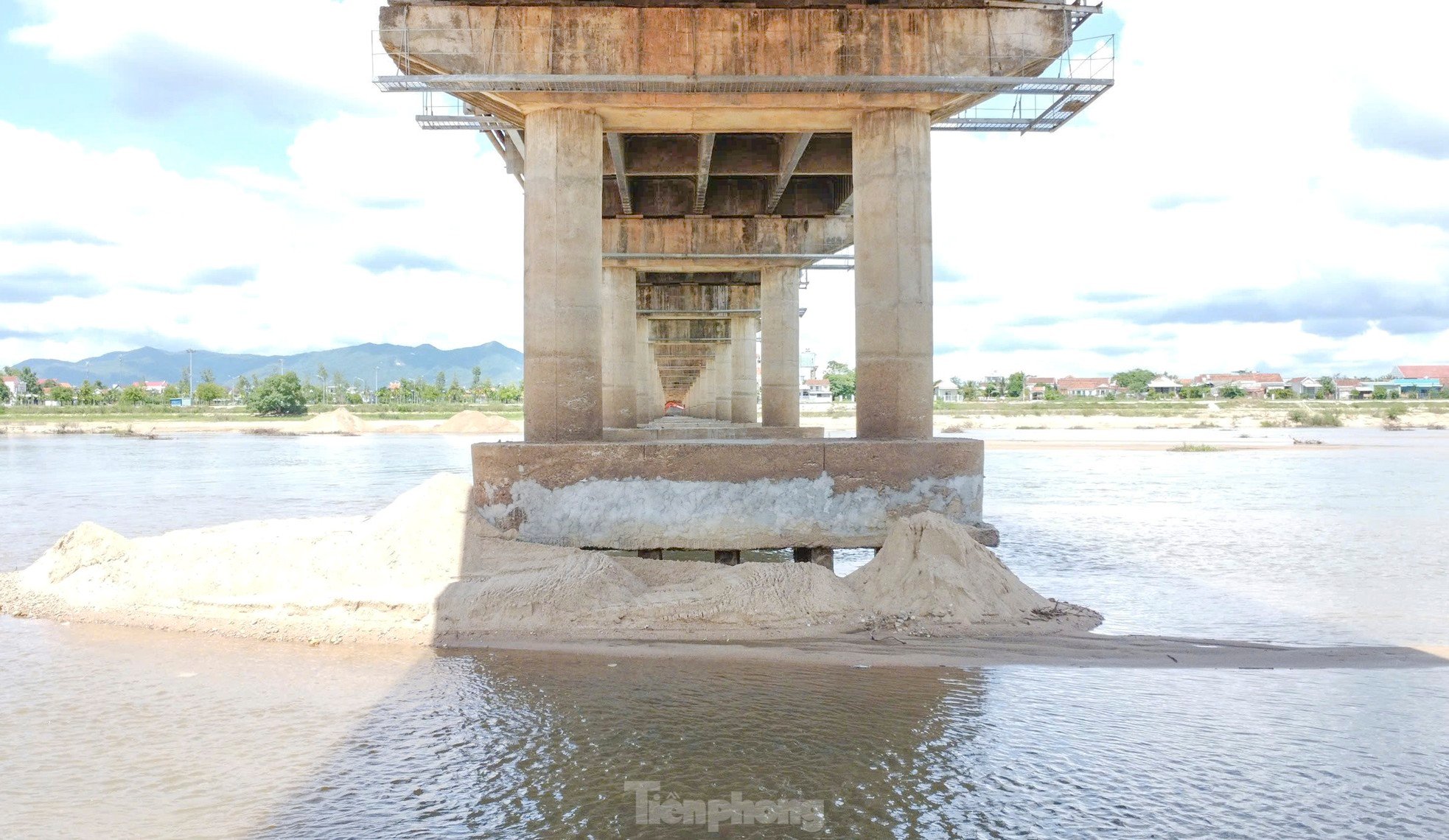
The Department of Transport of Binh Dinh province stated that it has requested the Vietnam Road Administration to consider and approve the urgent remediation and repair of the erosion affecting these 11 bridge piers. (Photo: Truong Dinh) |
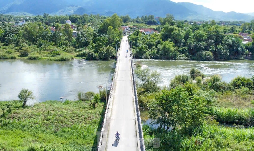 |
Meanwhile, in Vinh Thanh district (Binh Dinh province), the Dinh Binh bridge, after 29 years, is also severely degraded, shaking violently whenever a truck passes over it. Photo: Truong Dinh |
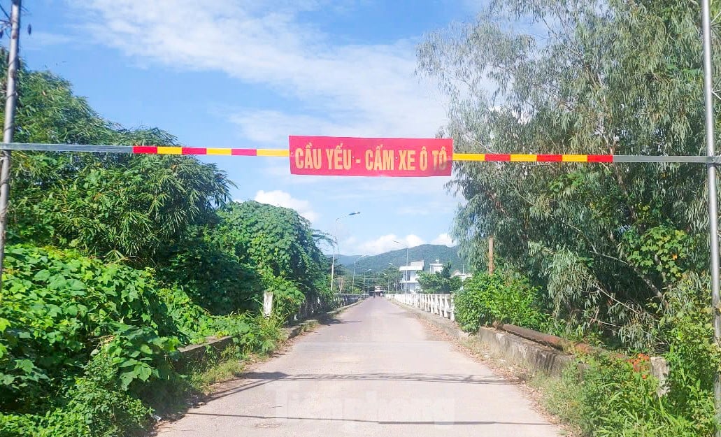 |
Due to concerns about the bridge collapsing, local authorities have placed signs prohibiting cars at both ends of the bridge. According to the leaders of Vinh Thanh District People's Committee, Binh Dinh Province People's Committee has agreed to include the Dinh Binh bridge in the list of projects under preparation for investment in the 2026-2030 period. The District People's Committee has assigned the Project Management Board to hire a consulting unit to redesign the new bridge. Photo: Truong Dinh |
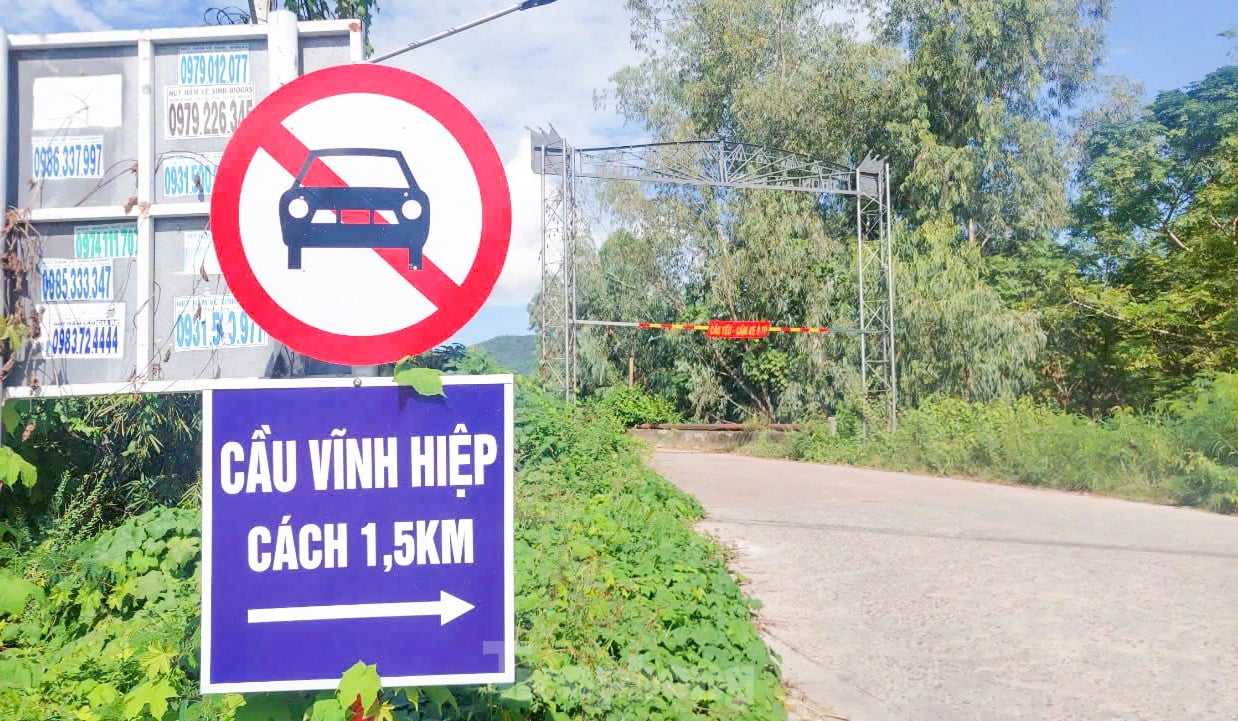 |
For the time being, Vinh Thanh district will develop plans to ensure safety and prevent people from traveling during the flood season and high water levels. At the same time, traffic will be diverted to Vinh Hiep bridge, 1.5km away, to ensure safety. Photo: Truong Dinh |
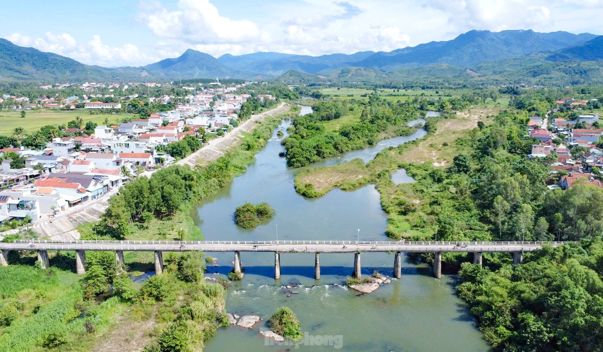 |
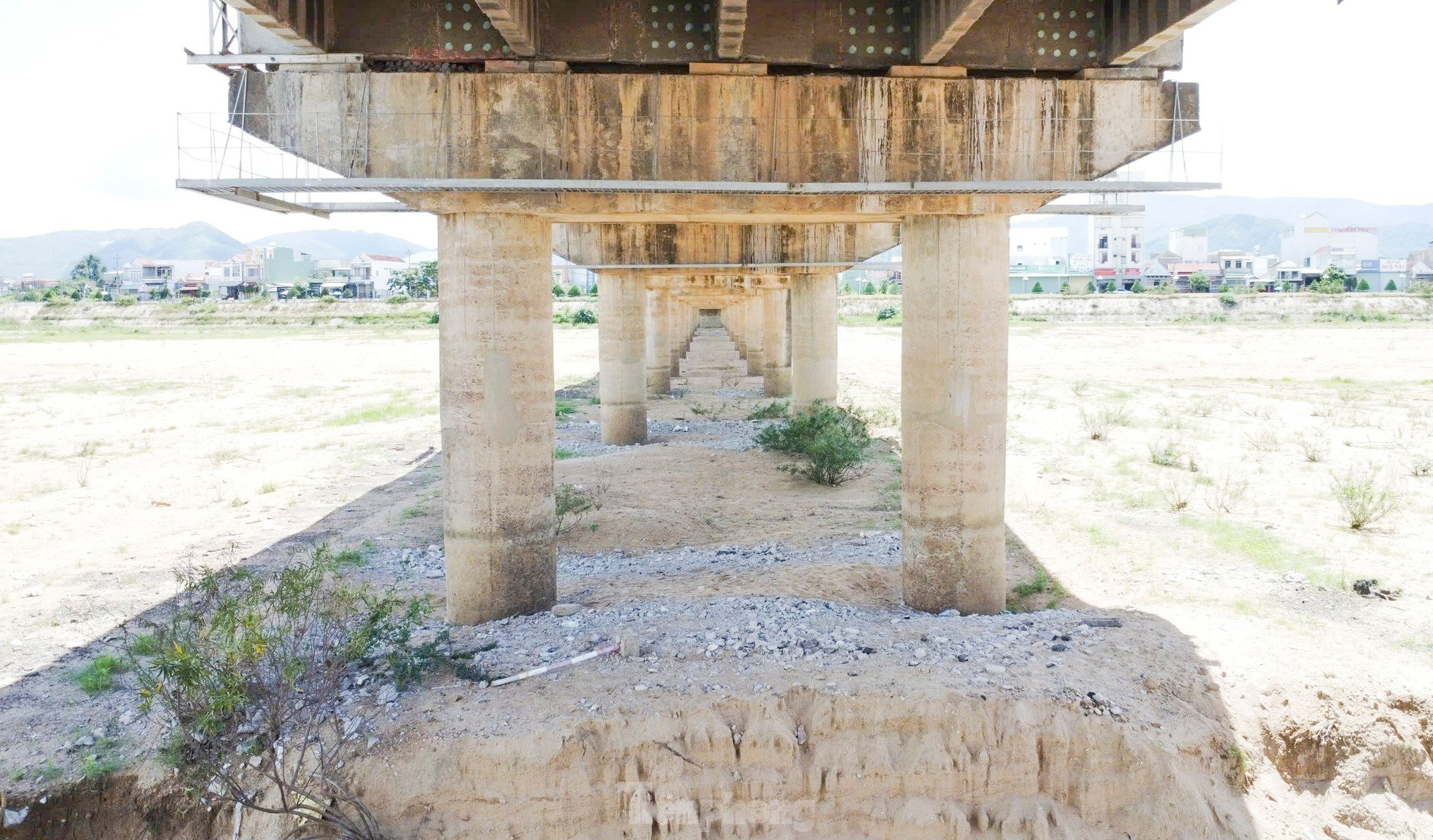
The Dinh Binh Bridge, spanning the Kon River, was built in 1995 and is 180 meters long. This bridge connects Vinh Thanh town with the communes east of the Kon River, such as Vinh Thinh, Vinh Hiep, and Vinh Hoa. Photo: Truong Dinh |
 |
According to the Department of Transport of Binh Dinh province, there are currently 27 weak and narrow bridges on provincial roads that need to be replaced to ensure traffic safety and standardize load capacity. These bridges have already been inspected and have load limit signs posted. (Photo: Department of Transport) |
 |
Reinforcement against erosion of the An Lão bridge pier foundation at Km25+727 on provincial road DT.629. |
 |
According to the Department of Transport, in the past period, the Department has used its internal resources to repair and rectify damage, ensuring the safety of the infrastructure during the rainy season and floods. |
 |
In the long term, to ensure the stable and sustainable operation of the bridge and to standardize load capacity across the roads, the Department of Transport proposes that the Provincial People's Committee consider and allow the repair and reinforcement of the bridge abutments, piers, and girders with a more durable structure using the annual economic development budget allocated to the Department. |
 |
At the same time, the plan includes establishing a project to replace weak, narrow bridges to ensure traffic safety and standardize operating load capacity on provincial roads, using funds from the medium-term public investment plan for the period 2026-2030. |


Source: https://tienphong.vn/cau-dai-hon-500m-bac-qua-song-kon-o-binh-dinh-bi-xoi-lo-11-tru-post1684232.tpo


Comment (0)