
Switch from flood prevention to living with water
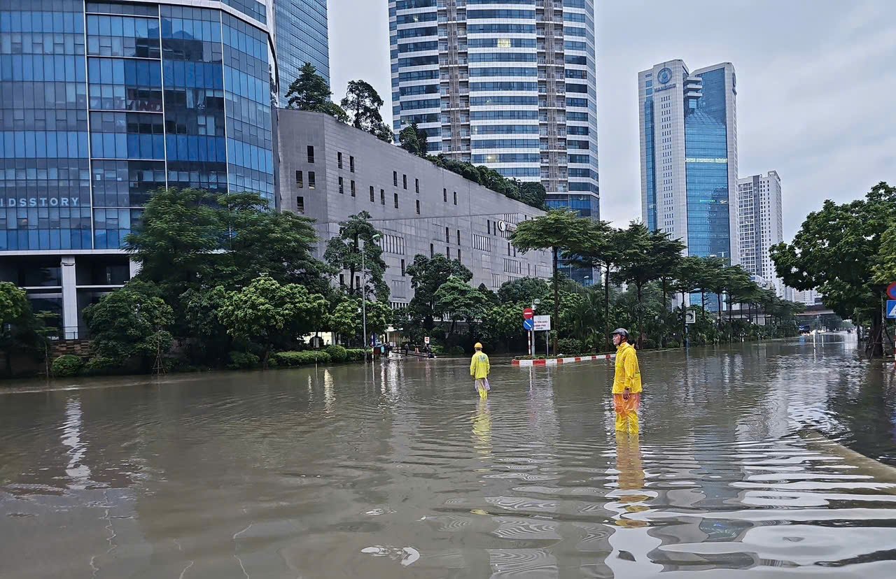
In the rainy season of 2025, Ho Chi Minh City and Hanoi continuously recorded widespread flooding, which is no longer a seasonal phenomenon but has become the "new normal". In Ho Chi Minh City, many areas such as An Khanh, Phu Thuan, Tan Hung, Thanh My Tay wards and Nha Be commune are often submerged in water. Rising water forces people to raise furniture and use sandbags to block doors to prevent overflow. High tides on the Saigon River are forecast to exceed alert level 3, seriously threatening low-lying areas. The already overloaded drainage system and regulating lakes are almost no longer effective.
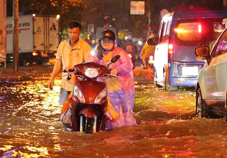
In Hanoi, after storm Bualoi, many inner-city wards such as Truc Bach, Hang Bong, and suburban areas such as Dong Anh, Yen Vien (Gia Lam) were also submerged in water, causing many streets to be paralyzed, causing economic damage of hundreds of billions of dong.
According to Dr. Vu Thi Hong Nhung (RMIT University), the current sewer system is overloaded. Traditional solutions such as dykes, tidal sluices or individual pumps are no longer enough to cope with climate change, extreme heavy rains and high tides. The cause lies in urban concreting, filling in ponds and lakes, narrowing river and canal corridors, causing the natural water storage and infiltration capacity to almost disappear.
In Ho Chi Minh City, the total area of public parks is about 237 hectares, mainly for entertainment purposes, without integrating water storage functions. Meanwhile, the adjustment of the general planning of Ho Chi Minh City to 2040, with a vision to 2060, identifies the river-canal axis as the "green-water backbone" of the city, requiring parks and squares to incorporate water storage functions. However, the mechanism and land fund for project implementation are still unclear, causing slow progress.
Meanwhile, Hanoi has many large regulating lakes such as West Lake, Hoan Kiem Lake, Linh Dam Lake... but most of them only serve the purpose of landscape and daily life, not capable of coping with continuous heavy rains or unusual high tides. Current flood prevention planning mainly upgrades sewers, dredging rivers and lakes, building local regulating tanks, and has not yet integrated the "living with water" model into public spaces or riverside corridors.
The "living with water" model learned from international experience
Faced with the serious flooding situation, experts have recommended that Ho Chi Minh City and Hanoi apply the dual-mode water storage park-square model, learning from Rotterdam, Copenhagen, Singapore, Tokyo and Seoul. This is not only a technical solution but also turns public spaces into temporary flood protection while maintaining community living functions.
According to Dr. Vu Thi Hong Nhung, in Rotterdam, Benthemplein Square is both a playground and a rainwater reservoir with three different levels, helping to reduce pressure on the sewer system. Meanwhile, Singapore turned the Bishan - Ang Mo Kio canal into an ecological park, both absorbing rainwater and serving community activities.
Copenhagen designed its parks and streets using the “Cloudburst” model, temporarily storing rainwater in underground or low-lying tanks. Tokyo and Seoul use canals, parks, reservoirs and automatic warning systems to protect millions of people. These lessons show that green, multifunctional and flexible infrastructure is the key to preventing flooding and improving quality of life.
In Ho Chi Minh City, experts have proposed a pilot project in flood-prone areas and along canals, combining a park and a square with two water storage modes. Specifically, An Khanh ward can use a riverside square with a low level containing 5,000 - 10,000 m³ of water. When dry, it is a playground, when it rains, it becomes a temporary lake, with a one-way valve and a quick pump to ensure safety for surrounding residential areas.
Areas along the Nhieu Loc - Thi Nghe canal are designed with "rain gardens" with biological ditches and flood-resistant trees to retain water in place, reducing pressure on existing sewers. Tan Hung and Phu Thuan wards take advantage of sports fields, parks or parking lots with a depression of about 0.5m, combining sensors and IoT to automatically regulate water, draining quickly in 30 - 90 minutes.
For Hanoi, Dr. Phan Thanh Chung (RMIT University) suggested turning part of Thong Nhat Park into a temporary reservoir of 8,000 - 15,000 m³ to serve inner-city drainage such as Hoan Kiem and Hai Ba Trung.
The Red River corridor is expanded into an ecological buffer zone, retaining upstream water and reducing flooding in the inner city. Industrial parks and suburban parking lots (Dong Anh, Cau Giay) apply a “dual-mode” model, integrating IoT and sensors, and green infrastructure absorbs up to 70% of rainwater, reducing pressure on the old sewer system.
Mr. Chung emphasized: “Parks, squares and riverside corridors are not only public spaces but also temporary shields against flooding, helping to improve microclimate and enhance quality of life.”
These solutions also open up opportunities for socialization, businesses can exploit commercial services, organize events, restaurants or cultural spaces on water parks, both reducing pressure on the public budget and creating community value. Cost and benefit analysis shows that just by renovating the existing space, the amount of water flowing into the sewer can be reduced by 20-30%, saving thousands of billions of VND compared to building new hard infrastructure.
According to experts, urban flooding cannot be solved by sewers or hard dikes alone. Ho Chi Minh City and Hanoi need to turn the idea of “living with water” into an indispensable part of modern urban structures. Parks and squares are no longer just places for walking or playing, but become green shields to protect the city from climate change, while creating livable community spaces.
Source: https://baotintuc.vn/van-de-quan-tam/chuyen-gia-hien-ke-bien-cong-vien-quang-truong-thanh-ho-chua-nuoc-de-chong-ngap-20251009195002640.htm


Comment (0)