
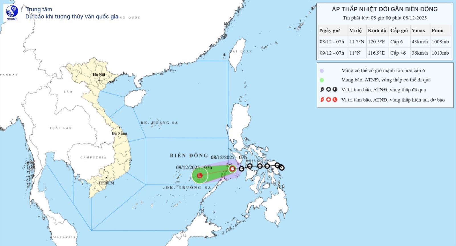
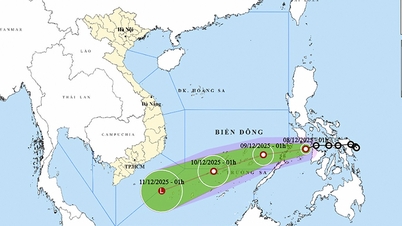
According to the National Center for Hydro-Meteorological Forecasting, at 7:00 a.m. on December 8, the center of the tropical depression was located at about 11.7 degrees North latitude; 120.5 degrees East longitude, on the eastern coastal area of Palaoan Island, Philippines. The strongest wind near the center of the tropical depression was level 6 (39-49 km/h), gusting to level 8. The tropical depression moved westward at a speed of about 15-20 km/h.
Forecast until 7:00 a.m. on December 9, the tropical depression in the sea area southeast of the central East Sea, moving in the West Southwest direction at a speed of about 15 - 20 km/h and weakening into a low pressure area. Wind force below level 6, gusting to level 8. The affected area is the sea area southeast of the central East Sea (including the sea area northeast of Truong Sa special zone); natural disaster risk level 3.
Due to the impact of the tropical depression, the sea area southeast of the central East Sea (including the sea area northeast of Truong Sa special zone) has winds gradually increasing to level 6, gusting to level 8, waves 2-4m high, rough seas.
Vessels operating in the above mentioned danger zones are susceptible to the effects of storms, whirlwinds, strong winds and large waves.
Source: https://baotintuc.vn/van-de-quan-tam/ap-thap-nhiet-doi-doi-huong-va-di-chuyen-nhanh-hon-20251208083855483.htm


![[Photo] General Secretary To Lam receives the Director of the Academy of Public Administration and National Economy under the President of the Russian Federation](/_next/image?url=https%3A%2F%2Fvphoto.vietnam.vn%2Fthumb%2F1200x675%2Fvietnam%2Fresource%2FIMAGE%2F2025%2F12%2F08%2F1765200203892_a1-bnd-0933-4198-jpg.webp&w=3840&q=75)


Comment (0)