
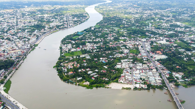
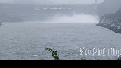
The water level on the Hau River at Khanh An is forecast to continue to decrease slowly, and the water level in the next 5 days is likely to remain high, at approximately alert level 2.
According to the An Giang Province Hydrometeorological Station: In the past 12 hours, the water level on the canals in the Long Xuyen Quadrangle such as Vinh Te, Tri Ton, Ba The, Nui Choc Nang Gu, Rach Gia, Long Xuyen has been rising slowly. The highest water level in the past 12 hours reached 0.02-0.14 m above alert level 2; on Nui Choc and Nang Gu canals at Vinh Hanh station, the water level reached its highest value on October 11 at 2.7 m, equivalent to alert level 3 and is slowly falling.
According to the forecast of the Hydrometeorological Station of An Giang province, the water level on the canals in the Long Xuyen Quadrangle will continue to rise slowly and will likely reach its highest value in the next 1-3 days, then change slowly. It is forecasted that by October 18, the highest water level on the Hau River at Khanh An will be approximately at alert level 2; on the canals in the Long Xuyen Quadrangle will be 5-20 m above alert level 2.
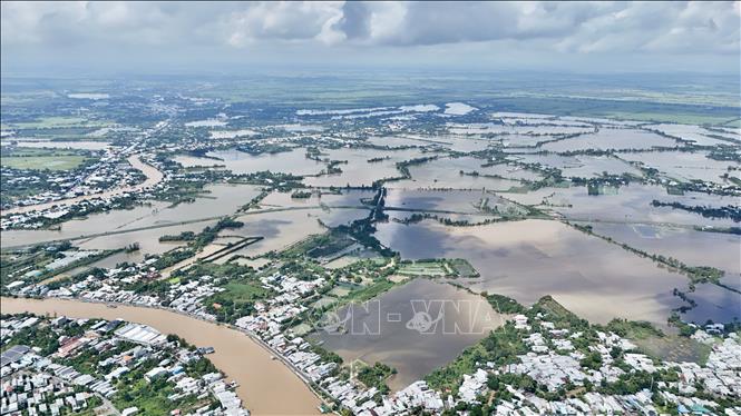
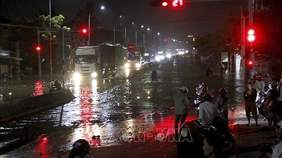
The An Giang Provincial Hydrometeorological Station warns of level 2 flood risk. Therefore, the risk of flooding in An Giang province occurs in low-lying areas, along rivers, canals, ditches and deep flooding in areas outside the dyke. Therefore, localities need to be on guard against the possibility of landslides on embankments, weak dykes and traffic routes in flooded areas.
Many areas have large and deep flooded areas, strong winds can create large waves causing erosion, landslides... affecting activities such as transportation, aquaculture, agricultural production, people's lives and socio- economic activities.
Source: https://baotintuc.vn/kinh-te/du-bao-muc-nuoc-tren-song-hau-5-ngay-toi-kha-nang-van-xap-xi-bao-dong-2-20251014141412790.htm


![[Photo] Cat Ba - Green island paradise](/_next/image?url=https%3A%2F%2Fvphoto.vietnam.vn%2Fthumb%2F1200x675%2Fvietnam%2Fresource%2FIMAGE%2F2025%2F12%2F04%2F1764821844074_ndo_br_1-dcbthienduongxanh638-jpg.webp&w=3840&q=75)


![[VIMC 40 days of lightning speed] Da Nang Port: Unity - Lightning speed - Breakthrough to the finish line](https://vphoto.vietnam.vn/thumb/402x226/vietnam/resource/IMAGE/2025/12/04/1764833540882_cdn_4-12-25.jpeg)


Comment (0)