
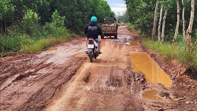
According to the land use planning adjustment map for the period 2021 - 2030 of Can Duoc district, Long An province, Tan Lan commune is oriented to develop traffic infrastructure with some notable new routes. These routes are expected to contribute to strengthening regional connectivity and promoting local socio-economic development.

Overview of planned routes
Based on planning documents, Tan Lan commune will have three main roads opened in the future, focusing on connecting National Highway 50, Can Duoc bypass and crossing Can Duoc river.
1. Provincial Road 826B
This is one of the important planned routes. Within Tan Lan commune, the route starts at National Highway 50 and ends across the Can Duoc River, with a total estimated length of about 1.5 km. When completed, this route will create a new connecting axis, reducing the load on existing routes.
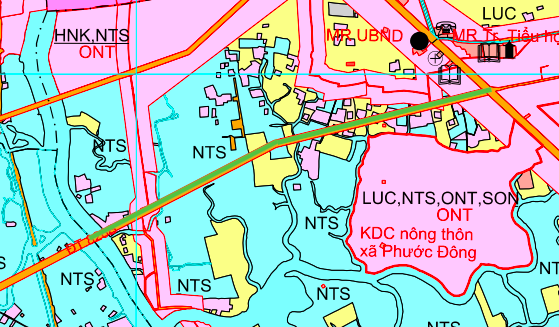
2. Route across Can Duoc River
Another route is also planned with a length of about 1.5 km. This route has one end crossing the Can Duoc River, connecting to the intersection of National Highway 50 and the Can Duoc bypass. This project is expected to increase traffic capacity and connect areas on both sides of the river.

3. Road parallel to Can Duoc bypass
According to the plan, a road section of about 1.1 km long will be built parallel to the existing Can Duoc bypass. This route will play a supporting role, diverting traffic and facilitating the development of residential and service areas along the route.

Note: Information on routes is described based on the Land Use Planning Adjustment Map for the period 2021 - 2030 of Can Duoc district, Long An province. Actual implementation may change according to decisions of competent authorities.
Source: https://baolamdong.vn/long-an-quy-hoach-3-tuyen-duong-sap-mo-tai-xa-tan-lan-can-duoc-406711.html


![[Photo] Parade to celebrate the 50th anniversary of Laos' National Day](/_next/image?url=https%3A%2F%2Fvphoto.vietnam.vn%2Fthumb%2F1200x675%2Fvietnam%2Fresource%2FIMAGE%2F2025%2F12%2F02%2F1764691918289_ndo_br_0-jpg.webp&w=3840&q=75)
![[Photo] Worshiping the Tuyet Son statue - a nearly 400-year-old treasure at Keo Pagoda](/_next/image?url=https%3A%2F%2Fvphoto.vietnam.vn%2Fthumb%2F1200x675%2Fvietnam%2Fresource%2FIMAGE%2F2025%2F12%2F02%2F1764679323086_ndo_br_tempimageomw0hi-4884-jpg.webp&w=3840&q=75)


Comment (0)