
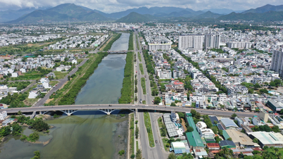
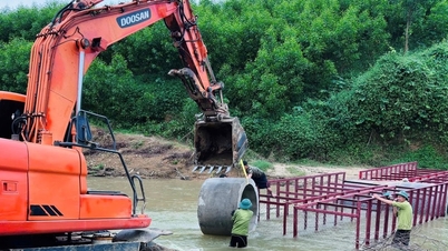
Through observation, the water flow on Cai Nha Trang River through Vinh Phuong Bridge is quite strong and fierce. Many people in the surrounding area, especially the elderly and children, have moved to a safe place.
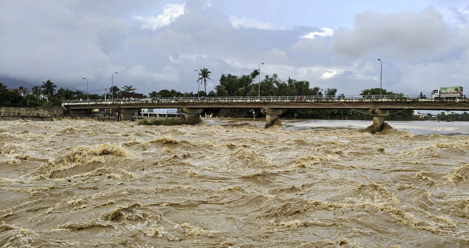 |
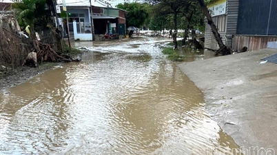
| Water on Cai River Nha Trang morning of December 4. |
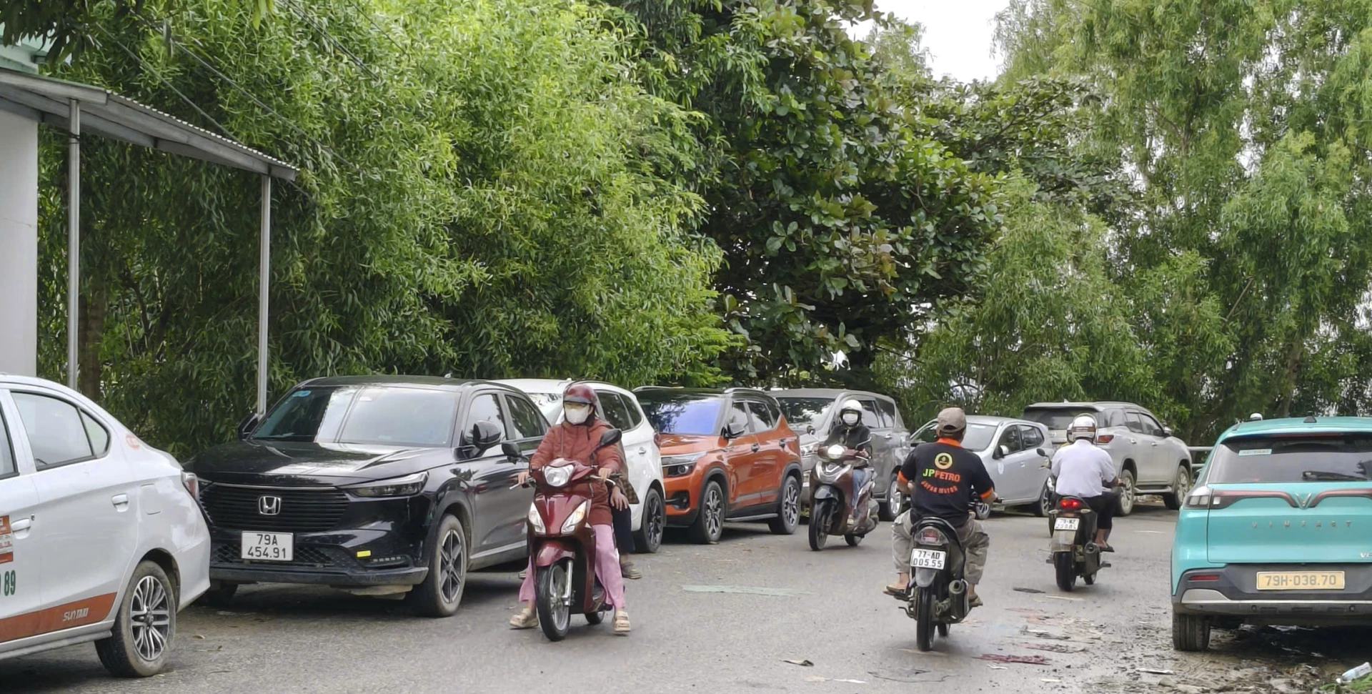 |
| Many people have moved their cars to higher ground to avoid the risk of flooding. |
The leader of Khanh Hoa Province's Hydrometeorological Station said that from 3:00 p.m. on December 3 to 6:00 a.m. on December 4, Khanh Hoa province had moderate rain, heavy rain, and very heavy rain in some places; the average rainfall was from 50-120mm. Particularly in Khanh Hiep, it was 200.3mm; Son Thai 135mm; Da Nhim 134.4mm; Khanh Phu 129.4mm... The water level on Cai Nha Trang River at 6:00 a.m. on December 4 was 4.75m, below alert level 1 by 3.25m. At the same time, Suoi Dau Lake regulated water at 24.5m 3 /s, Am Chua Lake 2.58m 3 /s. Due to heavy rain concentrated in a short period of time, it caused flooding in low-lying areas in some communes such as Dien Khanh, Dien Dien...
According to Khanh Hoa Province Hydrometeorological Station, water levels on rivers have fluctuated to the point of causing small floods, and the floods are currently continuing to rise.
Regarding reservoirs, the total capacity of 64 reservoirs (including 53 irrigation reservoirs and 11 hydroelectric reservoirs) as of 6:00 a.m. on December 4 was 621.19 million m3 (82.6%) compared to the design. Reservoirs with a capacity of over 10 million m3 have achieved a water storage capacity ratio of 39% - 98%. In particular, reservoirs with large capacities such as Da Ban, Suoi Dau, Song Cai, Song Sat, and Song Trau have achieved a water storage capacity ratio of 76% - 87%. Reservoirs with a capacity of 1 to 10 million m3 have achieved a water storage capacity ratio of 58% - 100%.
Regarding the reservoirs that are operating and regulating, in the southern region of the province there are the following reservoirs: Cai River regulates with a flow of 19.67 m 3 /s; Tra Co 103.78 m /s; Tan Giang 156.59 m 3 /s; Than River 93 m 3 /s.
Lakes in the northern region of the province that are regulating include: Hoa Son 11.8m 3 /s; Da Ban 7.6m 3 /s; Suoi Trau 5.51m /s; Suoi Dau 20.45m 3 /s; Cam Ranh 15.2m 3 /s; Ta Ruc 28.76m 3 /s.
Forecast for the day and night of December 4, Khanh Hoa province's weather is cloudy, with rain, moderate to heavy rain. Specifically, rainfall in the north is generally from 20-40mm, in some places higher than 60mm. Rainfall in the south is generally from 30-50mm, locally over 90mm.
The sea off Khanh Hoa province has strong winds of level 5, sometimes level 6, gusting to level 7-8, waves 2-4m high, rough seas. The sea off Truong Sa special economic zone has northeast winds of level 4-5, gusting to level 6; waves 1.5-2.5m high, lightly rough seas.
According to the forecast of the professional agency, in the next 24 hours, a flood will appear on the rivers of Khanh Hoa province, the flood peak will be above and below the warning level 1; especially the Cai Phan Rang river at Tan My station and the Cai Nha Trang river at Dien Phu station will be above and below the warning level 2. Warning of the risk of flash floods and landslides in the communes and wards: Van Hung, Van Thang, Dai Lanh, Tay Ninh Hoa, Dong Ninh Hoa, Suoi Hiep, Cam Lam, Cam An, Suoi Cat, Bac Khanh Vinh, Tay Khanh Vinh, Trung Khanh Vinh, Khanh Son, Dong Khanh Son, Tay Khanh Son, Lam Son, Bac Ai Tay, Bac Ai, Bac Ai Dong, Ninh Son.... Warning of the risk of localized flooding in some low-lying areas in some communes and wards: Dien Khanh, Suoi Hiep, Dien Dien, Bac Nha Trang, Nha Trang, Tay Nha Trang, Nam Nha Trang, Phan Rang, Bao An, Ninh Phuoc, Phuoc Dinh, Phuoc Hau, Phuoc Huu, Ninh Phuoc, Thuan Nam, Cam Ranh....
C.D
Source: https://baokhanhhoa.vn/xa-hoi/202512/lu-tren-song-dang-len-canh-bao-lu-quet-ngap-lut-tai-36-xa-phuong-42155ab/


![[Photo] Parade to celebrate the 50th anniversary of Laos' National Day](/_next/image?url=https%3A%2F%2Fvphoto.vietnam.vn%2Fthumb%2F1200x675%2Fvietnam%2Fresource%2FIMAGE%2F2025%2F12%2F02%2F1764691918289_ndo_br_0-jpg.webp&w=3840&q=75)


![[VIMC 40 days of lightning speed] Hai Phong Port determined to break through, reaching the target of 2 million TEUs by 2025](https://vphoto.vietnam.vn/thumb/402x226/vietnam/resource/IMAGE/2025/12/04/1764816441820_chp_4-12-25.jpeg)


Comment (0)