

Doing this well will not only help minimize damage to people and property, but also affirm the nation's self-reliance in science and technology in the field of disaster prevention and control.
For many years, Quang Tri province has consistently been among the localities most severely affected by storms and floods. While engineering solutions such as reservoirs, dikes, flood control, and population relocation have proven effective, they require significant funding and long investment periods, while the nature of natural disasters is changing rapidly.
A pressing need arises to develop early warning tools based on real-time data, modern mathematical models, and rapid information transmission technology.
Based on that reality, the Ministry of Science and Technology assigned the National Key Laboratory of River and Coastal Dynamics to carry out the project "Research on the application of advanced technology to build an early warning system for natural disaster risks caused by floods and inundation in Quang Tri province and neighboring areas," led by Associate Professor, Dr. Nguyen Thanh Hung.
")
The project has three strategic objectives: Developing a Disaster Risk Map (establishing a detailed flood and inundation risk map down to the commune level, directly serving disaster prevention efforts); developing real-time warning technology (building advanced technology for early warning of flood and inundation risks in real time, based on meteorological and hydrological forecasts); and improving the Transmission and Response System (developing technology for transmitting warning information and proposing appropriate and effective response plans).
To achieve these goals, the research team implemented six main initiatives, focusing on in-depth data collection and analysis, and the application of breakthrough technologies.
The key to the system's effectiveness lies in the simultaneous application of several cutting-edge technologies. First and foremost is the mathematical model based on physical processes.
The research team developed a flood simulation and risk assessment toolkit using a physical approach, that is, simulating the real-world behavior of runoff, rainfall, topographic slope, and hydrological factors to create more realistic forecast scenarios.
In addition, artificial intelligence (AI) and machine learning act as an "augmented brain." Associate Professor, Dr. Nguyen Thanh Hung and his colleagues have trained the system on large datasets over many years, thereby creating 282 different scenarios for disaster warning.
Thanks to AI, the processing and forecasting speed is significantly reduced, which is a key factor in disaster prevention and response, which requires real-time action.
Another key pillar is integrated information transmission technology. The system is designed to send alerts and response instructions directly to citizens via mobile phones, websites, and social media, ensuring that critical information is delivered quickly, to the right place, and at the right time.
The initial results of the project were tested during the 2024 flood season in Quang Tri. Real-time forecasts and warnings based on the new model were highly appreciated by management agencies and experts for their completeness, modernity, and ability to meet urgent practical requirements in the locality.
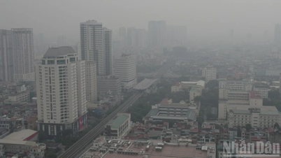
Not only the central region, but many coastal areas of Vietnam also face the risk of serious flooding due to the combination of strong storms, rising sea levels, and large waves.
In response to this situation, the National Center for Hydro-Meteorological Forecasting has launched a national-level project titled "Developing a model and technological process for forecasting coastal flooding caused by storm surges and waves," led by Associate Professor, Dr. Nguyen Ba Thuy, and implemented from December 2022 to November 2025.
The objective was to master the integrated atmospheric-wave-storm surge computing model and develop a forecasting process suitable for Vietnam's coastal conditions. The research team completed the collection and processing of meteorological, hydrological, oceanographic, and topographic data, and integrated three advanced models: WRF (storm wind simulation), SWAN (wave simulation), and ADCIRC (storm surge simulation).
The system allows for detailed simulation of how storms interact with coastal terrain, thereby predicting flood levels under specific scenarios. The model was tested in Thanh Hoa province at a map scale of 1/10,000, assessing flooding based on storm levels 11-14, with and without sea dikes, and incorporating various tidal periods.
The products have been delivered to local authorities to develop evacuation plans, protect boats, aquaculture areas, and dike infrastructure. The forecasting toolkit was tested during the 2025 typhoon season and showed a high degree of correlation with actual data.
Mr. Hoang Duc Cuong, Deputy Director of the Department of Meteorology and Hydrology, assessed that the project has made an important contribution to improving the quality of early warning for coastal areas, in line with the industry's goal of modernizing forecasting.
A notable point is that the model separates the forecasting process for two types of terrain: areas with dikes and areas without dikes. Sea dikes strongly influence wave propagation and storm surge, thus requiring a different forecasting method. This allows the model to be suitable for each coastal province with different shoreline structures, from Thanh Hoa and Hue to Khanh Hoa, Vinh Long, and Ca Mau.
According to Associate Professor, Dr. Nguyen Ba Thuy, the model also helps improve the forecasting capacity of the forecasting team. However, for the model to operate in real time for professional purposes, further investment in a powerful computing system is still needed.
Both studies demonstrate Vietnam's maturity in developing advanced disaster simulation and warning technologies for self-reliance. While difficult to quantify directly in economic terms, the indirect benefits from damage mitigation are substantial.
In the context of increasingly extreme natural disasters, developing integrated forecasting models, applying AI, big data, and rapid communication technologies is the right direction for Vietnam to perfect its national-scale early warning system.
This is not only a goal of the meteorological and hydrological sector but also a core requirement for sustainable socio-economic development, especially in high-risk areas.
Source: https://nhandan.vn/mo-hinh-canh-bao-thien-tai-the-he-moi-post929692.html


![[Photo] Prime Minister Pham Minh Chinh holds a phone call with the CEO of Russia's Rosatom Corporation.](/_next/image?url=https%3A%2F%2Fvphoto.vietnam.vn%2Fthumb%2F1200x675%2Fvietnam%2Fresource%2FIMAGE%2F2025%2F12%2F11%2F1765464552365_dsc-5295-jpg.webp&w=3840&q=75)


![[Photo] Closing Ceremony of the 10th Session of the 15th National Assembly](/_next/image?url=https%3A%2F%2Fvphoto.vietnam.vn%2Fthumb%2F1200x675%2Fvietnam%2Fresource%2FIMAGE%2F2025%2F12%2F11%2F1765448959967_image-1437-jpg.webp&w=3840&q=75)


![[OFFICIAL] MISA GROUP ANNOUNCES ITS PIONEERING BRAND POSITIONING IN BUILDING AGENTIC AI FOR BUSINESSES, HOUSEHOLDS, AND THE GOVERNMENT](https://vphoto.vietnam.vn/thumb/402x226/vietnam/resource/IMAGE/2025/12/11/1765444754256_agentic-ai_postfb-scaled.png)


Comment (0)