
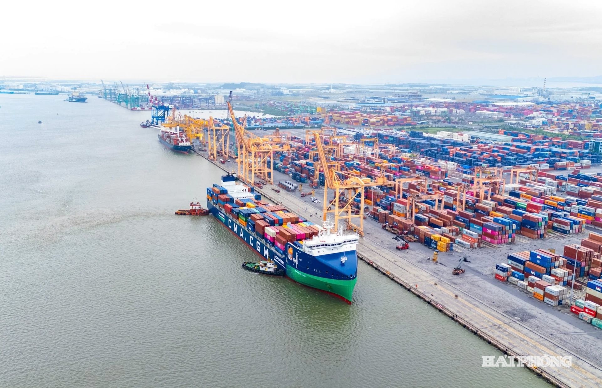
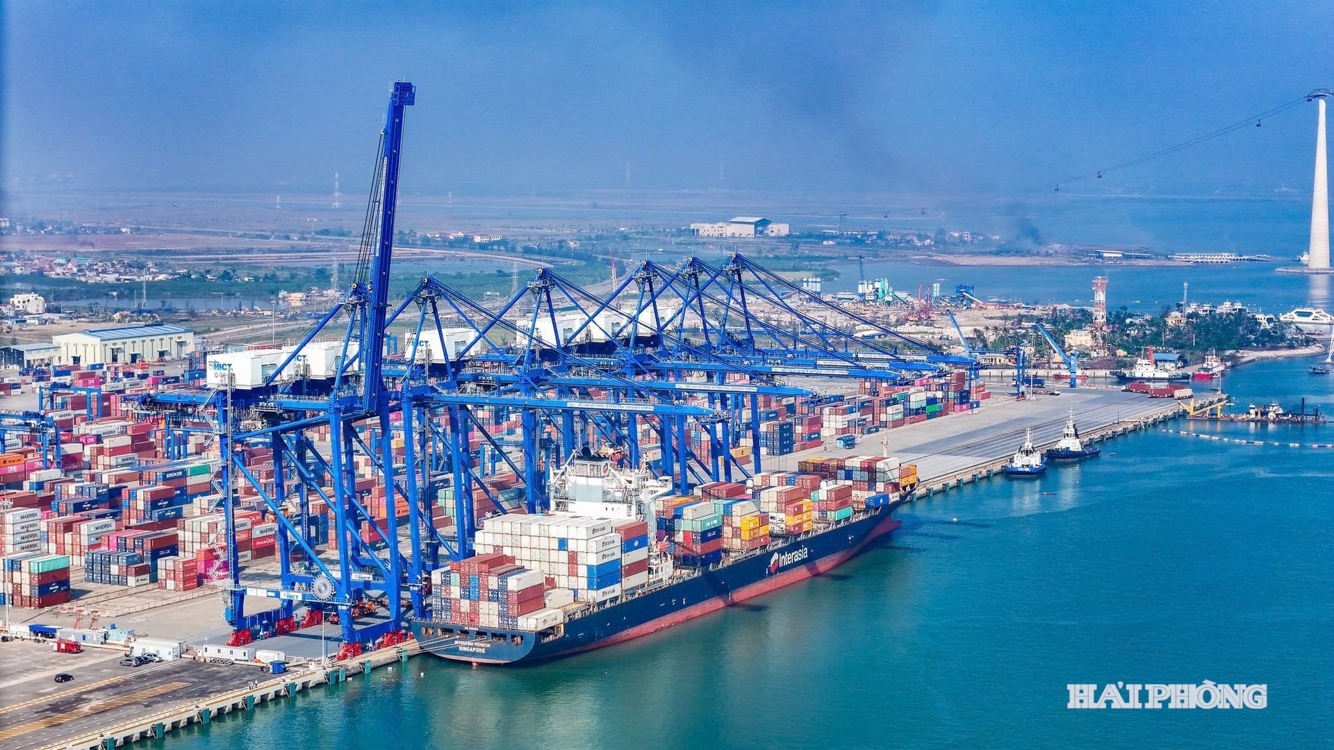
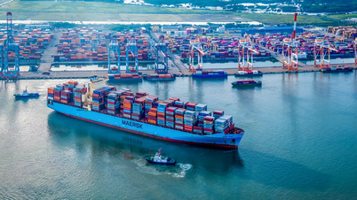
More effective management of port waters.
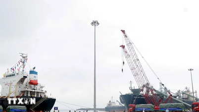
The draft Circular announcing the port waters within the territory of Hai Phong city and the management area of the Hai Phong Maritime Port Authority, which the Ministry of Construction is seeking opinions on, defines the scope of the Hai Phong port waters as including: Van Uc River, Nam Do Son, Northeast of Thai Binh River estuary, Hon Dau, Lan Ha Bay, Lach Huyen, Ha Nam Canal, Cai Trap Canal, Bach Dang River, Cam River, and Gia River. Notably, according to this proposal, the Ministry of Construction allows the city to expand the water boundary towards the sea, closely following the port system development plan for the period 2021-2030 and the vision to 2050.
According to the newly added port plan, many additional anchorage areas, transshipment areas, buoy berths, and storm shelters have been established. Several offshore dredged material disposal sites (points D1–D4) have been inspected and approved; the coastline in the South Dinh Vu area has also changed significantly as the industrial zone continues to expand. If the water boundary is not adjusted in a timely manner, some pilot boarding and disembarking areas and large-tonnage vessel anchorage areas will fall outside the current management scope, causing difficulties in licensing, monitoring, and responding to maritime incidents.
Establishing boundaries along the 20°31'00" latitude encompasses the entire dredging area and new maritime corridors. This not only expands the administrative scope but also creates a legal framework for coordinating vessels, channeling, granting mooring permits, and managing the marine environment within the expanded port area. However, the adjustment process needs to be implemented cautiously, combining environmental assessments and dredging management plans. Furthermore, the expansion of the water area must be accompanied by regulations on wastewater discharge monitoring, coastal ecosystem conservation, and mechanisms for handling oil spills, avoiding a situation where scale is expanded but management is lax.
Leveraging logistics
Expanding the boundaries of port waters is not only a matter of state management but also a lever to promote the development of logistics and supply chains. When port waters are expanded, businesses have a clearer legal basis to invest in floating warehouses, mooring buoys, container transshipment, depots, and riverside logistics services. These are crucial infrastructures for transshipment and import/export activities.
Chairman of the Hai Phong Logistics Association, Tran Tien Dung, stated: “The expanded waterway space will remove many barriers for logistics businesses, such as reducing licensing time, facilitating mooring and transshipment, and encouraging businesses to invest in larger vessels and modern loading and unloading equipment. This is a necessary condition for Hai Phong to achieve its goal of becoming a national-level logistics center before 2030.”
In reality, the ports within the Hai Phong seaport system are increasing their capacity, many shipping channels are being dredged, and the extended channels allow for the reception of large-tonnage vessels. Along with the decision to establish a free trade zone covering over 6,200 hectares and connecting it to the Dinh Vu - Cat Hai Economic Zone, the expansion of the waterway will create a port-industrial and logistics ecosystem with regional competitiveness.
However, for truly sustainable effectiveness, the city and central government ministries need to synchronize solutions in upgrading multimodal connectivity (road and rail connections to the port), standardizing warehouse infrastructure, building incentive mechanisms for green logistics investment, and training specialized human resources. In addition, inter-agency coordination mechanisms in monitoring maritime safety and environmental protection must be strengthened to avoid conflicts of interest between exploitation and preservation of marine ecosystems.
Expanding the boundaries of Hai Phong's port waters is a strategic and necessary step for Hai Phong to fully utilize its potential as a gateway port, promote logistics, and ensure national security and defense. However, success depends on the synchronization of land and water area planning, environmental management mechanisms, investment in connecting infrastructure, and close coordination between state agencies and businesses. When these factors are implemented, the city has the foundation to reach the position of a leading port in the region.
BAO ANHSource: https://baohaiphong.vn/mo-rong-ranh-gioi-nang-tam-cang-cua-ngo-hai-phong-524731.html


![[Photo] Two flights successfully landed and took off at Long Thanh Airport.](/_next/image?url=https%3A%2F%2Fvphoto.vietnam.vn%2Fthumb%2F1200x675%2Fvietnam%2Fresource%2FIMAGE%2F2025%2F12%2F15%2F1765808718882_ndo_br_img-8897-resize-5807-jpg.webp&w=3840&q=75)


Comment (0)