
 |
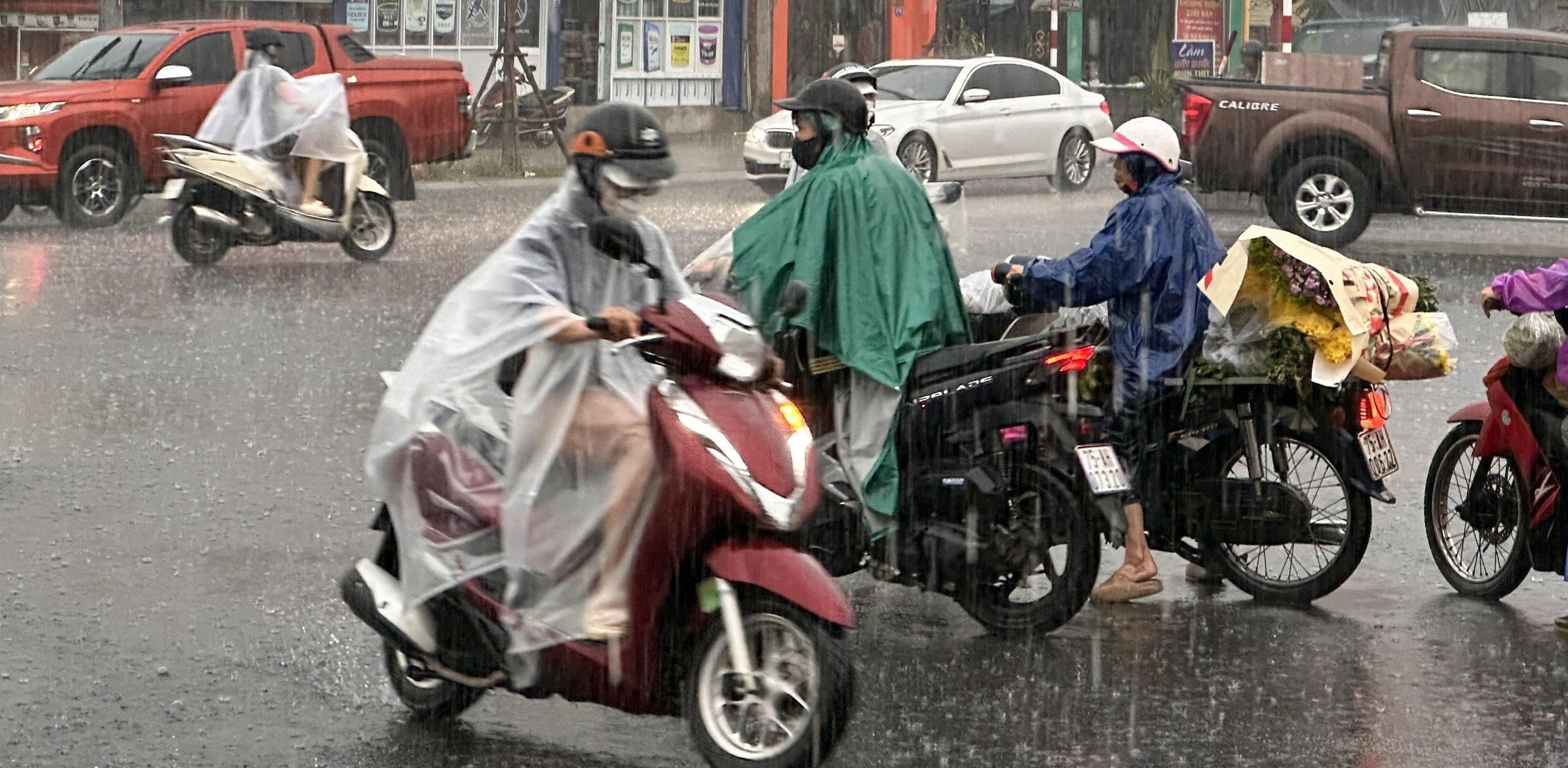
| Heavy rain continues in the coming days |
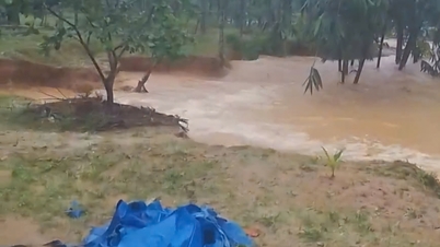
In the sea area of Hue city, the North to Northeast wind gradually increases to level 6, gusting to level 7-8; rough sea; waves 2-3.5m high. From the night of October 25 to the morning of October 27, Hue city will have heavy rain, some places will have very heavy rain. Total rainfall from 1pm on October 25 to 4am on October 27 is commonly 250-450mm. Some places are higher such as Bach Ma peak 1,426mm, Khe Tre 700mm, Huong Son 589mm, Thuong Quang 585mm, Huong Phu 574mm. The highest hourly rainfall is 104.6mm/hour at Nam Dong station in the period from 24:00 to 1:00 on October 27.
It is forecasted that due to the influence of the cold air combined with disturbances in the upper easterly wind zone, from early morning of October 27 to early morning of October 29, Hue City will have heavy rain, very heavy rain, and some mountainous areas will have especially heavy rain. The total rainfall is generally 250-500mm, with some places over 700mm. It is expected that the water level of the Huong River and the Bo River will continue to rise and reach above alert level III. The safety of irrigation and hydroelectric reservoirs in the city is guaranteed.
Heavy rain, areas at high risk of landslides and mountain slides. These are Nam Dong, which is at risk of affecting 89 households in Lap village, A Tin village (old Thuong Nhat commune); Khe Tre (90 households), residential group 1, residential group 2 (old Khe Tre town); group 4, village 1 and Doi village hill; Pa Yem hill, Khe Tre commune (old Thuong Lo commune); slope of La Son - Tuy Loan highway.
Chan May Lang Co and Phu Loc, National Highway 49B section passing through (old Loc Binh commune) belongs to Phu Loc commune; Bach Thach village belongs to Loc An commune (old Loc Dien); the area of the passes: Phuoc Tuong, Phu Gia, Hai Van, the road to Bach Ma peak; the road to Laguna tourist area; the eastern slope of Chan May Lang Co cape; Trung Phuoc Tuong village and Trung An village belong to (old Loc Tri commune).
Phong Dien, landslides along Highway 71 from Phong Xuan to the hydroelectric reservoirs of Rao Trang 3, Rao Trang 4, A Lin B2, A Lin B1. Binh Dien, landslides in the hillside area, note the high-risk areas along Highway 49A through the communes of Binh Thanh, Binh Tien, Huong Binh (old). Communes of A Luoi 1 to A Luoi 5: Areas that need to be on guard against landslides in hills and mountains, residential areas along the Ho Chi Minh road, Highway 49A.
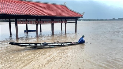
When the water level on Huong River and Bo River rises above alarm level III; O Lau River, Truoi River, Bu Lu River have high water levels and are at risk of flooding in 30 communes and wards including: Phong Dinh, Phong Phu, Phong Quang, Phong Thai, Dan Dien, Quang Dien, Hoa Chau, Duong No, Thuan An, Huong Tra, Huong An, Kim Tra, My Thuong, Phu Ho, Kim Long, Thuan Hoa, Phu Xuan, Thuy Xuan, Huong Thuy, Vy Da, An Cuu, Thanh Thuy, Phu Vinh, Phu Vang, Vinh Loc, Phu Bai, Loc An, Hung Loc.
National Highway 1 through the communes of Phu Loc, Loc An, and Hung Loc has many deep and long flooded spots (due to rain pouring from Bach Ma mountain range flowing over the road) and flooded urban areas and industrial zones due to heavy rain.
National Highway 49B section through Phong Dinh ward, from km5+050 to km5+200, the water is 0.05 to 0.1m deep; from km5+870 to km6+400, the water is 0.1 to 0.3m deep and has been barricaded to prohibit vehicles; from km7+500 to km9+300, the water is 0.1 to 0.4m deep and has been barricaded to prohibit vehicles.
Phong Phu Ward, from km10+450 to km10+650, is flooded from 0.15 to 0.2m deep; from km15+750 to km15+950, is flooded from 0.15 to 0.2m deep; from km16+150 to km16+550, is flooded from 0.1 to 0.15m deep; Duong No Ward, from km43+300 to km48+000, is flooded from 0.2 to 0.25m deep;
National Highway 49, at Lim 1 bridge under construction, is temporarily flooded, and is being diverted to the direction of Tam Thai and into the planning area. Km23+800, section from Cham to Tuan bridge (Thuy Xuan ward), the slope landslide is 6m deep and 14m long, and is currently clearing a section of the road. Sections on route Km47+270; Km50+500; Km74+600, Km61-Km75+100-Km76 (Ta Luong pass) have slope landslides, and are currently clearing a section of the road.
Ho Chi Minh Road has only minor landslides, has been repaired, traffic is normal. Phong Dien Ward, the section of Provincial Road 6 Trach Ta passing through Khuc Ly Ba Lap is flooded 0.8m deep; at Provincial Road 6 Khuc Ly Ba Lap passing through Phong Dinh Ward, the water is 1m deep and 300m long; the section of Provincial Road 17 is flooded 0.1m in Vinh Nguyen and 0.2m in Huynh Lien, traffic is restricted; the section of Xuan Loc going to Hien An Ben Cui is flooded 60cm deep and 70m long, traffic is not allowed; the section of Xuan Loc going to Co Xuan - Quang Loc is flooded 50cm and 500m long, traffic is not allowed; the intersection of Vinh Huong (Phong Thai Ward) going to Hien An Ben Cui (Phong Dien Ward) is flooded 1m deep and 100m long, traffic is not allowed.
Provincial Road 4 - Hoa Chau Ward, from km9+800 to km9+900, is flooded from 0.2 to 0.3m deep; Quang Dien Commune, from km14+100 to km14+500 (Thu Le overflow), is flooded from 0.9 to 1m deep and has been barricaded to prohibit vehicles. Provincial Road 8A - Quang Dien Commune, from km6+650 to km6+800, is flooded from 0.8 to 0.9m deep and has been barricaded to prohibit vehicles.
Provincial Road 8C, Phong Dinh Ward, from km26+000 to km26+700, is flooded from 0.1 to 0.2m deep; Phong Phu Ward, from km27+200 to km27+700, is flooded from 0.1 to 0.15m deep. Provincial Road 10C - Phu Vang Commune, from km0+10 to km3+000, is flooded from 0.3 to 0.5m deep and has been barricaded to prohibit vehicles. Provincial Road 19 - Quang Dien Commune, from km13+000 to km13+100, is flooded from 0.2 to 0.25m deep and has been barricaded to prohibit vehicles.
Provincial Road 21 Dien Huong, from Km9+000-Km10+500 was completely eroded and damaged. Provincial Road 1 Thanh Thuy, km3+800, the road surface was flooded 0.6-0.8m, barricaded and prohibited traffic.
Provincial Road 2 Duong No, km7+200-Km7+500, the road surface is flooded from 0.1 to 0.2m; Km8+200-Km8+330, the road surface is flooded from 0.2 to 0.3m; Km8+450-Km8+620, the road surface is flooded from 0.2 to 0.3m; Km9+750, the road surface is flooded from 0.2 to 0.3m.
Provincial Road 3 Huong Thuy, km0+200, the road surface is flooded 0.6-0.7m and km4+800, the road surface is flooded 0.6-0.7m, has been barricaded and prohibited from traffic. Provincial Road 8B Kim Tra, km1+700-km2+100, the road surface is flooded 0.15m-0.4m deep; km3+500-km4+500, the road surface is flooded 0.2m-0.3m deep; km5+700-km6+700, the road surface is flooded 0.2m-0.4m deep.
Provincial Road 12C, Kim Tra Ward, Km2+570, the road surface is still flooded 0.1-0.2m deep. Provincial Road 25 Huong Thuy (branch 2) Km0+530-Km0+545, the negative slope has collapsed for a 15m long section, eroding 0.5m-0.6m deep into the roadbed. Warning signs have been placed at both ends, prohibiting people and vehicles from passing. Provincial Road 25B, Provincial Road 25B, Huong Thuy Ward at km 0+200, heavy rain, water overflowed underground about 1.1-1.2m, the unit has placed signs at both ends, prohibiting people and vehicles from passing.
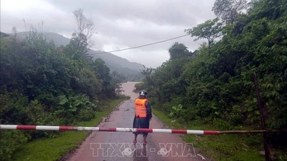
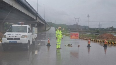
To ensure safety and prevent danger to people and vehicles entering Highway 71 during storms, local authorities have directed the installation of barriers, prohibiting people and vehicles from passing.
Urban roads Ngo Duc Ke, Nguyen Chi Dieu, Dang Dung, Le Van Huu... are flooded with the highest water level of 0.5m. Phan Anh, Hai Trieu, To Huu, Ha Huy Tap, Doan Lanh, Le Quang Dao, Nguyen Huu Tho, Hoang Van Thu... are flooded from 0.3-0.5m.
Due to the impact of consecutive natural disasters in August, September and storm No. 12, the coastline in the area continued to erode, the section through Hoa Duan residential group, Thuan An ward, was severely eroded with a length of 1.0km. The coastline eroded 50÷70m deep into the mainland, affecting essential infrastructure works, tourism services and the risk of opening a new sea gate. The coastline section through Vinh Loc commune is 2.0km long, the coastline eroded 10÷30m deep into the mainland, affecting provincial road 21, essential infrastructure works, and the risk of opening a sea gate.
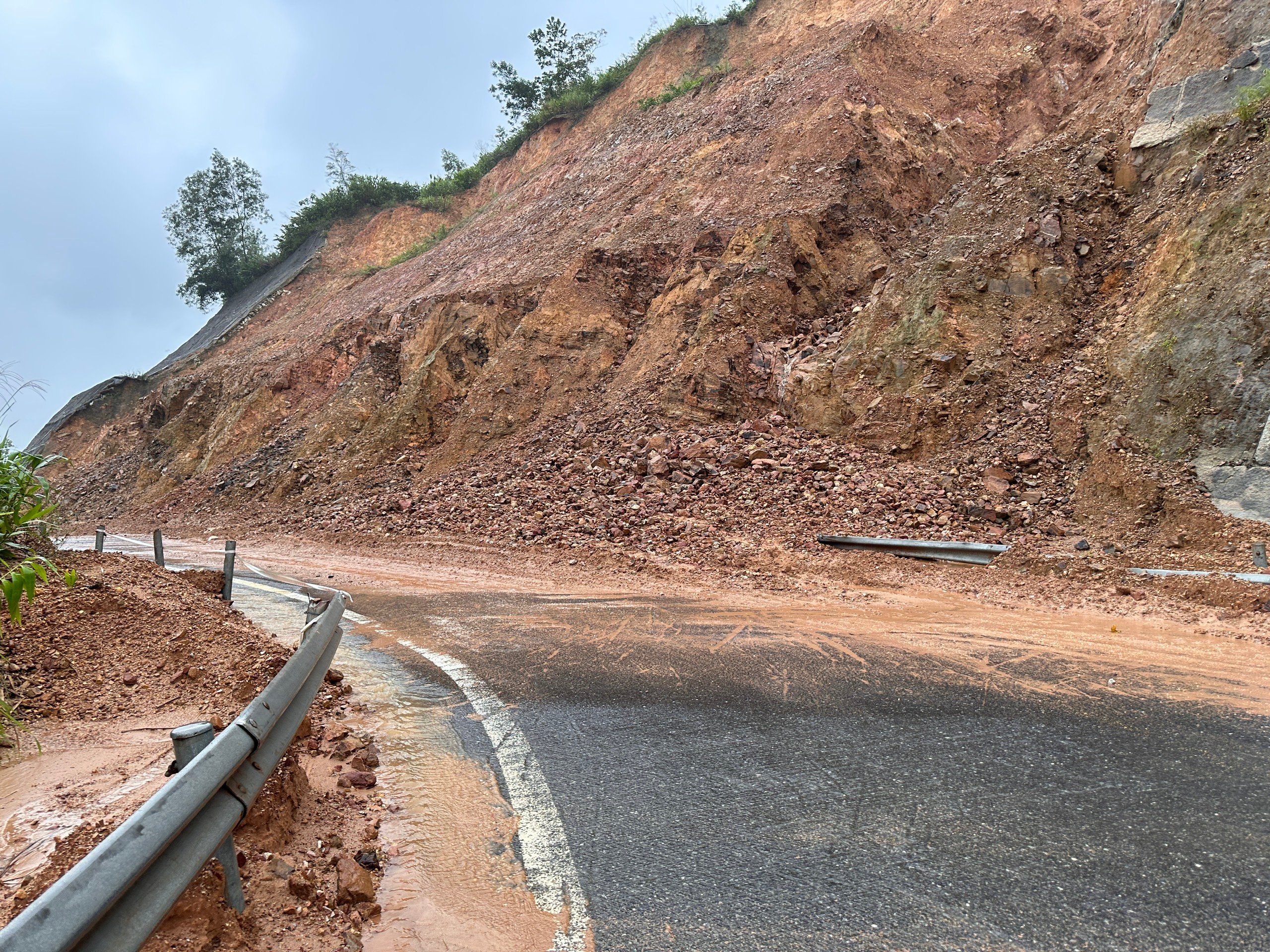 |
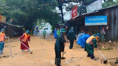
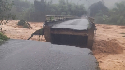
| Heavy rain causes landslides on key roads in mountainous areas |
At the asphalt road section into Tan An Hai village, Phu Loc commune (the starting point is about 450m from Tu Hien bridge), the sea waves eroded the existing roadbed from 0.5 to 2m, about 500m long. Due to heavy rains in recent days, a number of landslides have occurred in the city, specifically: Khe Tre commune, location 1: At the turn from the highway to the center of Khe Tre commune, a landslide occurred on the slope. The locality has coordinated with the Ho Chi Minh Road Project Management Board to deploy a treatment plan and at the same time, prevent vehicles from passing through this area.
Location 2, Pass No. 5, Loc Hung village, is at high risk of landslides, which could isolate about 40 households. The locality has developed a plan to ensure safety. Location 3: Central area of the commune, adjacent to the landslide between Da Phu and Ha An villages (38 households) and village 2 (27 households), there is a risk of affecting households living here.
In Kim Long ward, at Km23+800 of National Highway 49, from Cham to Tuan bridge, the negative slope has collapsed towards the bank of Huong river, with a risk of further landslides; the force has put up warning signs of narrow roads, allowing traffic in one lane, and guards are on duty to monitor.
By 6 p.m. on October 26, communes and wards had evacuated 265 households/730 people (Hoa Chau, An Cuu, Thanh Thuy, Thuy Xuan, Duong No). To prepare for flood response, localities reviewed and updated details of each storm and storm surge response plan to be ready to evacuate 10,132 households/32,697 people, focusing on coastal areas, lagoons, low-lying areas, and landslide risk areas.
Source: https://huengaynay.vn/kinh-te/nong-nghiep-nong-thon/sang-som-27-den-29-10-tai-tp-hue-co-mua-to-mua-rat-to-vung-nui-co-noi-mua-dac-biet-to-159232.html
![[Photo] The 5th Patriotic Emulation Congress of the Central Inspection Commission](https://vphoto.vietnam.vn/thumb/1200x675/vietnam/resource/IMAGE/2025/10/27/1761566862838_ndo_br_1-1858-jpg.webp)
![[Photo] Party Committees of Central Party agencies summarize the implementation of Resolution No. 18-NQ/TW and the direction of the Party Congress](https://vphoto.vietnam.vn/thumb/1200x675/vietnam/resource/IMAGE/2025/10/27/1761545645968_ndo_br_1-jpg.webp)


![[Photo] National Assembly Chairman Tran Thanh Man receives Chairman of the House of Representatives of Uzbekistan Nuriddin Ismoilov](https://vphoto.vietnam.vn/thumb/1200x675/vietnam/resource/IMAGE/2025/10/27/1761542647910_bnd-2610-jpg.webp)


Comment (0)