
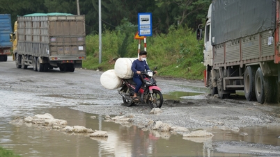
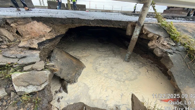
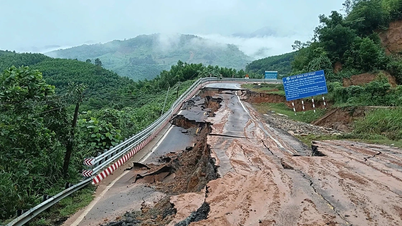
Specifically, from km 58+100 to km 59+730 on National Highway 14B (in Dai Hong commune, Dai Loc district), the road surface is damaged due to numerous potholes and muddy areas, making it difficult for vehicles to pass. From km 65+00 to km 65+500 on National Highway 14H (in Phuoc Ninh commune, Nong Son district), traffic is blocked due to flooding up to 1 meter deep.
National Highways 40B and 14E are currently under construction, making travel difficult. Notably, the Dakmi 1 bridge on National Highway 14E is severely damaged, so only passenger vehicles with fewer than 16 seats, trucks under 5 tons, and motorcycles, bicycles, and pedestrians are allowed to cross.
Regarding provincial roads, traffic congestion occurred at km36+300 – km36+700 on provincial road DT.601 (in Que Trung commune, Nong Son district) due to flooding up to 0.5m deep; and at km15+800 and km17+200 on provincial road DT.615B (in Tien Lanh commune, Tien Phuoc district) due to flooding exceeding 1m. Water accumulated on provincial road DT.613B, and numerous potholes appeared in two sections: km37+300 - km37+400 and km39+650 - km39+750 (in Tam Hoa commune, Nui Thanh district), making traffic difficult.
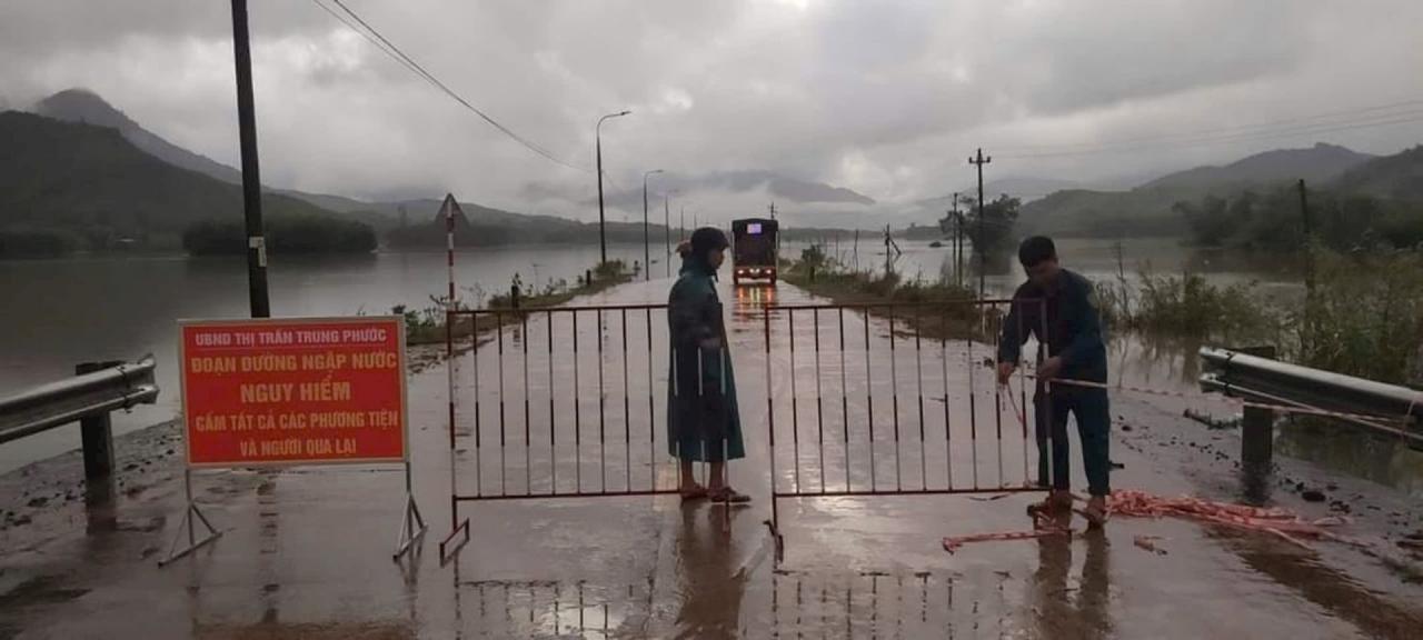
Currently, at locations with traffic congestion and damaged road surfaces that hinder traffic flow, the road management and maintenance units have placed warning signs and barriers to guide vehicles to use the roads safely.
The Hoi An – Cu Lao Cham inland waterway route is currently closed to passenger vessels.
Regarding landslide forecasts, the communes of Phuoc Hiep (Phuoc Son), Tra Leng, and Tra Don (Nam Tra My) are at very high risk of flash floods. A very high risk of landslides is predicted within the next 3 hours for the communes of Binh Lam (Hiep Duc) and Tra Don (Nam Tra My).
Source: https://baoquangnam.vn/tac-duong-kho-khan-luu-thong-mot-so-tuyen-quoc-lo-tinh-lo-3145913.html


![[Video] The craft of making Dong Ho folk paintings has been inscribed by UNESCO on the List of Crafts in Need of Urgent Safeguarding.](https://vphoto.vietnam.vn/thumb/402x226/vietnam/resource/IMAGE/2025/12/10/1765350246533_tranh-dong-ho-734-jpg.webp)


Comment (0)