
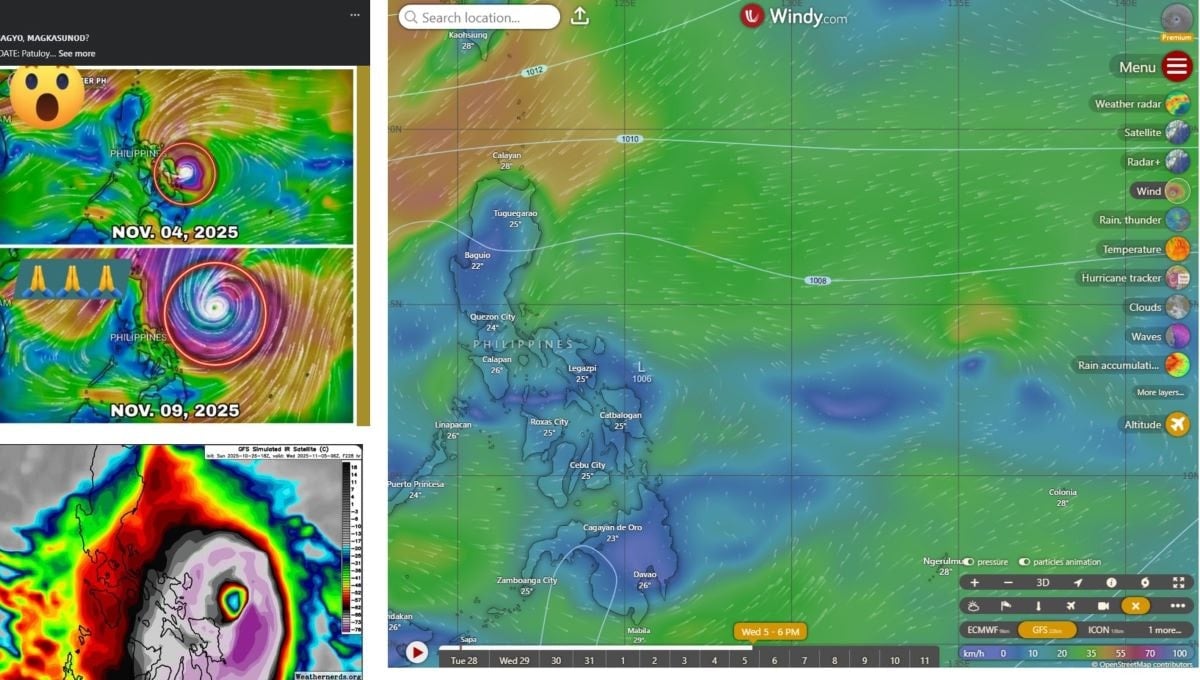
However, regional meteorological agencies confirmed that this information was unverified and the latest storm forecast models have eliminated the possibility of a super typhoon forming next week.
Several websites claiming to be “weather sites” have posted maps and simulated forecasts suggesting that a powerful super typhoon will appear in the Pacific Ocean, heading towards the central Philippines and possibly entering the South China Sea.
However, according to meteorological experts, this is a long-term forecast with high uncertainty and should not be spread as official information.
Experts warn that such posts can cause unnecessary panic and anxiety among the public. Forecasts beyond five days often have large errors, especially regarding the intensity and direction of storms.
According to the October 27 update from two global meteorological models - GFS (US) and ECMWF (Europe), scenarios that predicted the formation of super storms have been eliminated in the latest model runs.
Even Google's DeepMind artificial intelligence model, which had predicted the possibility of a strong storm, withdrew this scenario in an update on October 27.
This suggests there is no reliable signal of a super typhoon in early November, although the Northwest Pacific region still has some weather disturbances to watch.
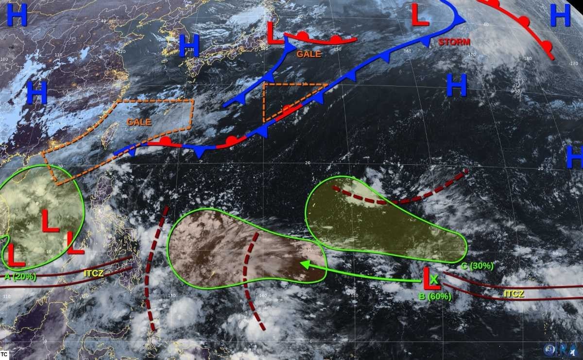
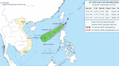
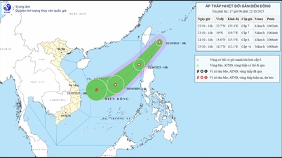
According to the storm/low pressure forecast on October 28 of the US Joint Typhoon Warning Center (JTWC), a large-scale low pressure area (A) is active in the East Sea, near the South Central coast, causing scattered rain and strong winds due to the impact of the northeast monsoon. This low pressure is unlikely to develop further and is likely to gradually dissipate when it reaches the mainland from October 30. The possibility of a cyclone forming in the next 7 days is low, 20%.
Low pressure system B, near Pohnpei, is moving westward and could strengthen as it passes south of Guam this weekend. Some models suggest it could develop into a tropical depression, but it's too early to say whether it will become a hurricane. The chance of it forming is moderate, at 60 percent.
Disturbance C (northeast of Pohnpei) is expected to form along the trough over the next few days and may develop slowly as it moves toward the Mariana Islands. The chance of formation is low, 30%.
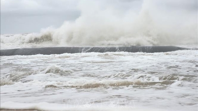
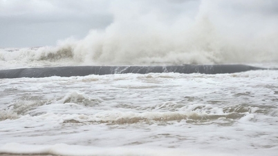
In addition to the above-mentioned disturbance areas, many sea areas are being affected by strong northeast monsoon winds. According to the Vietnam National Center for Hydro-Meteorological Forecasting, on the day and night of October 28, the sea area north of the northern East Sea (including the sea area north of Hoang Sa special zone) will have strong northeast winds of level 6-7, gusting to level 8-9; rough seas, waves 3-5m high.
The Gulf of Tonkin and the sea area from southern Quang Tri to Quang Ngai have strong northeast winds of level 5, sometimes level 6, gusting to level 7-8; rough seas, waves 1.5-3m high; the area from southern Quang Tri to Quang Ngai has waves 2.5-3.5m high, high tide.
On October 28, the flood on the Huong River (Hue City) is fluctuating at a high level; on the Vu Gia River (Da Nang City), on the Tra Khuc River (Quang Ngai) is receding. The flood on the Thu Bon River (Da Nang City) at Cau Lau station is fluctuating at its peak level, equivalent to the flood peak in 2007 (5.39m).
Source: https://hanoimoi.vn/thuc-hu-tin-sieu-bao-sap-xuat-hien-gan-bien-dong-dau-thang-11-721235.html
![[Photo] National Assembly Chairman Tran Thanh Man received a delegation of the Social Democratic Party of Germany](https://vphoto.vietnam.vn/thumb/1200x675/vietnam/resource/IMAGE/2025/10/28/1761652150406_ndo_br_cover-3345-jpg.webp)
![[Photo] Flooding on the right side of the gate, entrance to Hue Citadel](https://vphoto.vietnam.vn/thumb/1200x675/vietnam/resource/IMAGE/2025/10/28/1761660788143_ndo_br_gen-h-z7165069467254-74c71c36d0cb396744b678cec80552f0-2-jpg.webp)


![[Photo] Draft documents of the 14th Party Congress reach people at the Commune Cultural Post Offices](https://vphoto.vietnam.vn/thumb/1200x675/vietnam/resource/IMAGE/2025/10/28/1761642182616_du-thao-tai-tinh-hung-yen-4070-5235-jpg.webp)


![[Photo] President Luong Cuong attends the 80th Anniversary of the Traditional Day of the Armed Forces of Military Region 3](https://vphoto.vietnam.vn/thumb/1200x675/vietnam/resource/IMAGE/2025/10/28/1761635584312_ndo_br_1-jpg.webp)


Comment (0)