
According to the National Center for Hydro-Meteorological Forecasting, there is currently a tropical depression in the sea east of Taiwan (China). At the same time, Typhoon No. 12 has weakened.
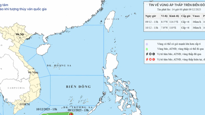
Specifically, at 4 PM, the center of the tropical depression was located at approximately 22.7 degrees North latitude and 123.3 degrees East longitude. The strongest winds near the center of the tropical depression were at level 7 (50-61 km/h), with gusts up to level 9. It was moving southwest at a speed of 20-25 km/h.
Forecasts indicate that by 4 PM on October 23rd, a tropical depression will be located in the eastern part of the North East Sea, with wind speeds of 6-7 Beaufort, gusting to 9 Beaufort, moving in a South-Southwest direction at a speed of 20-25 km/h. The affected area is the eastern part of the North East Sea. The level of natural disaster risk is level 3.
At 4 PM on October 24th, a tropical depression was located approximately 350km east of the Hoang Sa Special Economic Zone, with wind speeds of level 6, gusting to level 8. Its intensity gradually weakened, and it moved southwest at a speed of about 20-25 km/hour. The affected area is the southern part of the North East Sea. The level of natural disaster risk is level 3.
Over the next 48 to 72 hours, the tropical depression will move mainly in a west-southwest direction, traveling 15-20 km per hour and gradually weakening into a low-pressure area.
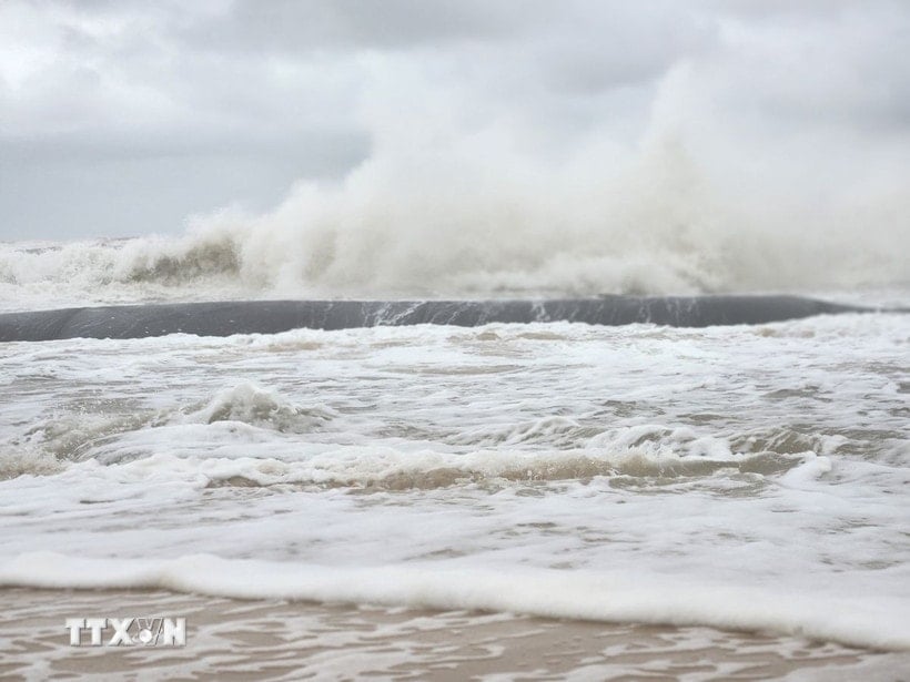
Forecasts indicate that due to the influence of a tropical depression combined with a strengthening cold front, the eastern part of the North East Sea will experience strong winds of force 6-7, gusting to force 9, with waves 3-5 meters high and rough seas.
Vessels operating in the above mentioned dangerous areas are susceptible to the impact of storms, whirlwinds, strong winds and large waves.
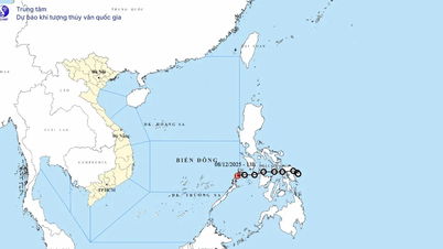
Regarding Typhoon No. 12, at 4 PM, the typhoon's center was located at approximately 17.1 degrees North latitude and 109.8 degrees East longitude, over the sea area from southern Quang Tri to Quang Ngai, about 200km east-northeast of Da Nang city. The strongest winds near the center of the typhoon were at level 9 (75-88 km/h), with gusts up to level 11. It was moving westward at a speed of about 10 km/h.
Forecasts indicate that by 4:00 AM on October 23rd, the storm will be approximately 100 km east-northeast of Da Nang city, with wind speeds of level 8, gusts of level 10, moving west-southwest at a speed of about 10 km/hour and gradually weakening.
The affected area includes the western sea region of the North East Sea (including the Hoang Sa Special Economic Zone), the sea region from Quang Tri to Quang Ngai (including the special economic zones of Con Co, Ly Son and Cu Lao Cham islands), and the coastal mainland of provinces and cities from Quang Tri to Da Nang.
The level of natural disaster risk is level 3. Subsequently, at 4 PM on October 23rd, the storm in the western area of Da Nang city, with wind speeds below level 6, moved in a west-southwest direction at a speed of approximately 15 km/h and gradually weakened into a low-pressure area.
The affected area includes the sea region from Quang Tri to Quang Ngai (including the special island zones of Con Co, Ly Son, and Cu Lao Cham); and the coastal mainland of provinces and cities from Quang Tri to Da Nang.
Due to the influence of the storm, the western sea area of the North East Sea (including the Hoang Sa special zone) will experience strong winds of force 7-8; near the storm's center, winds will be force 9, gusting to force 11; sea waves will be 4-6m high, and the sea will be very rough.
The sea area from Quang Tri to Quang Ngai (including Con Co Special Zone, Cu Lao Cham Island and Ly Son Special Zone) will experience strong winds of force 6-7, with winds reaching force 8-9 near the storm's center, gusting to force 11, and waves 3-5 meters high, resulting in very rough seas.
Coastal areas from Quang Tri to Da Nang city have storm surges ranging from 0.4-0.8m high.
Warning: Coastal areas and river mouths from Quang Tri to Da Nang city need to be wary of large waves combined with high tides and storm surges causing flooding in low-lying areas, waves overflowing coastal and river roads, and coastal erosion.
All ships, boats, and aquaculture farms in the aforementioned hazardous areas are susceptible to the effects of thunderstorms, tornadoes, strong winds, high waves, and storm surges. Be prepared for the risk of thunderstorms and tornadoes accompanied by strong gusts of wind in the areas affected by the storm's circulation, both before and during landfall.
PVSource: https://baohaiphong.vn/lai-xuat-hien-ap-thap-nhiet-doi-gan-bien-dong-524290.html


![[Photo] Explore the US Navy's USS Robert Smalls warship](/_next/image?url=https%3A%2F%2Fvphoto.vietnam.vn%2Fthumb%2F1200x675%2Fvietnam%2Fresource%2FIMAGE%2F2025%2F12%2F10%2F1765341533272_11212121-8303-jpg.webp&w=3840&q=75)


Comment (0)