
Over the next 24 hours, Typhoon No. 6 (Tra Mi) is likely to reach its maximum intensity of level 12, with gusts up to level 15. In the Hoang Sa archipelago area, the typhoon is being affected by cold air and a new typhoon, resulting in a very "unusual" trajectory.
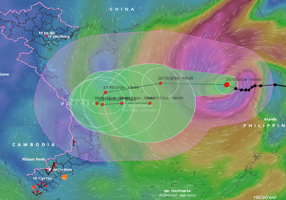
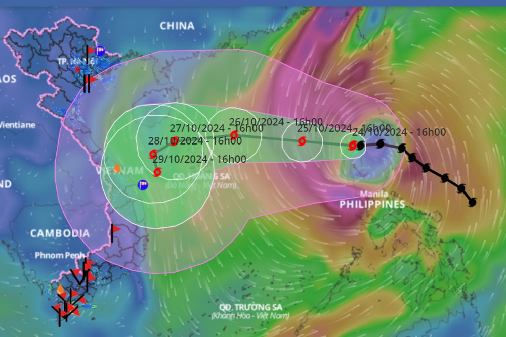
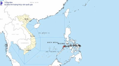
According to the National Center for Hydro-Meteorological Forecasting, as of 10:00 AM today (October 25th), the storm's center was located in the eastern part of the North East Sea. The strongest winds near the storm's center reached level 10 (89-102 km/h), with gusts up to level 12. It is moving in a west-northwest direction at a speed of approximately 15 km/h.
Forecasts indicate that by 10:00 AM on October 26th, the storm's center will be located in the northern South China Sea, approximately 160km northeast of the Hoang Sa (Paracel) Islands. Maximum wind speeds near the storm's center will reach levels 11-12, with gusts up to level 15. The storm is moving westward at a speed of 20km/h.
As of 10:00 AM on October 27th, the storm's center was located west of the Hoang Sa archipelago, approximately 200km northeast of Quang Tri and Quang Ngai provinces . The strongest winds near the storm's center reached level 11, with gusts up to level 14. The storm was moving west-southwest at a speed of 15km/hour.
As of 10:00 AM on October 28th, the storm's center was located in the sea off the coast of Central Vietnam. The strongest winds near the storm's center reached level 10, with gusts up to level 12. The storm was moving southwest, then southeast, at a speed of approximately 5-10 km/hour.
Over the next 72 to 120 hours, the storm will move mainly eastward at a speed of 5-10 km per hour, and its intensity will continue to weaken.
Earlier that day, at a meeting to respond to Typhoon No. 6 (Tra Mi) organized by the Department of Dyke Management and Disaster Prevention ( Ministry of Agriculture and Rural Development ), Mr. Nguyen Van Huong, Head of the Weather Forecasting Department, National Center for Meteorological and Hydrological Forecasting, also explained the very complex trajectory of the typhoon.
Accordingly, over the next 24 hours, Typhoon Tra Mi will move westward and is likely to reach a maximum intensity of level 12, with gusts up to level 15. Upon reaching the area north of the Hoang Sa archipelago, the typhoon is expected to weaken due to the influence of cold air, potentially reducing its intensity to level 10-11.
Mr. Huong stated that after passing through the Hoang Sa archipelago (crossing the 110-degree East meridian), the storm is likely to change direction towards the sea because there is a tropical depression east of the Philippines, which has the potential to strengthen into a typhoon.
The interaction of the two storms caused Typhoon No. 6 to shift outwards and weaken. However, the strong wind circulation of the storm is relatively wide, and the convective cloud area is also shifted to the west, therefore the northern and central areas of the South China Sea will be mainly affected by strong winds.
With the storm's trajectory as described above, strong winds of force 6-7 are possible in the central coastal waters around tomorrow afternoon (October 26th). As the storm approaches, winds will increase to force 8-9, and the Ly Son island area will also experience similar strong winds.
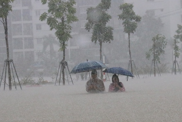
Notably, with cloud circulation shifting westward, it is likely that from tomorrow evening and night until October 29th, Typhoon No. 6 will cause heavy rain in Central Vietnam (from Ha Tinh to Binh Dinh and Phu Yen), with the heaviest rainfall concentrated in Quang Tri to Quang Nam , Kon Tum, and Gia Lai; rainfall in this area could reach 200-300mm, and the possibility of even heavier rainfall in some areas cannot be ruled out.
Furthermore, due to the influence of typhoon No. 6, the northern area of the East Sea experienced strong winds of force 8-9, reaching force 10-12 (89-133 km/h) near the center of the typhoon, with gusts up to force 15; sea waves were 5-7 meters high, and 7-9 meters near the center of the typhoon; the sea was extremely rough.
Vessels operating in the aforementioned hazardous areas (especially in the Hoang Sa archipelago) are susceptible to the effects of thunderstorms, tornadoes, strong winds, and large waves.
According to experts, Typhoon Tra Mi is considered to have a complex trajectory, changing direction four times before entering the East Sea. Therefore, people need to regularly update themselves on weather forecasts to monitor its progress.
Typhoon No. 6 is likely to approach the central coast, with heavy rainfall concentrated in 5 provinces.
Typhoon No. 6 is likely to encounter its nemesis, a cold front, and its trajectory is unusual.

Hanoi weather forecast for the next 3 days: Cold air persists, with significant temperature differences between day and night.
Source: https://vietnamnet.vn/vi-sao-bao-so-6-co-huong-di-ki-di-2335387.html


Comment (0)