
Need full awareness, thorough investment, effective exploitation
According to Deputy Prime Minister Tran Hong Ha, remote sensing has now become an important means and tool for space research, especially Earth research, with applications in almost all fields. Therefore, when building the Law on Surveying and Mapping, Vietnam for the first time established a legal basis for this activity.

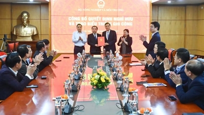
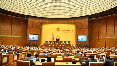
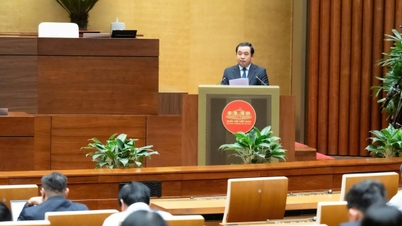
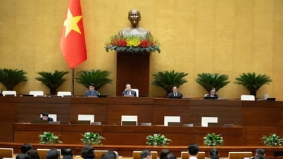
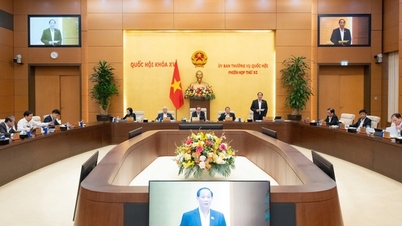
Deputy Prime Minister Tran Hong Ha chaired a meeting to give opinions on the draft Decree replacing Decree No. 03/2019/ND-CP on remote sensing activities. Photo: VNA.
Therefore, remote sensing activities in Vietnam need to be fully recognized and invested in, not only in machinery and equipment but also in people and research institutes, to create secondary products serving the socio-economy and national defense and security.
The Deputy Prime Minister requested the Ministry of Agriculture and Environment (drafting agency) to clarify two major contents.
Firstly, the consistency of the Decree with the Law on Surveying and Mapping, the Party and State's policy in determining the goals, requirements and tasks of remote sensing activities is to ensure support for all sectors and fields and meet the requirements of socio-economic development and national security and defense.
Second is to identify remote sensing activities that can be "developed jointly and exploited jointly", especially those related to national defense; at the same time, clearly identify which tasks require investment in specialized national defense remote sensing.
“To effectively manage remote sensing activities, secondary products must be shared to serve economic and social sectors, from which investment efficiency can be calculated,” Deputy Prime Minister Tran Hong Ha said.
Proposal for grouping remote sensing data management mechanisms
According to the report of the Ministry of Agriculture and Environment, Decree No. 03/2019/ND-CP has initially created a legal corridor to manage and promote the development of remote sensing technology, exploit and use space to serve the monitoring, supervision, management of agriculture, environment, socio-economic development and ensure national defense and security.
However, in practice, the management of remote sensing activities still reveals some major limitations. Some concepts of remote sensing such as remote sensing data and remote sensing products are no longer suitable for practice and are not really consistent with the definitions of remote sensing in international documents.
Remote sensing databases lack connectivity due to the lack of mandatory regulations for data connectivity and sharing.

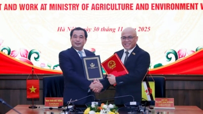
The new decree on remote sensing activities also stipulates many organizations and individuals participating in remote sensing activities. Photo: VNA.
In addition, we need to supplement specific regulations on the application of remote sensing in practice, at the same time orient, encourage and promote the application of remote sensing technology in agricultural monitoring, resource and environmental management and serving socio-economic development, ensuring national defense and security; make the most of data and technology potential; supplement regulations on priority scientific and technological activities in the field of remote sensing.
The new Decree on remote sensing activities also stipulates for many organizations and individuals participating in remote sensing activities including: Building infrastructure for collecting remote sensing data, providing remote sensing data, and applying remote sensing.
At the meeting, opinions assessed that amending and replacing Decree No. 03/2019/ND-CP is necessary to keep up with the rapid development of remote sensing technology and expand the application space of remote sensing data more widely in state management, socio-economics and national security and defense.
Delegates focused on discussing four major groups of issues: Scope of regulation and concept of remote sensing; consistency with current laws; data management and sharing; application orientation - international cooperation - satellite development.
Many delegates said that the concept of “remote sensing” is not only satellite images but also includes data collected from many means, such as aircraft, UAVs, and ground equipment. Therefore, if the Decree regulates remote sensing activities, the content must cover all of these activities. If it only regulates remote sensing activities from collecting satellite image data, the name needs to be reconsidered accordingly.
The Ministry of Agriculture and Environment needs to review to ensure consistency between the draft Decree and the Law on Surveying and Mapping as well as the Decree on digital data management, which stipulates that remote sensing data is “shared data”. Therefore, the revised Decree must ensure consistency in management models, connection and sharing mechanisms, avoid creating additional layers of procedures, avoid spreading and duplication of investment, and overcome the situation where each unit keeps its own data and has little connection.
Representatives of several ministries and sectors proposed expanding the legal corridor for remote sensing activities in line with new trends in international cooperation in cross-border data exploitation, creating conditions for domestic satellite research and development and moving towards the ability to self-launch satellites in the future.
The leader of the Military Industry - Telecommunications Group (Viettel) said that with the strong development of technology and the increasingly cheap cost of collecting remote sensing data. Therefore, the remote sensing data management mechanism needs to be grouped, including: Data group invested by the State, especially satellite data serving national defense, security and disaster prevention strategies; data group collected by private enterprises, which can be deployed by UAVs, aircraft or vehicles with sensors. The Ministry of Agriculture and Environment continues to preside over state management of surveying, mapping and remote sensing, including satellite data and other acquisition methods.
Agreeing with this opinion, Vietnam Posts and Telecommunications Group (VNPT) emphasized the need to add regulations on ensuring information security for remote sensing data - an "extremely important" factor, especially for high-level, sensitive data; adding areas of remote sensing data application such as monitoring land use status, land changes, serving national digital transformation and spatial data infrastructure.
Covers the process from collecting, exploiting, using to managing remote sensing data
Concluding the meeting, Deputy Prime Minister Tran Hong Ha emphasized that up to now, Vietnam still does not have a complete legal framework for the field of remote sensing activities and remote sensing data, "even the concept and perception of remote sensing are not as comprehensive and systematic as international standards".

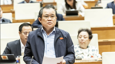
Deputy Prime Minister Tran Hong Ha requested the Ministry of Agriculture and Environment to absorb the opinions at the meeting and continue to review and complete the draft Decree on remote sensing activities in two directions. Photo: VGP.
The content of the draft Decree currently only manages surveying and mapping activities using remote sensing images from satellites, while current technology has expanded the collection of remote sensing data using many types of sensors from radar waves, electronic signals, gravity variation signals... to unmanned aerial vehicles (UAVs), airplanes, cars with cameras...
From that reality, the Deputy Prime Minister requested the Ministry of Agriculture and Environment to absorb the opinions at the meeting, continue to review and complete the draft Decree on remote sensing activities in two directions.
The first is to only regulate remote sensing activities using satellite image data collected from satellites, according to Articles 14 and 16 of the Law on Surveying and Mapping, but “the scope of such regulation will be very narrow”.
The second is to develop a new decree regulating remote sensing activities with a wide scope, not yet regulated in the Law on Surveying and Mapping, but covering the entire process from collecting, exploiting, using to managing remote sensing data and infrastructure, including receiving stations, satellite stations, means of receiving from aircraft, UAVs to ground equipment.
Deputy Prime Minister Tran Hong Ha suggested that the Ministry of Agriculture and Environment preside over the drafting of the decree, with the participation of the Ministry of Science and Technology, the Ministry of National Defense, the Ministry of Public Security, the Ministry of Justice, the Ministry of Finance, the Vietnam Academy of Science and Technology, and enterprises such as VNPT, Viettel and related units. This will be a preparatory step for the future development of a law on remote sensing activities, which may include regulations on security, safety, confidentiality and prohibited acts.
Source: https://nongnghiepmoitruong.vn/bat-kip-cong-nghe-mo-rong-khong-gian-ung-dung-du-lieu-vien-tham-d787874.html
![[Photo] Cat Ba - Green island paradise](/_next/image?url=https%3A%2F%2Fvphoto.vietnam.vn%2Fthumb%2F1200x675%2Fvietnam%2Fresource%2FIMAGE%2F2025%2F12%2F04%2F1764821844074_ndo_br_1-dcbthienduongxanh638-jpg.webp&w=3840&q=75)


![[VIMC 40 days of lightning speed] Hai Phong Port determined to break through, reaching the target of 2 million TEUs by 2025](https://vphoto.vietnam.vn/thumb/402x226/vietnam/resource/IMAGE/2025/12/04/1764816441820_chp_4-12-25.jpeg)


Comment (0)