
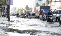
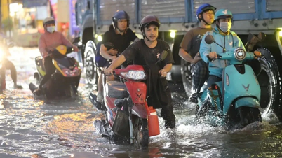
TPO - The Standing Office of the Steering Committee for Disaster Prevention and Search and Rescue in Binh Duong province announced the situation of high tides in the lower reaches of the Saigon River. Meanwhile, in Binh Phuoc, prolonged heavy rain caused severe flooding in one commune.
On September 17th, the Binh Duong Provincial Meteorological and Hydrological Station warned that from September 19th to 21st, the water level in the lower Saigon River will reach its peak high tide level. The highest daily high tide levels will occur in the morning from 6:30 AM to 8:30 AM and in the evening from 5:00 PM to 7:30 PM, potentially reaching 1.62m to 1.67m, exceeding Warning Level III at the Thu Dau Mot station (Ba Lua port). The risk level for natural disasters due to high tides in Thu Dau Mot City and Thuan An City is at level 1.
The Binh Duong Provincial Meteorological and Hydrological Station advises residents to be prepared for peak high tides combined with heavy rain, which could cause overflowing banks and flooding low-lying areas along the Saigon River.
Specifically, in Thu Dau Mot City: Doan Tran Nghiep Street, Ong Danh Canal (Phu Cuong Ward); Nguyen Tri Phuong Street, Bau Bang Canal (Chanh Nghia Ward; area outside Tan An dike).
Thuan An City: Areas outside the An Son - Lai Thieu dike (Vinh Phu ward, Binh Nham ward); canals: Mieu, Sau Em, Cau Nho, Ba Tam, Muong Do, Bung canal branch (An Thanh ward); subsided and low-lying embankments and canal banks in Vinh Phu ward.
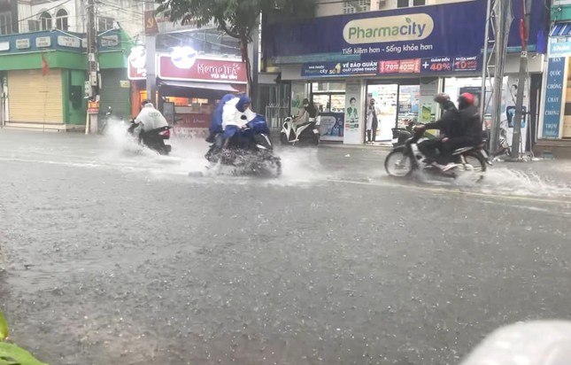 |
It has been raining in Binh Duong for the past few days. |
To proactively prevent flooding caused by high tides, the Standing Office of the Steering Committee for Disaster Prevention and Search and Rescue of Binh Duong province requests the Steering Committees for Disaster Prevention and Search and Rescue of Ben Cat, Thuan An, and Thu Dau Mot cities, and the Center for Investment and Exploitation of Irrigation and Rural Clean Water to widely disseminate information to people in low-lying areas along the Saigon River so that they can proactively implement preventive measures to mitigate damage.
Simultaneously, strengthen inspections and reviews of dikes, embankments, and canal banks, especially vulnerable sections that have been breached or overflowed. Immediately reinforce and expand sections of dikes, embankments, and canal banks that are likely to break or overflow; operate sluice gates and tidal gates according to procedures to prevent flooding that could affect people's lives and production. Organize 24/7 duty shifts to monitor high tides and heavy rains; prepare forces, materials, and equipment to proactively respond and promptly address any incidents that may occur.
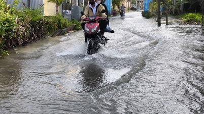
Later that same day, Mr. Ly Trong Nhan, Secretary of the Bu Gia Map District Party Committee ( Binh Phuoc province ), said that the district's disaster prevention and search and rescue command had directly inspected the flooded areas caused by heavy rain.
Prolonged heavy rain causes flooding in Binh Phuoc.
According to reports, heavy rain lasting from the night of September 16th to the early morning of September 17th caused flooding in several areas of Dak O commune (Bu Gia Map district). Three areas were flooded, with strong currents and water levels reaching approximately 1 meter: Dak O bridge on National Highway 14C, the bridge in Hamlet 4 (the road from Bu Xia hamlet to the intersection in Hamlet 4), and the area around the green bridge (on National Highway 14C).
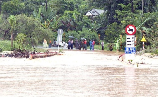 |
The road leading to Dak O commune (Bu Gia Map district, Binh Phuoc province) is flooded. |
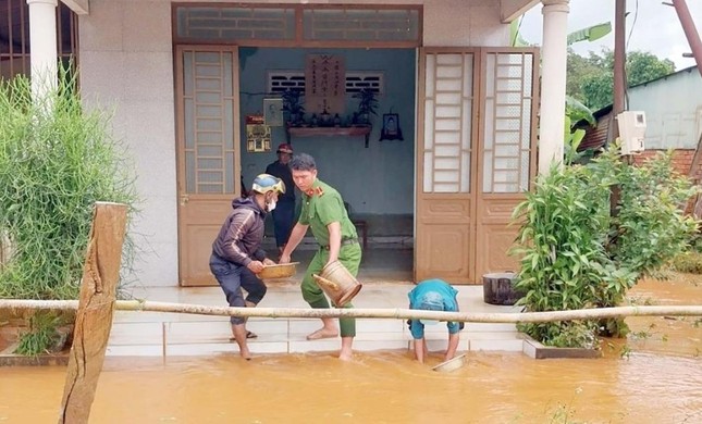 |
After the floodwaters receded, authorities assisted residents in cleaning up and recovering. |
Initial statistics show that approximately 7 households in the flooded area have been safely evacuated by local authorities, and some crops in the flooded area have been damaged. At the same time, a section of road from Dak Con village to Bu Ren village in Bu Gia Map commune has been affected by landslides. Currently, local forces are coordinating support, placing warning signs to guide people to safe routes, and clearing the area as the water recedes.

Source: https://tienphong.vn/canh-bao-trieu-cuong-vung-ha-luu-song-sai-gon-dat-dinh-binh-phuoc-mot-xa-bi-ngap-sau-post1673936.tpo


![[Photo] Prime Minister Pham Minh Chinh holds a phone call with the CEO of Russia's Rosatom Corporation.](/_next/image?url=https%3A%2F%2Fvphoto.vietnam.vn%2Fthumb%2F1200x675%2Fvietnam%2Fresource%2FIMAGE%2F2025%2F12%2F11%2F1765464552365_dsc-5295-jpg.webp&w=3840&q=75)


![[Photo] Closing Ceremony of the 10th Session of the 15th National Assembly](/_next/image?url=https%3A%2F%2Fvphoto.vietnam.vn%2Fthumb%2F1200x675%2Fvietnam%2Fresource%2FIMAGE%2F2025%2F12%2F11%2F1765448959967_image-1437-jpg.webp&w=3840&q=75)


![[OFFICIAL] MISA GROUP ANNOUNCES ITS PIONEERING BRAND POSITIONING IN BUILDING AGENTIC AI FOR BUSINESSES, HOUSEHOLDS, AND THE GOVERNMENT](https://vphoto.vietnam.vn/thumb/402x226/vietnam/resource/IMAGE/2025/12/11/1765444754256_agentic-ai_postfb-scaled.png)


![[Photo gallery] Long Thanh Airport 'lights up' ready to welcome its first flight](https://vphoto.vietnam.vn/thumb/402x226/vietnam/resource/IMAGE/2025/12/11/1765467251707_bia_20251211222704.jpeg)


Comment (0)