
(DN) - On the morning of November 3, Dong Nai Hydrometeorological Station said: From 7:00 a.m. on November 3 to 7:00 a.m. on November 5, Dong Nai province will have moderate rain, heavy rain and thunderstorms with common rainfall of 60-110mm, in some places over 110mm (heavy rain concentrated in the afternoon and night).
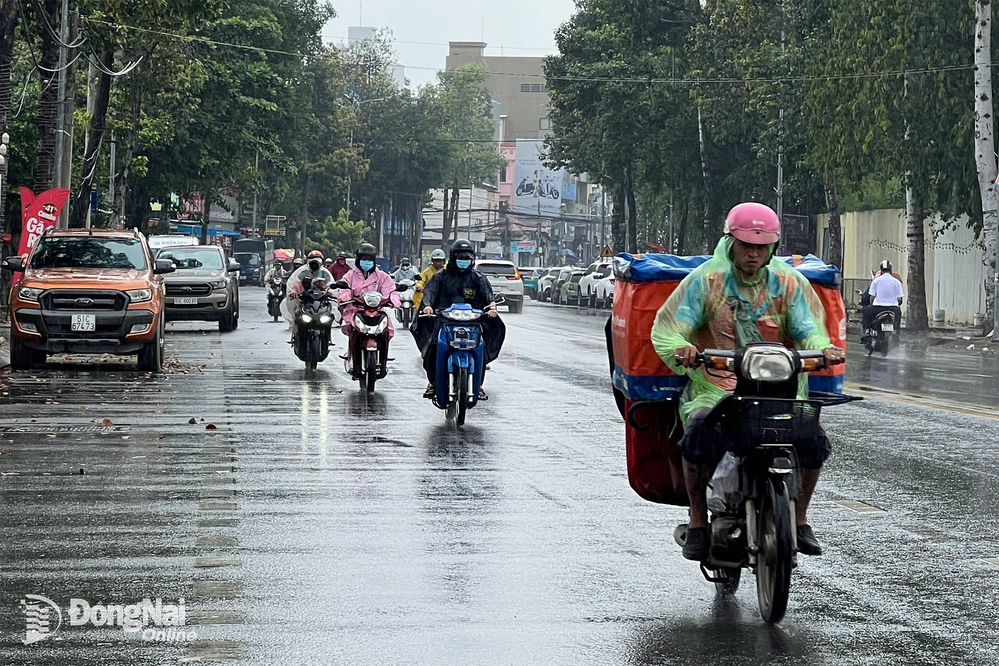 |
| People move on Vo Thi Sau Street (Tran Bien Ward) in the rain at noon on November 3. Photo: Kim Lieu |
Heavy rain is likely to continue in Dong Nai province in the next 48-72 hours. It is necessary to guard against the risk of flash floods and landslides in mountainous areas and flooding in low-lying areas. Beware of heavy rain in a short period of time causing flooding in urban areas, riverside areas, and canals. During thunderstorms, there is a possibility of tornadoes, lightning, hail and strong gusts of wind.
Director of Dong Nai Hydrometeorological Station Nguyen Phuoc Huy said: Currently, the water level on rivers and streams in the Dong Nai river system is quite high, with the risk of flooding low-lying areas along rivers and streams, adversely affecting water transport activities, aquaculture, and agricultural production in rivers, streams, river banks, and stream banks.
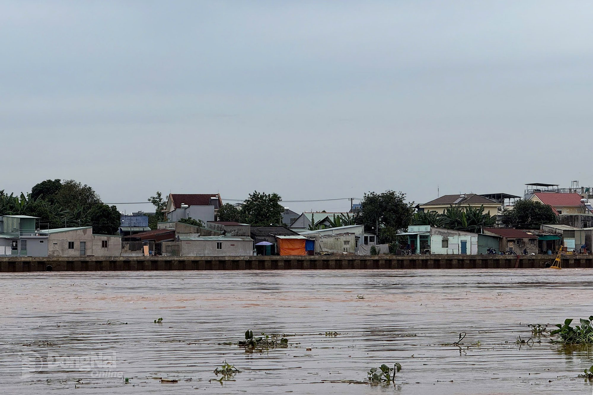 |
| The water level of Dong Nai River is rising. Illustration photo: Dang Tung |
At Ta Lai station, the water level is rising rapidly, exceeding alarm level 1 (112.00m). At Phu Hiep station (La Nga river), the water level is changing slowly, above alarm level 1 (104.50m). At Bien Hoa station (downstream of Dong Nai river), the peak high tide water level is rising, at alarm level 1 (1.80m).
It is necessary to guard against the possibility of heavy rain combined with floods causing inundation and landslides on river banks, streams, and low-lying areas in the following wards and communes: Dak Lua, Nam Cat Tien, Ta Lai, Thanh Son, Phu Vinh, Phu Lam, Tan Phu, Phu Hoa, Dinh Quan, Tri An, Tan An, Trang Dai, Tan Trieu, Bien Hoa, Tran Bien, Long Hung, Phuoc Tan, Tam Phuoc, An Phuoc, Nhon Trach, Dai Phuoc, Phuoc An and neighboring areas.
Kim Lieu
Source: https://baodongnai.com.vn/xa-hoi/202511/dong-nai-kha-nang-tu-48-72-gio-toi-mua-lon-tiep-tuc-dien-ra-e7309d4/


![[Photo] Opening of the 14th Conference of the 13th Party Central Committee](https://vphoto.vietnam.vn/thumb/1200x675/vietnam/resource/IMAGE/2025/11/05/1762310995216_a5-bnd-5742-5255-jpg.webp)
![[Photo] Panorama of the Patriotic Emulation Congress of Nhan Dan Newspaper for the period 2025-2030](https://vphoto.vietnam.vn/thumb/1200x675/vietnam/resource/IMAGE/2025/11/04/1762252775462_ndo_br_dhthiduayeuncbaond-6125-jpg.webp)


Comment (0)