
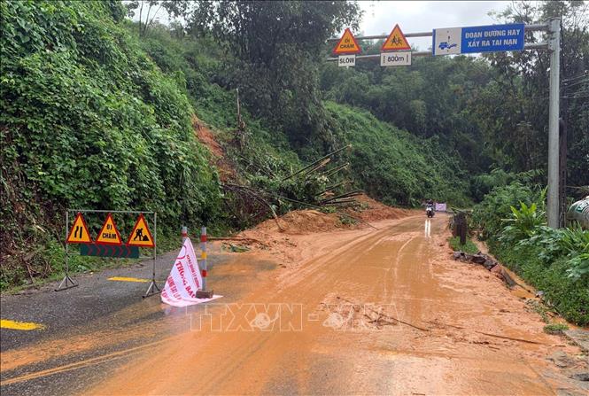
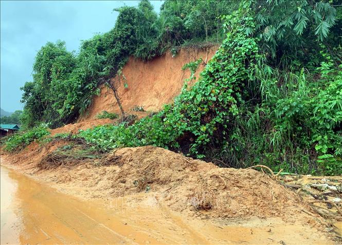
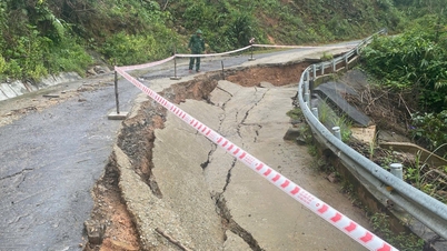
Specifically, the National Highway has 3 landslide points including: on National Highway 9C at Km29+100, Km38+400 (Kim Ngan commune) landslide on positive slope with length of 60m, volume of about 2,500 m3; on National Highway 9B at Km 77+700 (Kim Ngan commune) landslide on positive slope with volume of about 3,500 m3 and National Highway 9 at Km48+120-140 landslide on positive slope with volume of about 200 m3.
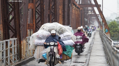
On provincial roads 587 and 571, there are 7 landslides, the road surface is eroded, making it difficult for traffic to travel, posing a potential risk to traffic safety. In addition, many inter-village and inter-commune roads in Nam Hai Lang, Dakrong, Le Thuy, Kim Ngan, and Huong Hiep communes also have landslides on the positive slopes.
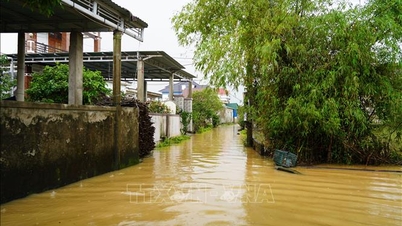
In addition, heavy rain also caused flooding at 44 points; including 8 points on national highways (national highway 15D, national highway 9C, national highway 9B), 12 points on provincial roads (provincial road 565C, provincial road 564...) and over 27 points on inter-commune and village roads in the communes of Nam Hai Lang, My Thuy, Dien Sanh, Dakrong, Ba Long, and Vinh Dinh.
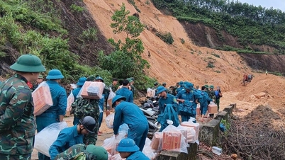
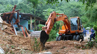
On landslide-prone roads, dangerous areas, and areas that are cut off by floods, local authorities and units have proactively deployed guards and set up barriers and warning signs to ensure the safety of people and vehicles. At the same time, there are plans to evacuate households in areas at risk of landslides to safe places.
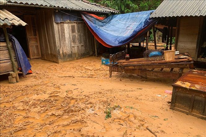
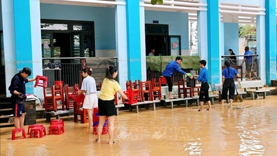
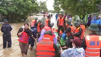
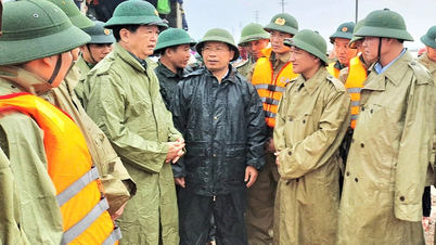
In Quang Tri province, heavy rains have left two people missing due to floodwaters; more than 534 households/1,578 people were flooded; more than 5,000 students/27 schools had to temporarily close to ensure safety in the communes of Nam Hai Lang, Hai Lang, My Thuy, Dien Sanh, Dakrong, Vinh Dinh. The whole province has evacuated and relocated 137 households/385 people and 14 officers and soldiers of the La Lay International Border Gate Border Guard Station.
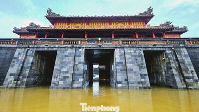
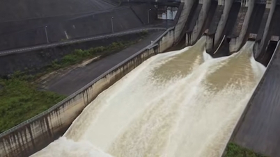
According to forecasts, in the next 6-12 hours, the flood on Kien Giang River at Le Thuy is likely to rise to 2.90m, 0.2m above alert level 3, and Thach Han River at Thach Han is likely to rise to 5.8m, 0.2m below alert level 3. The deep and widespread flooding in the downstream areas of Kien Giang River, Thach Han River, and O Lau River will continue for the next few days. There is a very high risk of flash floods and landslides on steep slopes in mountainous communes; landslides on river banks and road embankments.
Quang Tri province directed localities to continuously update the situation of natural disasters, heavy rains, and warnings on mass media, websites, and social networks to the community to have proactive response plans. At the same time, be ready to deploy plans to evacuate people from dangerous areas when situations arise.
Source: https://baotintuc.vn/xa-hoi/nhieu-tuyen-duong-o-quang-tri-sat-lo-ngap-sau-sau-mua-lon-keo-dai-20251030105136554.htm
![[Photo] Prime Minister Pham Minh Chinh attends the 5th National Press Awards Ceremony on preventing and combating corruption, waste and negativity](https://vphoto.vietnam.vn/thumb/1200x675/vietnam/resource/IMAGE/2025/10/31/1761881588160_dsc-8359-jpg.webp)


![[Photo] Da Nang: Water gradually recedes, local authorities take advantage of the cleanup](https://vphoto.vietnam.vn/thumb/1200x675/vietnam/resource/IMAGE/2025/10/31/1761897188943_ndo_tr_2-jpg.webp)


Comment (0)