
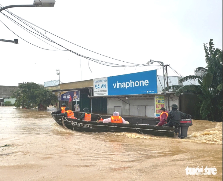
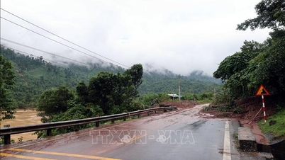
Flood in Dai Loc commune, Da Nang this afternoon, October 29 - Photo: LE TRUNG
On the afternoon of October 29, the Central Hydrometeorological Station said that data measured on the Thu Bon River showed that the water level of the Thu Bon River in many places was equal to or higher than the historical flood peak of the Year of the Dragon 1964.
The Central Hydrometeorological Station has issued an urgent flood warning, especially large ones on the Vu Gia - Thu Bon River. As of 3:30 p.m. today, the water level on the Vu Gia - Thu Bon River and the Tam Ky River is rising rapidly again.
Water levels at 1:00 p.m. on October 29 on rivers were measured as follows: Vu Gia River at Ai Nghia at: 10.01m, 1.01m above alarm level III.
Thu Bon River at Nong Son is at: 17.84m, 2.84m above alarm level III; at Giao Thuy is at: 9.38m, 0.58m above alarm level III; at Cau Lau is at: 5.17m, 1.17m above alarm level III; at Hoi An is at: 2.99m, 0.99m above alarm level III.
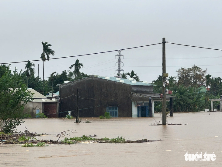
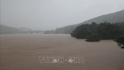
Flooding on Vu Gia River this afternoon, October 29 - Photo: LE TRUNG
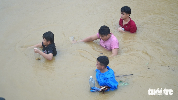
Flooding in residential areas near Cau Lau bridge due to rising Thu Bon river water - Photo: TRUONG TRUNG
The water level of the Han River at Cam Le is at 2.73m, 0.23m above alarm level III. The water level of the Tam Ky River at Tam Ky is at 2.44m, 0.24m above alarm level II.
Notably, according to this agency's forecast, in the next 6-18 hours, floods on the Vu Gia - Thu Bon River will continue to rise and peak, in some places exceeding historical flood peaks.
Specifically, the flood peak forecast on Vu Gia River at Ai Nghia is likely to reach 10.6-10.80m, 1.60-1.80m above alert level III - at approximately the historical flood level (in 2009 it was 10.77m); Thu Bon River at Cau Lau will reach 5.45-5.5m, 1.45-1.5m above alert level III - at approximately the historical flood level (in 1964 it was 5.48m).
Forecast in Hoi An reaches 3.5m, 1.5m above alarm level III - 0.1m higher than historical flood (in 1964 it was 3.40m).
Han River reaches 3.6-3.7m, 1.1-1.2m above alarm level III; on Tam Ky River fluctuates at alarm level II-III.
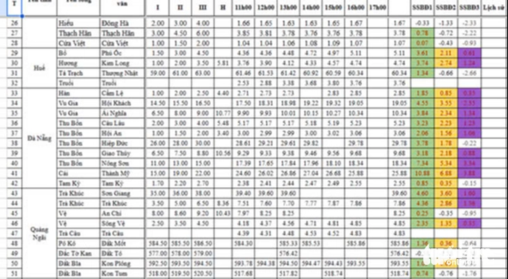
Flood forecast data on rivers in Hue, Da Nang, Quang Ngai today - Photo: TRUONG TRUNG
Severe widespread flooding
Severe widespread flooding continues to occur in low-lying riverside areas and inundation in urban areas.
Especially the communes: Que Phuoc, Nong Son, Que Son, Tam Xuan, Lanh Ngoc, Duy Xuyen, Thu Bon, Xuan Phu, Thanh My, Thuong Duc, Ha Nha, Phu Thuan, Vu Gia, Dai Loc, Go Noi, Dien Ban Tay, Dien Ban Bac, Hoa Tien, Hoi An, Hoi An Tay, Hoi An Dong, Nam Phuoc, Duy Nghia, An Thang, Ban Thach Ward, Huong Tra Ward, Quang Phu Ward, Tay Ho commune, Thang Dien, Thang Truong, Que Xuan, Hoa Xuan, Ngu Hanh Son, Cam Le, Ba Na, Thang An, Thu Bon, Hoa Vang, Hai Van...
In addition, there is a very high risk of flash floods and landslides on the slopes of mountainous areas of Da Nang city.
Source: https://tuoitre.vn/nong-nuoc-song-thu-bon-tai-hoi-an-co-the-vuot-muc-lu-lich-su-nam-thin-1964-trong-dem-nay-20251029172739506.htm

![[Photo] Prime Minister Pham Minh Chinh attends the 5th National Press Awards Ceremony on preventing and combating corruption, waste and negativity](https://vphoto.vietnam.vn/thumb/1200x675/vietnam/resource/IMAGE/2025/10/31/1761881588160_dsc-8359-jpg.webp)


![[Photo] Da Nang: Water gradually recedes, local authorities take advantage of the cleanup](https://vphoto.vietnam.vn/thumb/1200x675/vietnam/resource/IMAGE/2025/10/31/1761897188943_ndo_tr_2-jpg.webp)


Comment (0)