
Overview of planning adjustments
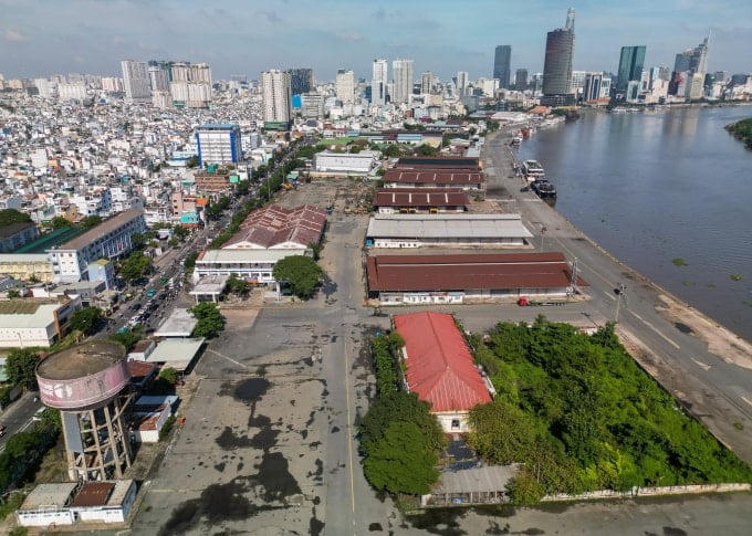
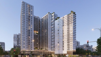
The Department of Planning and Architecture of Ho Chi Minh City has submitted to the City People's Committee a plan to adjust the master plan of Khanh Hoi Port (District 4). According to the new proposal, nearly 60% of the area will be converted into green parks and water surfaces, replacing the previous plan to build a high-rise complex. This decision was made after the Standing Committee of the Ho Chi Minh City Party Committee agreed to stop the Nha Rong - Khanh Hoi Complex project to prioritize the development of public and cultural spaces.
New planning details and comparison
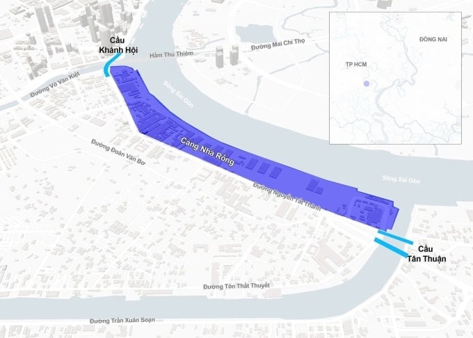
The new planning scheme for the land area of about 31.5 hectares (not including Ben Nha Rong - Ho Chi Minh Museum) shows a big change in urban development orientation. The land ratio for parks has increased 15 times compared to the detailed planning 1/2000 approved in 2015.
Land use function allocation
- Green parks and water surfaces: 60% of area.
- Public works: 20% of area.
- International port area: 20% of area.
Compare with the old planning in 2015
| Category | Planning 2015 | New proposal |
|---|---|---|
| Public parks | About 4% | 60% |
| High-rise residential area | Most of the area (3,116 apartments) | No longer available |
| Villa | 32 apartments | No longer available |
| Amenities (schools, hospitals) | Have | Converted into public works (20%) |
Impact on transport infrastructure
The suspension of the housing complex project opens up an opportunity to remove the serious traffic "bottleneck" on Nguyen Tat Thanh Street. This is the main artery connecting the South Saigon area with the city center.
Currently, this 2 km long road is only about 14 m wide with 4 lanes, often congested with traffic volume exceeding 140% of the design. The project to widen Nguyen Tat Thanh Street to 37-46 m has been stalled for many years due to land issues of the old project. With the new planning, the expansion of this road will become more feasible.
Progress and legal roadmap
To implement the new plan, the Department of Planning and Architecture has requested the People's Committee of Xom Chieu Ward to take the next legal steps. The expected roadmap includes:
- Prepare a local adjustment file for the 1/2000 scale zoning plan for the existing central area of 930 hectares, including the District 4 port sub-area.
- After the 1/2000 project is approved, select a consulting unit to prepare a detailed 1/500 scale plan for the entire land, as a legal basis for park construction.
Market analysis and socio-economic impact
The conversion of a "golden" land into a public park is expected to bring many positive impacts. Not only improving the environment and enhancing the quality of life for residents, the project also has the potential to increase real estate value for neighboring areas in District 4, District 1 and District 7 thanks to large green spaces and improved traffic infrastructure.
Important Warning
- Detailed planning information may change during the approval process by competent authorities.
- Investors and citizens need to follow official announcements to update the latest legal information.
- The road clearance and expansion progress of Nguyen Tat Thanh Street will depend on the implementation plan of the Department of Construction and related units.
Source: https://baolamdong.vn/quy-hoach-cang-khanh-hoi-60-dien-tich-lam-cong-vien-397985.html
![[Photo] National Assembly Chairman Tran Thanh Man receives Chairman of the House of Representatives of Uzbekistan Nuriddin Ismoilov](https://vphoto.vietnam.vn/thumb/1200x675/vietnam/resource/IMAGE/2025/10/27/1761542647910_bnd-2610-jpg.webp)
![[Photo] The 5th Patriotic Emulation Congress of the Central Inspection Commission](https://vphoto.vietnam.vn/thumb/1200x675/vietnam/resource/IMAGE/2025/10/27/1761566862838_ndo_br_1-1858-jpg.webp)
![[Photo] Party Committees of Central Party agencies summarize the implementation of Resolution No. 18-NQ/TW and the direction of the Party Congress](https://vphoto.vietnam.vn/thumb/1200x675/vietnam/resource/IMAGE/2025/10/27/1761545645968_ndo_br_1-jpg.webp)


Comment (0)