
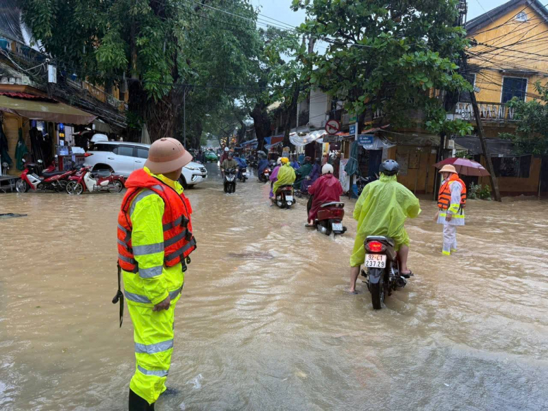
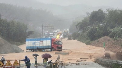
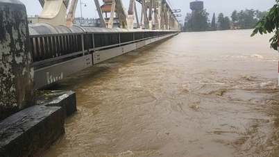
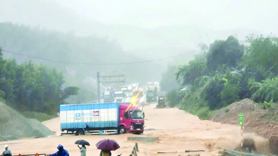
This afternoon (October 27), the Traffic Police Department, Da Nang City Police informed that prolonged heavy rain caused 113 flooding spots across the area, cutting off traffic on many roads in communes and wards in the midland and mountainous areas.
Notably, in the morning of the same day, the water level of the rivers continued to rise, many areas were deeply flooded, and there were serious landslides. At dangerous points, the Traffic Police Department mobilized all its forces, organized checkpoints, put up warning signs, erected barriers, and instructed people and vehicles not to move into areas with potential safety risks.
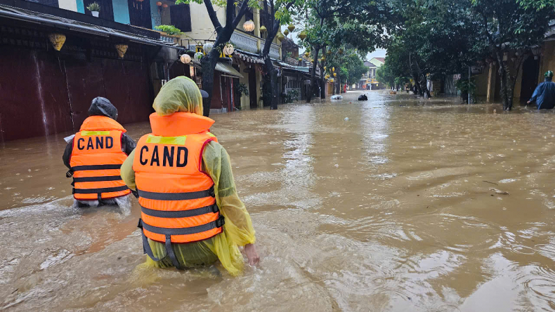
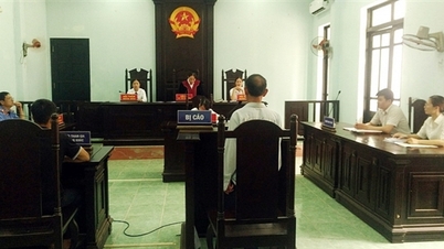
According to the leader of the Traffic Police Department of Da Nang City Police, in the past few days, the unit has also been on duty at key points, proactively posted warning signs, erected barriers and instructed people and vehicles not to move into dangerous areas.
From October 26 to early morning of October 27, the Traffic Police actively coordinated with the Commune Police to carry out rescue work, support people and vehicles to reach safety, provide drinking water and fast food to help people feel secure, ensure security and order, promptly respond to sudden and unexpected situations, and help people and drivers overcome this difficult time.
Many inter-commune routes through many communes and wards were flooded, bridges were submerged, and localized, making it impossible for vehicles to circulate.
As of 11:30 a.m. on October 27, the Da Nang Traffic Police Department recorded 113 flooded and landslide spots in various areas.
Specifically: Km 15+800 (Tum River overflow), Lanh Ngoc commune; Km 44+85, Lanh Ngoc commune; Km59+182, Km61+150 QL40B, Tra My commune; Section through Truong River bridge, Tra My commune; Song Tien bridge on route DH9, Son Cam Ha commune; Route DH1, Tra Duong commune; Section through village 5, Tra Doc commune; DH road to Tien Tho, Thanh Binh commune; My Cang bridge, My Cang village, Ban Thach ward; Tay Yen bridge, Ban Thach ward; Tai Thanh bridge, Tien Chau bridge, Son Cam Ha commune; Village 6 bridge, Tien Phuoc commune (old Tien Tho); Submerged bridge (connecting Me Thu road with La Vinh Huy), Tien Phuoc commune; Gieng Gio bridge, inter-village concrete road, in Danh Son village, Duc Phu commune; Tra My bypass road to Nam Tra My, Tra My commune; Thuong Duc commune: route DH12, Tan An village; Dai Loc Commune: Km 31+400, DT609, Ha Thanh village, Dai Loc commune; Ha Nha Commune (3 points): Truong An village, Ban Thach village, Ba Khe village; Song Kon Commune: Km 41+700 route 14G; Vu Gia Commune (3 points): Km8+900, km2+650 route DT609C; DH6-DL road section to Quang Dai village...
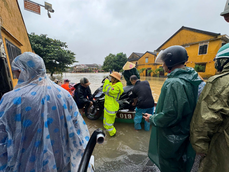
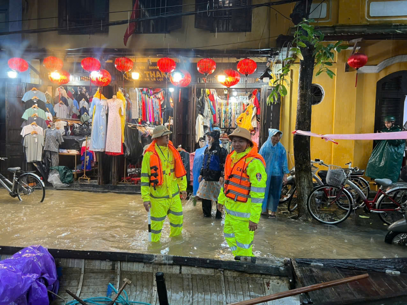
At flooded and landslide areas, leaders of the Da Nang Traffic Police Department urgently mobilized maximum forces, organized checkpoints, put up warning signs, erected barriers and instructed people and vehicles not to move into dangerous areas.
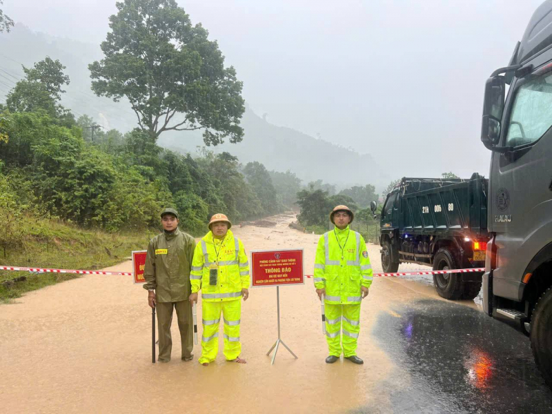
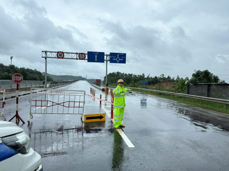
On the same day, on the La Son - Tuy Loan expressway, the traffic police discovered a crack tens of meters long on the road surface, with a high risk of landslides. Immediately upon discovery, Hoa Hiep Traffic Police Station (Traffic Police Department of Da Nang Police) quickly assigned officers and soldiers to be on duty, organize traffic flow, guide vehicles to turn back to Hai Van tunnel, and temporarily stop traffic on the damaged expressway section to ensure safety for people and vehicles.
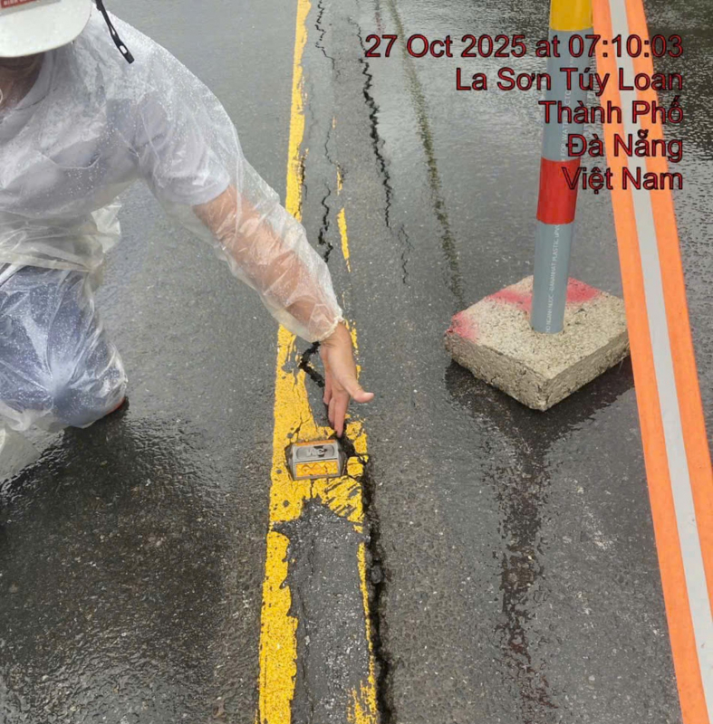
According to the Hoa Hiep Traffic Police Station, the negative slope of La Son - Hoa Lien Expressway is Provincial Road 601 (DT601), and the negative slope of DT601 is located close to the bank of Cu De River. Prolonged heavy rain caused the river water to rise and flow rapidly, causing serious landslides on the negative slope of DT601, making the road surface of DT601 tilt towards the riverbed. The landslide of DT601 caused a 2 cm crack stretching for dozens of meters on La Son - Hoa Lien Expressway, threatening the safety of the expressway project.
The initial cause of the large crack on the La Son - Tuy Loan highway was due to the roadbed being eroded after many days of heavy rain. The mountainous terrain and water-saturated soil and rocks increased the risk of landslides. Currently, the Traffic Police have coordinated with the Ho Chi Minh Road Project Management Board and the road management unit to put up ropes, place warning signs, and strictly control the area.
The Traffic Police Department recommends that people limit going out on the roads when not really necessary, absolutely do not try to cross flooded areas or areas with fast-flowing water; proactively monitor weather warning information and follow the instructions of the task force to ensure safety for themselves and the community.
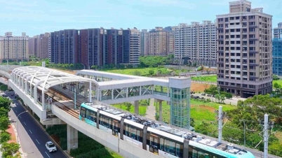
Stop many railway trains
On the afternoon of October 27, the Railway Transport Joint Stock Company announced that due to prolonged heavy rain in the provinces of Quang Tri, Thua Thien - Hue, Da Nang and Quang Ngai, the railway industry had to temporarily suspend many North - South trains. Specifically, on the evening of October 27, the railway stopped running trains SE1/SE2, SE3/SE4 departing from Hanoi and Ho Chi Minh City; and stopped running trains SE19/SE20 departing from Hanoi and Da Nang. In addition, the "Connecting Central Heritage" trains HD1/2 and HD3/4 departing from Hue and Da Nang on October 28 and 29 were also temporarily suspended.
According to estimates, the suspension of the above trains affected about 2,700 passengers. The railway industry implemented a ticket refund policy at the stations, with a 30-day return period. A representative of the Railway Transport Joint Stock Company added: "We have notified passengers via SMS, Zalo, website and fanpage, and continue to monitor the flood situation to adjust train schedules accordingly."
Source: https://cand.com.vn/Xa-hoi/da-nang-canh-bao-113-diem-ngap-ung-chia-cat-giao-thong--i786028/

![[Photo] Party Committees of Central Party agencies summarize the implementation of Resolution No. 18-NQ/TW and the direction of the Party Congress](https://vphoto.vietnam.vn/thumb/1200x675/vietnam/resource/IMAGE/2025/10/27/1761545645968_ndo_br_1-jpg.webp)
![[Photo] The 5th Patriotic Emulation Congress of the Central Inspection Commission](https://vphoto.vietnam.vn/thumb/1200x675/vietnam/resource/IMAGE/2025/10/27/1761566862838_ndo_br_1-1858-jpg.webp)


![[Photo] National Assembly Chairman Tran Thanh Man receives Chairman of the House of Representatives of Uzbekistan Nuriddin Ismoilov](https://vphoto.vietnam.vn/thumb/1200x675/vietnam/resource/IMAGE/2025/10/27/1761542647910_bnd-2610-jpg.webp)


Comment (0)